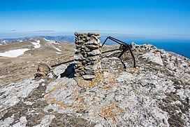
Zeytin-Kosh[a] is a mountain in Crimea and the third highest mountain in the Crimean Mountains.[2] Its height stands at 1,537 metres (5,043 ft) above sea level.
| Zeytin-Kosh | |
|---|---|
 Top of Zeytin-Kosh | |
| Highest point | |
| Elevation | 1,537 m (5,043 ft)[1] |
| Coordinates | 44°37′04″N 34°16′58″E / 44.61778°N 34.28278°E |
| Geography | |
| Country | Disputed: |
| Parent range | Crimean Mountains |
Etymology edit
The name of the mountain is of Crimean Tatar origin and literally means "olive kosh" (zeytün or in the southern coast dialect zeytin - "olive, olive tree"; qoş - "koshara, sheepfold").[3][4]
Notes edit
- ^ Ukrainian: Зейтін-Кош, Russian: Зейтин-Кош, Crimean Tatar: Zeytin Qoş
References edit
- ^ "Topographic map of Zeytin-Kosh". opentopomap.org. Retrieved 2024-02-11.
- ^ "Краткая геополитическая характеристика АРК" (in Ukrainian). Главное управление статистики в Автономной Республике Крым. Archived from the original on 2013-07-10. Retrieved 2013-05-12.
- ^ Сост. С. М. Усеинов (2008). Крымскотатарско-русско-украинский словарь (in Russian). Симферополь: Тезис. pp. 182, 295. ISBN 978-966-470-005-1.
- ^ "Топонимический словарь Крыма". kimmeria.com (in Russian). Archived from the original on 2014-03-23. Retrieved 2013-05-11.
