Wikipedia:WikiProject Maps/Conventions/Topographic maps
This page provide conventions to produce topographic maps.
Topographic maps, displaying an area's relief, de facto explain many other things such as human occupation, cultivated areas, kingdoms borders, exchanges ways, etc.
If you create a topographic map, note that these colorimetric values are indicatives. If need, you can adapt colours to your needs : if more altitude layers are needed, create new ones ; if less are needed, select just some allowing the best contrast.
Be also conscient that a topographic maps is first a background, which then will be complete by other layers. Most of time, these upper layers are transport ways (see exchanges maps), Kingdoms' areas or troops and moves (see areas maps & historical maps), or even officials borders from location maps.
- Tutorials
- Wikipedia:Graphic Lab/Resources/QGis lesson 1: Create a topographic background
- See also: Topographic tutorials are partially translated into english there : User:JaneVannin/translations.
Convention edit
| Subject | Colorimetry |
|---|---|
| Positive altitudes |
#F5F4F2
R:245 G:244 B:242 #E0DED8
R:224 G:222 B:216 #CAC3B8
R:202 G:195 B:184 #BAAE9A
R:186 G:174 B:154 #AC9A7C
R:172 G:154 B:124 #AA8753
R:170 G:135 B:83 #B9985A
R:185 G:152 B:90 #C3A76B
R:195 G:167 B:107 #CAB982
R:202 G:185 B:130 #D3CA9D
R:211 G:202 B:157 #DED6A3
R:222 G:214 B:163 #E8E1B6
R:232 G:225 B:182 #EFEBC0
R:239 G:235 B:192 #E1E4B5
R:225 G:228 B:181 #D1D7AB
R:209 G:215 B:171 #BDCC96
R:189 G:204 B:150 #A8C68F
R:168 G:198 B:143 #94BF8B
R:148 G:191 B:139 #ACD0A5
R:172 G:208 B:165 |
| Depressions |
#A7DFD2
R:167 G:223 B:210 |
| Negative altitudes |
#D8F2FE
R:216 G:242 B:254 #C6ECFF
R:198 G:236 B:255 #B9E3FF
R:185 G:227 B:255 #ACDBFB
R:172 G:219 B:251 #A1D2F7
R:161 G:210 B:247 #96C9F0
R:150 G:201 B:240 #8DC1EA
R:141 G:193 B:234 #84B9E3
R:132 G:185 B:227 #79B2DE
R:121 G:178 B:222 #71ABD8
R:113 G:171 B:216 |
| Rivers, coasts, hydronyms | #0978AB
R:9 G:120 B:171 |
| Subject toponyms | #000000
R:0 G:0 B:0 |
| Border, country and province names | #646464
R:100 G:100 B:100 |
| Roads, highways, railroads, etc.: | see exchanges conventions there |
|
Naming (upload):
| |
| SVG template: Image:Maps_template-en.svg provide further label conventions. | |
History and current work edit
- History
This convention takes its source in the GMT tool and User:Captain_Blood work. User:Sting then pushes the creation of topographic maps to a new level, mixing SVG and bitmap technology, his work is since almost each time granted feature picture statut. Sting also produced a full set of topographic map tutorials (:fr:here), allowing other users such Sémhur, Historicair, Bourrichon, NNW, and then a dozen of other to follow this style, leading to the common acceptation as being the topographic convention on wikipedia.
Discussions have long for 2-3 years, with several update, to lead to this current web-friendly, screen friendly, and wiki-specific topo style.
- Leading place and future
Currently, the French team is leading this initiative on its Map Lab, according to Sting's French tutorials, and working according to specific requests. But some German, Norwegian and English speakers are also following them. Some part of the tutorial have been translated into English, and help is welcome to complete the translation.
In the future, a good way to follow should be to start a methodical project, based on the German Location map initiative, working continent after continent and country after country, to provide a complete set of SVG topographic maps, respecting these topographic conventions.
- To learn
Several tutorials are now available, on wiki-en, wiki-fr, wiki-ru. Currently active topo-mapmakers which may help your to learn are:
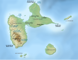
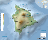
Gallery of examples edit
-
 Empty topo background, relief AND location map of France.
 -
 Topo background with some few labels.
 -

-
-
 Complex map: Topographic background, shaded relief, roads, administrative borders + icons, label and legend.


Map conventions and Map Project | |||
|---|---|---|---|
 | Conventions set |  | |
| Drafts | |||
| Others |
| ||