Walwa (/ˈwɒlwə/; Aboriginal for "a place of waters"), is a town in the Shire of Towong in north east Victoria, Australia. The town is located 1 kilometre from the Murray River on the former Murray Valley highway between Wodonga and Corryong. At the 2016 census, the Walwa population had declined to just 177 having been 268 just ten years earlier.[1]
| Walwa Victoria | |||||||||
|---|---|---|---|---|---|---|---|---|---|
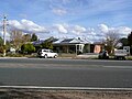
 Main street | |||||||||
 Walwa Location in Shire of Towong, Victoria | |||||||||
| Coordinates | 35°58′S 147°44′E / 35.967°S 147.733°E | ||||||||
| Population | 177 (2016 census)[1] | ||||||||
| Postcode(s) | 3709 | ||||||||
| Elevation | 215 m (705 ft) | ||||||||
| Location |
| ||||||||
| LGA(s) | Shire of Towong | ||||||||
| State electorate(s) | Benambra | ||||||||
| Federal division(s) | Indi | ||||||||
| |||||||||
Across the river on the New South Wales side are the nearby towns of Jingellic and Tumbarumba.
History edit
A Post Office first opened on 1 March 1861 and closed in 1865. A Post Office again opened on 1 December 1885, although known as Walwa Creek from 1886 until 1905. Currently, the Walwa Post Office is owned and operated by Belinda Mann, and services the areas of Walwa, Burrowye, Guys Forrest and Sandy Creek.[2]
The First Nations owners of this Country are the "Dhudhuroa" speaking people, whose language was spoken in the Murray River Valley from Albury to around Welaregang and Corryong, and inland along the lower Mitta Mitta River, Tallangatta Creek and parts of the Kiewa Valley.[3]
Walwa Hotel was first built in the 1870s. The original timber hotel was burnt down in the 1930s and rebuilt from locally made bricks.. The "Old Brick Kiln" remains can still be seen on the Eastern side of the township.
The remnants of the Tin Mines are evident on the Western side of Walwa.
Walwa also had a Butter Factory but closed in the 1970s. There was a large dairy industry in the district.
Attractions edit
Pine Mountain a few kilometers out of Walwa, located in the Burrowa-Pine Mountain National Park is the largest monolith in the southern hemisphere at 1.5 times the size of Uluru (Ayres Rock).
The town had an Australian rules football team competing in the Upper Murray Football League known as the Border-Walwa Magpies which folded before the 2020 season due to lack of players.
Golfers play at the course of the Walwa Golf Club on Murray River Road.[4]
Walwa also has a Townhall, Walwa Services Memorial Hall. This memorial hall (sometimes named Soldiers' Memorial Hall) commemorates the residents of Walwa who served their country in the First World War and the Second World War.
Climate edit
Rainfall edit
The Bureau of Meteorology has kept rainfall records at Walwa since 1884. The nearest temperature data can be found at Corryong.
| Climate data for Walwa (1884–2023); 215 m AMSL; 35.96° S, 147.74° E | |||||||||||||
|---|---|---|---|---|---|---|---|---|---|---|---|---|---|
| Month | Jan | Feb | Mar | Apr | May | Jun | Jul | Aug | Sep | Oct | Nov | Dec | Year |
| Average precipitation mm (inches) | 53.7 (2.11) |
46.4 (1.83) |
56.9 (2.24) |
52.3 (2.06) |
67.9 (2.67) |
82.6 (3.25) |
84.5 (3.33) |
86.1 (3.39) |
75.4 (2.97) |
78.2 (3.08) |
63.2 (2.49) |
58.9 (2.32) |
808.1 (31.81) |
| Source: Australian Bureau of Meteorology; Walwa | |||||||||||||
References edit
- ^ a b Australian Bureau of Statistics (25 October 2007). "Walwa (State Suburb)". 2006 Census QuickStats. Retrieved 15 August 2007.
- ^ "Post Office List". Phoenix Auctions. Retrieved 23 February 2021.
- ^ R. H. Mathews, ‘The Dhudhuroa Language of Victoria,’ reprinted from the American Anthropologist, Vol. 11, No. 2, April-June, 1909, pp:278-284. Many sacred sites, scar trees, and cave paintings are in the area.
- ^ "Walwa Golf Club". Golf Select. Retrieved 11 May 2009.
External links edit
Gallery edit
-
 General store and cafe
 -
 View towards the centre of Walwa
 -
 Walwa Medical Centre
 -
 Roman Catholic Church


This article about a location in Hume (region) is a stub. You can help Wikipedia by expanding it. |