Uffelte is a village in the Dutch province of Drenthe. It is a part of the municipality of Westerveld, and lies about 15 km west of Hoogeveen.
Uffelte | |
|---|---|
 Bridge near Uffelte | |
 Flag | |
 The village centre (dark green) and the statistical district (light green) of Uffelte in the municipality of Westerveld. | |
 Uffelte Location in province of Drenthe in the Netherlands  Uffelte Uffelte (Netherlands) | |
| Coordinates: 52°47′N 6°17′E / 52.783°N 6.283°E | |
| Country | Netherlands |
| Province | Drenthe |
| Municipality | Westerveld |
| Area | |
| • Total | 22.52 km2 (8.70 sq mi) |
| Elevation | 6 m (20 ft) |
| Population (2021)[1] | |
| • Total | 1,430 |
| • Density | 63/km2 (160/sq mi) |
| Time zone | UTC+1 (CET) |
| • Summer (DST) | UTC+2 (CEST) |
| Postal code | 7975[1] |
| Dialing code | 0521 |
Uffelte was first mentioned as Ulfo in 1040 when Emperor Henry III donated estates from a certain Uffo and his brothers, located in Uffelte, Wittelte and Peelo, to Bishop Bernold of Utrecht.Wittelte Uffelte is an esdorp on a sandy ridge. The village has two large communal pastures and a village square.[3]
The villages of Uffelte and Darp decided to build a joint church halfway between the two villages. The church was built in 1310, and the village of Havelte developed around the church.[4] Uffelte received its own church in 1910, when the Dutch Reformed church was built.[3]
Uffelte was home to 651 people in 1840.[4]
Gallery edit
-
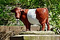 Cow statue
 -
 Stork at Uffelte
 -
 Church of Uffelte


References edit
- ^ a b c "Kerncijfers wijken en buurten 2021". Central Bureau of Statistics. Retrieved 12 April 2022.
- ^ "Postcodetool for 7975AA". Actueel Hoogtebestand Nederland (in Dutch). Het Waterschapshuis. Retrieved 12 April 2022.
- ^ a b Ronald Stenvert (2001). Paterswolde (in Dutch). Zwolle: Waanders. ISBN 90 400 9454 3. Retrieved 12 April 2022.
- ^ a b "Uffelte". Plaatsengids (in Dutch). Retrieved 12 April 2022.
This Drenthe location article is a stub. You can help Wikipedia by expanding it. |