Talk:19th-century London
| This article is rated Start-class on Wikipedia's content assessment scale. It is of interest to the following WikiProjects: | |||||||||||||||||||||||||||||||
| |||||||||||||||||||||||||||||||


Untitled edit
Removed westminster abbey from list of buildings constructed in 19th century — Preceding unsigned comment added by 91.110.18.45 (talk) 09:04, 20 June 2018 (UTC)
Housing issues for the poor edit
This article could do with reference to the housing issues of the poor that the city suffered. — billinghurst sDrewth 10:13, 5 October 2013 (UTC)
There are no references at all!? — Preceding unsigned comment added by 74.109.60.9 (talk) 14:07, 10 April 2014 (UTC)
Amazed … edit
.. that an article about what was the most important, wealthy and populous city in the world, where many aspects of the 20th century world were pioneered, omits huge areas of civic life:
- infrastructure: roads, canals, tramways, street lighting, docks, bridges, tunnels
- energy: coal, gas, electricity
- food and drink: brewing, distilling, food processing
- health: hospitals
- education & training: schools, colleges, universities
- welfare: social housing, workhouses, charities
- culture: museums, art galleries, concert halls, libraries
- science: research (for example in biology and physics)
- justice: courts, prisons
- communications: post, telegraph, telephone
- media: newspapers, magazines, books
- transport: shipping
- finance: banking, insurance
- tourism: hotels, restaurants
- entertainment: theatres, music halls, pubs
- defence: Army technical branches centred on Woolwich
- sport: cricket, football, tennis
- employment: shops, offices, workshops, factories
Clifford Mill (talk) 18:42, 1 March 2017 (UTC)
Poverty - St. Giles Rookery edit
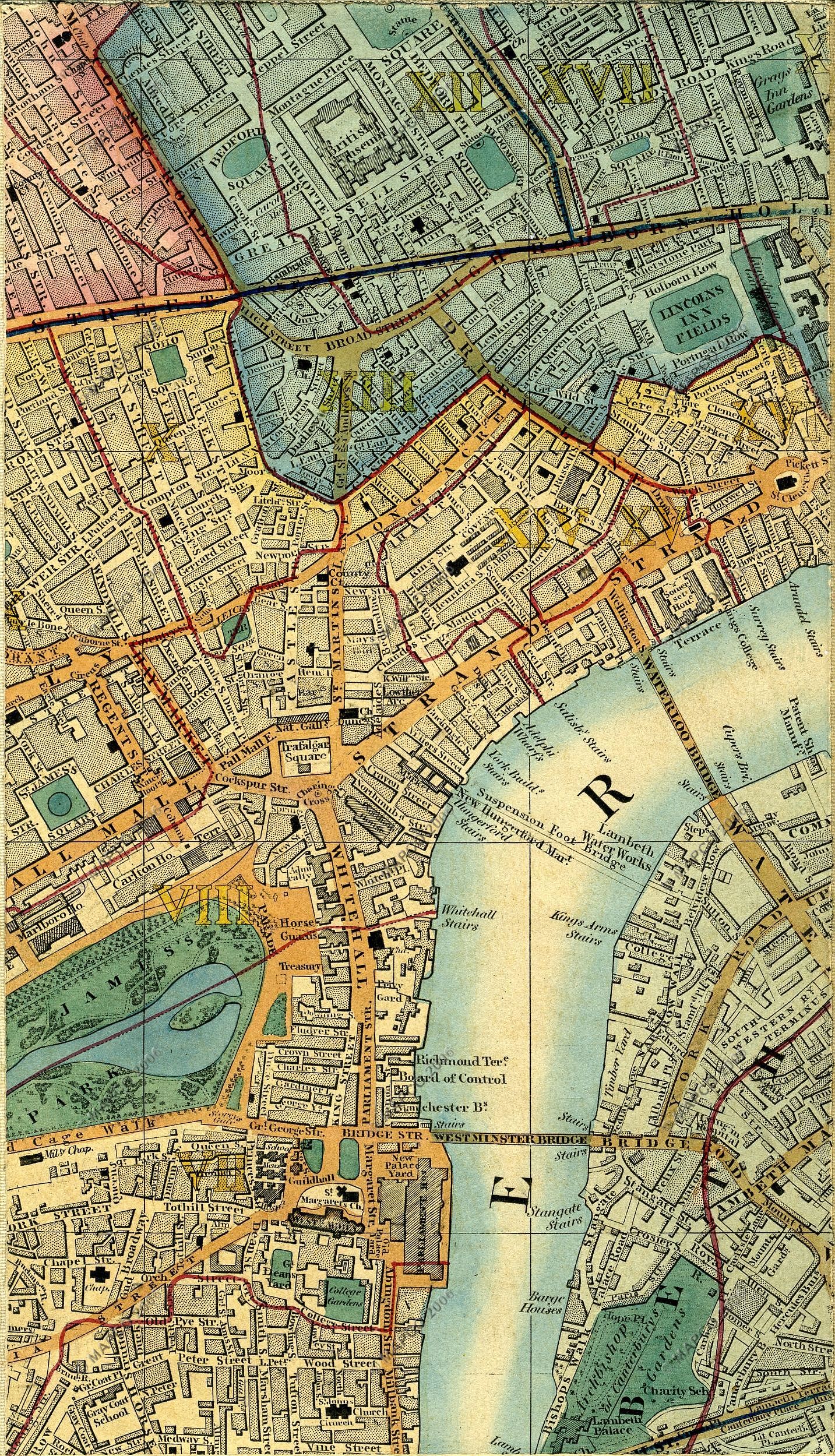
The top area of the following image shows the streets of the St. Giles Rookery before it was pulled down, when New Oxford Street replaced the narrower extension of Oxford Street, and Crown Street was replaced by Charing Cross Road. https://london1850.com/images/cross11b.jpg The following link shows a map of the same area in 1890 https://maps.nls.uk/geo/explore/#zoom=19&lat=51.51558&lon=-0.12907&layers=117746212&b=7
I mention this as the article (citing Beames) mentions both George Street and Church St. – both of which which only existed prior to the demolition. (George Street appears to have been renamed to Dyott Street, while Church St. seems to have been absorbed by the widening of Oxford Street).
On the latter map one can see New Street where the London Beer Flood killed eight people.
(20040302 (talk) 16:06, 13 December 2021 (UTC))
UPDATE: Definitive Source for the renaming of George Street to Dyott Street can be found on the Insurance Plan of London Vol. VIII: sheet 198 (1888)
cf. https://cloud.maptiler.com/data/new/edit?basemap=https://maps.georeferencer.com/georeferences/f0d21896-7aeb-59e6-9711-1455d1893774/2019-10-01T08:40:08.006175Z/map.json?key=4HG0mpU1uJywEuwuxdss
This is marked "Dyott St. (Late George St.)"