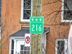
Route 216 is a two-lane east/west highway in Quebec, Canada, which starts in Sainte-Catherine-de-Hatley in the Estrie region at the junction of Route 108 and ends in Sainte-Perpétue in Chaudière-Appalaches at the junction of Route 204.
Route 216 | ||||
|---|---|---|---|---|
 | ||||
| Route information | ||||
| Maintained by Transports Québec | ||||
| Length | 315.5 km[1] (196.0 mi) | |||
| Major junctions | ||||
| West end | ||||
| East end | ||||
| Location | ||||
| Country | Canada | |||
| Province | Quebec | |||
| Highway system | ||||
| ||||

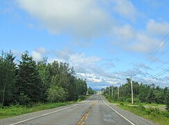
Route 216 follows mostly a northeast/southwest course, and it is not a busy highway as it mostly links small villages between themselves in the backroads of the Appalachians. The only two major towns along the way are Sherbrooke and Sainte-Marie. Between Ham-Nord (junction with Route 161) and Saint-Jacques-le-Majeur-de-Wolfestown (junction with Route 263), the road is unpaved.
Municipalities along Route 216 edit
- Sainte-Catherine-de-Hatley
- Sherbrooke
- Stoke
- Saint-Camille
- Wotton
- Saint-Adrien
- Ham-Nord
- Saint-Jacques-le-Majeur-de-Wolfestown
- Saint-Julien
- Irlande
- Saint-Adrien-d'Irlande
- Saint-Jean-de-Brébeuf
- Kinnear's Mills
- Saint-Jacques-de-Leeds
- Saint-Sylvestre
- Saint-Elzéar
- Sainte-Marie
- Sainte-Marguerite
- Saint-Malachie
- Saint-Nazaire-de-Dorchester
- Notre-Dame-Auxiliatrice-du-Buckland
- Saint-Philémon
- Saint-Paul-de-Montminy
- Sainte-Apolline-de-Patton
- Saint-Marcel
- Sainte-Félicité
- Sainte-Perpétue
-
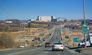
 Route 216 in Mont-Bellevue borough, Sherbrooke.
 -
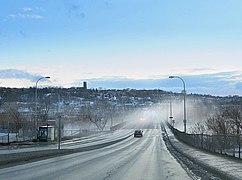 Route 216 through downtown Sherbrooke.
 -
 Route 216 is the main road to Centre hospitalier universitaire de Sherbrooke.
 -
 Route 216 in Stoke.
 -
 Route 216 in Saint-Jacques-de-Leeds.
 -
 Principale street in à Saint-Sylvestre.
 -
 Route 216 in Sainte-Félicité.
 -
 Route 216 in Saint-Marcel.


.jpg)
_%C3%A0_Saint-Sylvestre-de-Beaurivage.jpg)
.jpg)
.jpg)
See also edit
References edit
- ^ Ministère des transports, "Distances routières", page 82, Les Publications du Québec, 2005
External links edit
- Provincial Route Map (Courtesy of the Quebec Ministry of Transportation) (in French)
- Route 216 in Google Maps