Puerto Rico Highway 114 (PR-114) is a rural road that travels from Mayagüez to San Germán. PR-114 begins at the intersection of PR-2 and Avenida los Corazones in Mayagüez and ends at the intersection with PR-102 at the entrance to the center of San Germán. This road passes through the municipalities of Hormigueros and Cabo Rojo before coming to San Germán.[2][3]
Highway 114 | ||||
|---|---|---|---|---|
| Ruta 114 | ||||
| Route information | ||||
| Maintained by Puerto Rico DTPW | ||||
| Length | 14.7 km[1] (9.1 mi) | |||
| Major junctions | ||||
| West end | ||||
| East end | ||||
| Location | ||||
| Country | United States | |||
| Territory | Puerto Rico | |||
| Municipalities | Mayagüez, Hormigueros, Cabo Rojo, San Germán | |||
| Highway system | ||||
| ||||


It is a fairly straight road, but is often flooded during periods of heavy rain due to poor drainage and its location near the Guanajibo River.
-
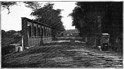 Silva Bridge is at kilometer 4 on Highway 114 (photographed c. 1898 during the Spanish-American War)
.jpg)
Major intersections edit
| Municipality | Location | km[1] | mi | Destinations | Notes | |||
|---|---|---|---|---|---|---|---|---|
| Mayagüez | Sábalos | 0.0 | 0.0 | Western terminus of PR-114 | ||||
| Hormigueros | Guanajibo | 2.3 | 1.4 | |||||
| 3.6 | 2.2 | Incomplete diamond interchange; no access to PR-100 southbound; no access from PR-100 | ||||||
| 3.7 | 2.3 | |||||||
| Río Guanajibo | 4.0 | 2.5 | Puente Silva[4] | |||||
| Cabo Rojo | Guanajibo | 4.2 | 2.6 | |||||
| 5.4– 5.5 | 3.4– 3.4 | |||||||
| Hormigueros | Benavente | 7.0 | 4.3 | |||||
| Río Guanajibo | 10.1 | 6.3 | Puente Pezuela[4] | |||||
| Cabo Rojo |
No major junctions | |||||||
| San Germán | Sabana Grande Abajo–Sabana Eneas– Maresúa tripoint | 12.7 | 7.9 | |||||
| Maresúa–Sabana Grande Abajo line | 14.7 | 9.1 | Eastern terminus of PR-114 | |||||
| 1.000 mi = 1.609 km; 1.000 km = 0.621 mi | ||||||||
See also edit
References edit
- ^ a b Google (2 March 2020). "PR-114" (Map). Google Maps. Google. Retrieved 2 March 2020.
- ^ National Geographic Maps (2011). Puerto Rico (Map). 1:125,000. Adventure Map (Book 3107). Evergreen, Colorado: National Geographic Maps. ISBN 978-1566955188. OCLC 756511572.
- ^ "Tránsito Promedio Diario (AADT)". Transit Data (Datos de Transito) (in Spanish). DTOP PR. pp. 64–65. Archived from the original on 1 April 2019.
- ^ a b Luis F. Pumarada O’Neill (1991). "Los Puentes Históricos de Puerto Rico" (PDF) (in Spanish). Retrieved 10 March 2020.
External links edit
 Media related to Puerto Rico Highway 114 at Wikimedia Commons
This Puerto Rican location article is a stub. You can help Wikipedia by expanding it. |
This Puerto Rico road-related article is a stub. You can help Wikipedia by expanding it. |