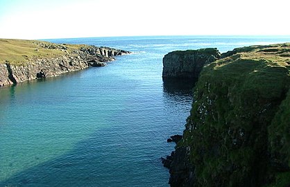
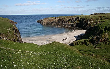
Port Stoth, known locally as Stoth and pronounced Stow,[1] is a sheltered inlet just southeast of the Butt of Lewis in the Outer Hebrides, Scotland.[2] It is the most northerly landing in the Outer Hebrides.[3] A track leads down to a slipway which runs across the sandy beach.[4]
| Port Stoth | |
|---|---|
 | |
 Port Stoth Location in the Outer Hebrides | |
| Location | Isle of Lewis, Scotland, UK Grid Reference NB524659 |
| Coordinates | 58°30′39″N 6°15′04″W / 58.510701°N 6.251169°W |
Port Stoth is about 400 yards (370 m) from the Butt of Lewis Lighthouse.[5] All the materials for the construction of the lighthouse (between 1859 and 1862) were brought by ship and landed in Port Stoth, due to lack of road infrastructure.[6] The port continued to play an important role in bringing supplies to the lighthouse[1] until about 1960.[6] Supplies and fuel were brought in small cargo vessels when the weather allowed, and were unloaded in Port Stoth by crane. The concrete base still remains, as does a brick storage building.[1]
There is a brick building to the North side of Stoth where shellfish was landed and there are the remains of a hoist fixed to the shore below.
-
 Slipway onto the beach
 -
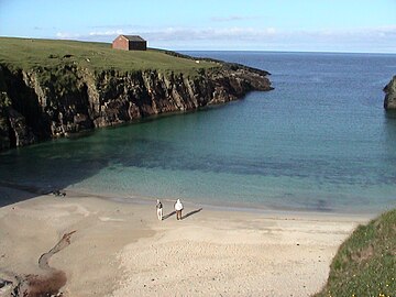 View showing brick storage building
 -
 View from the cliff top
 -
 View from north of the track


References edit
- ^ a b c "Butt of Lewis Lighthouse - Isle of Lewis - Western Isles". Virtual Hebrides. Archived from the original on 12 June 2011. Retrieved 25 August 2011.
- ^ John Allan (20 October 2010). "NB5265 : Port Stoth". Geograph. Retrieved 25 August 2011.
- ^ Mike Sullivan; Robert Emmott; Timothy Pickering (8 June 2010). Outer Hebrides. Pesda Press. p. 37. ISBN 978-1-906095-09-3. Retrieved 25 August 2011.
- ^ Dave Fergusson (4 October 2007). "NB5265 : Slipway at Port Stoth". Geograph. Retrieved 25 August 2011.
- ^ "The Butt of Lewis Lighthouse". Comunn Lachdraidh Nis. Archived from the original on 12 August 2011. Retrieved 25 August 2011.
- ^ a b "Butt of Lewis (Rubha Robhanais)". Undiscovered Scotland: The Ultimate Online Guide. Retrieved 25 August 2011.