Popovičky is a municipality and village in Prague-East District in the Central Bohemian Region of the Czech Republic. It has about 500 inhabitants.
Popovičky | |
|---|---|
 Church of Saint Bartholomew | |
 Flag  Coat of arms | |
 Popovičky Location in the Czech Republic | |
| Coordinates: 49°57′45″N 14°35′52″E / 49.96250°N 14.59778°E | |
| Country | |
| Region | Central Bohemian |
| District | Prague-East |
| First mentioned | 1352 |
| Area | |
| • Total | 5.20 km2 (2.01 sq mi) |
| Elevation | 377 m (1,237 ft) |
| Population (2023-01-01)[1] | |
| • Total | 454 |
| • Density | 87/km2 (230/sq mi) |
| Time zone | UTC+1 (CET) |
| • Summer (DST) | UTC+2 (CEST) |
| Postal code | 251 70 |
| Website | popovicky |
Administrative parts edit
The villages of Chomutovice and Nebřenice are administrative parts of Popovičky.
Etymology edit
The name is diminutive of Popovice. It was derived either from the personal name Pop, or from the old Czech word pop (i.e. 'priest'), meaning "the village of Pop's/priest's people".[2]
Geography edit
Popovičky is located about 10 km (6 mi) southeast of Prague. It lies in the Benešov Uplands. The highest point is at 495 m (1,624 ft) above sea level. The stream Chomutovický potok flows across the municipality.
History edit
The first written mention of Popovičky is from 1352. Chomutovice was first mentioned in 1205 and Nebřenice in 1437.[3]
Demographics edit
|
|
| ||||||||||||||||||||||||||||||||||||||||||||||||||||||
| Source: Censuses[4][5] | ||||||||||||||||||||||||||||||||||||||||||||||||||||||||
Transport edit
There are no railways or major roads passing through the municipality.
Sport edit
There is a modern golf course in Nebřenice.[6]
Sights edit
The landmark of Popovičky is the Church of Saint Bartholomew. The originally medieval church was completely rebuilt in the Baroque style in 1731–1736.[7]
The Nebřenice Chateau was built as a hunting lodge in the early 19th century. Today, it is the seat of the golf clubhouse.[8]
Gallery edit
-
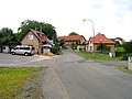
 Upper common
 -
 Lower common


References edit
- ^ "Population of Municipalities – 1 January 2023". Czech Statistical Office. 2023-05-23.
- ^ Profous, Antonín (1951). Místní jména v Čechách III: M–Ř (in Czech). p. 436.
- ^ "Historie" (in Czech). Obec Popovičky. Retrieved 2022-03-19.
- ^ "Historický lexikon obcí České republiky 1869–2011 – Okres Praha-východ" (in Czech). Czech Statistical Office. 2015-12-21. pp. 9–10.
- ^ "Population Census 2021: Population by sex". Public Database. Czech Statistical Office. 2021-03-27.
- ^ "Golf". Oaks Prague. Retrieved 2022-10-23.
- ^ "Kostel sv. Bartoloměje" (in Czech). National Heritage Institute. Retrieved 2022-10-23.
- ^ "History & Renovation". Oaks Prague. Retrieved 2022-10-23.
External links edit