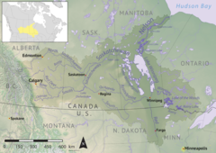
Piwei River[1] is a river in the east-central part of the Canadian province of Saskatchewan in the boreal forest[2] ecozone of Canada. It begins at the western end of the Porcupine Hills at Piwei Lakes and heads in an easterly direction through a glacier-formed valley and into the Etomami River, which is a tributary of the Red Deer River.[3]
| Piwei River | |
|---|---|
 Nelson River drainage basin | |
| Location | |
| Country | |
| Provinces | |
| Rural municipality | RM of Hudson Bay No. 394 |
| Physical characteristics | |
| Source | Porcupine Hills |
| • location | Piwei Lakes |
| • coordinates | 52°32′11″N 103°09′29″W / 52.5365°N 103.1580°W |
| • elevation | 511 m (1,677 ft) |
| Mouth | Etomami River |
• coordinates | 52°26′01″N 102°40′49″W / 52.4336°N 102.6802°W |
• elevation | 477 m (1,565 ft) |
| Basin features | |
| River system | Red Deer River |
| Tributaries | |
| • right | Big Valley Creek, Ravina Creek, Cameron Creek, Gara Creek |
The river is accessed from Highways 984 and 983. Save for a small recreation park on the river's north bank, there are no communities nor settlements along its course. Big Valley Lake Ecological Reserve,[4] one of Saskatchewan's Representative Area Ecological Reserves, is in Piwei River's watershed upstream along Big Valley Creek's course on the shore of Big Valley Lake.[5][6]
Course edit
Piwei River begins south of the town of Porcupine Plain at an elevation of 511 m (1,677 ft) in a chain of several lakes called the Piwei Lakes[7] at the western end of the Porcupine Hills. From the lakes, it heads east through the Porcupine Provincial Forest and glacier-formed valleys en route to its terminus at the Etomami River. The valley that the river follows continues east past Etomami River and is a natural portage to the Pepaw River, which follows that same valley farther east.[8]
- Tributaries
- Mud Creek (into Piwei Lakes)
- Big Valley Creek
- Wells Creek
- Lawson Creek
- Wells Creek
- Ravina Creek
- Cameron Creek
- Gara Creek
Piwei River Recreation Site edit
Piwei River Recreation Site (52°29′03″N 102°59′18″W / 52.4843°N 102.9883°W)[9] is a recreation site located on the north bank of Piwei River, just downstream from the Piwei Lakes. It is about 8 ha (20 acres) in size and 509 metres (1,670 ft) above sea level. The park facilities include an access to snowmobile trails, a warm up shelter, and access to the river. Accessed to the park is from Highway 984.[10][11]
See also edit
References edit
- ^ Government of Canada, Natural Resources Canada. "Place names - Piwei River". www4.rncan.gc.ca.
- ^ "Boreal Plains Ecozone". ecozones. Retrieved 13 April 2022.
- ^ "Piwei River Recreation Site, Saskatchewan Map". Geodata.us. Geodata.us. Retrieved 13 April 2022.
- ^ "Ecological Reserves in the Hudson Bay Area". Town of Hudson Bay. Town of Hudson Bay. Retrieved 13 April 2022.
- ^ Government of Canada, Natural Resources Canada. "Place names - Big Valley Lake". www4.rncan.gc.ca.
- ^ "Representative Area Ecological Reserve". Geohub.Saskatchewan. Saskatchewan Ministry of Environment. Retrieved 13 April 2022.
- ^ Government of Canada, Natural Resources Canada. "Place names - Piwei Lakes". www4.rncan.gc.ca.
- ^ "Map of Piwei River in 9-40-5-W2, Saskatchewan". Cartographic.info. Retrieved 13 April 2022.
- ^ Government of Canada, Natural Resources Canada. "Place names - Piwei River Recreation Site". www4.rncan.gc.ca.
- ^ "Piwei River Recreation Site". BRMBmaps. Mussio Ventures Ltd. Retrieved 13 April 2022.
- ^ "Piwei River Recreation Site at Saskatchewan Canada". 19 December 2021.

