Nandakumar is a village in Nandakumar CD block in Tamluk subdivision of Purba Medinipur district in the state of West Bengal, India.
Nandakumar | |
|---|---|
Village | |
 Nandakumar Location in West Bengal, India  Nandakumar Nandakumar (India) | |
| Coordinates: 22°11′19.7″N 87°55′08.7″E / 22.188806°N 87.919083°E | |
| Country | |
| State | West Bengal |
| District | Purba Medinipur |
| Population (2011) | |
| • Total | 845 |
| Languages | |
| • Official | Bengali, Hindi |
| Time zone | UTC+5:30 (IST) |
| PIN | 721632 (Nandakumar) |
| Telephone/STD code | 03228 |
| Lok Sabha constituency | Tamluk |
| Vidhan Sabha constituency | Nandakumar |
| Website | purbamedinipur |
Geography edit

5miles
M: municipal city/ town, CT: census town, R: rural/ urban centre, H: historical/ religious centre
Owing to space constraints in the small map, the actual locations in a larger map may vary slightly
Police station edit
Nandakumar police station has jurisdiction over Nandakumar CD block. Nandakumar police station covers an area of 151.73 km2 with a population of 239,442. It is located at Nandakumar Bazar.[1][2]
CD block HQ edit
The headquarters of this CD block are located at Kumarpur.[3]
Urbanisation edit
94.08% of the population of Tamluk subdivision live in the rural areas. Only 5.92% of the population live in the urban areas, and that is the second lowest proportion of urban population amongst the four subdivisions in Purba Medinipur district, just above Egra subdivision.[4]
Note: The map alongside presents some of the notable locations in the subdivision. All places marked in the map are linked in the larger full screen map.
Demographics edit
As per the map of Nandakumar CD block and subsequent alphabetical list of villages in the District Census Handbook, Purba Medinipur, Nandakumar is a part of Kumarpur village.[5]
As per 2011 Census of India Kumarpur had a total population of 845 of which 441 (52%) were males and 404 (48%) were females. Population below 6 years was 77. The total number of literates in Kumarpur was 643 (83.72% of the population over 6 years).[6]
Transport edit
Nandakumar stands at the crossing of NH 116 connecting Kolaghat and Haldia (both in Purba Medinipur district) and SH 4 connecting Jhalda (in Purulia district) and Digha (in Purba Medinipur district).[7][8]
There is a separate Mechada-Tamluk-Haldia road via Sutahata and Durga Chak, that passes through Nandakumar.[9]
| ||||||||||||||||||||||||||||||||||||||||||||||||||||||||||||||||||||||||||||||||||||||||||||||||||||||||||||||||||||||||||||||||||||||||||||||||||||||||||||||||||||||||||||||||||||||||||||||||||||||||||||||||||||||||||||||||||||||||||||||||||||||||||||||||||||||||||||||||||||||||||||||||||||||||||||||||||||||||||||||||||||||||||||||||||||||||||||||||||||||||||||||||||||||||||||||||||||||||||||||||||||||||||||||||||||||||||||||||||||||||||||||||||||||||||||||||||||||||||||||||||||||||||||||||||||||||||||||||||||||||||||||||||||||||||||||||||||||||||||||||||||||||||||||||||||||||||||||||||||||||||||||||||||||||||||||||||||||||||||||||||||||||||||||||||||||||||||||||||||||||||||||||||||
| Sources:[10][11][12][13] | ||||||||||||||||||||||||||||||||||||||||||||||||||||||||||||||||||||||||||||||||||||||||||||||||||||||||||||||||||||||||||||||||||||||||||||||||||||||||||||||||||||||||||||||||||||||||||||||||||||||||||||||||||||||||||||||||||||||||||||||||||||||||||||||||||||||||||||||||||||||||||||||||||||||||||||||||||||||||||||||||||||||||||||||||||||||||||||||||||||||||||||||||||||||||||||||||||||||||||||||||||||||||||||||||||||||||||||||||||||||||||||||||||||||||||||||||||||||||||||||||||||||||||||||||||||||||||||||||||||||||||||||||||||||||||||||||||||||||||||||||||||||||||||||||||||||||||||||||||||||||||||||||||||||||||||||||||||||||||||||||||||||||||||||||||||||||||||||||||||||||||||||||||||
Nandakumar railway station is situated on the Tamluk-Digha line,[14]
Healthcare edit
Khejurberia Rural Hospital at Khejurberia, PO Nandakumar (with 30 beds) is the main medical facility in Nandakumar CD block. There are primary health centres at Dakshin Damodarpur (with 10 beds) and Dakshin Gumai, PO Kalyanchak (with 2 beds).[15]
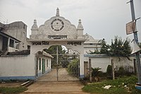
Nandakumar picture gallery edit
-
 Sridharpur Maktab Prathamik Vidyalaya
 -
 Paramhansapr Dakshin Prathamik Vidyalaya
 -
 Satsang Vihar


References edit
- ^ "District Statistical Handbook 2014 Purba Medinipur". Tables 2.1, 2.2. Department of Statistics and Programme Implementation, Government of West Bengal. Archived from the original on 29 July 2017. Retrieved 10 November 2016.
- ^ "Nandakumar PS". Purba Medinipur District Police. Archived from the original on 12 November 2016. Retrieved 10 November 2016.
- ^ "District Census Handbook: Purba Medinipur" (PDF). Map of Purba Medinipur with CD Block HQs and Police Stations. Directorate of Census Operations, West Bengal, 2011. Retrieved 9 November 2016.
- ^ "District Statistical Handbook 2014 Purba Medinipur". Table 2.2. Department of Planning and Statistics, Government of West Bengal. Archived from the original on 21 January 2019. Retrieved 20 April 2019.
- ^ "District Census Handbook, Purba Medinipur, Series 20, Part XIIA, Census of India, 2011" (PDF). Map on Page 297. Directorate of Census Operations, West Bengal. Retrieved 28 March 2019.
- ^ "2011 Census – Primary Census Abstract Data Tables". West Bengal – District-wise. Registrar General and Census Commissioner, India. Retrieved 10 November 2016.
- ^ "Rationalisation of Numbering Systems of National Highways" (PDF). New Delhi: Department of Road Transport and Highways. Archived from the original (PDF) on 1 February 2016. Retrieved 10 November 2016.
- ^ "List of State Highways in West Bengal". West Bengal Traffic Police. Retrieved 10 November 2016.
- ^ Google maps
- ^ Google Maps
- ^ Kharagpur-Howrah Local 38606 Indiarailinfo
- ^ Howrah-Haldia Local 68689 ⇒ 38089 Indiarailinfo
- ^ Santragachi-Digha EMU 78001 ⇒ 68687 Indiarailinfo
- ^ "68690 Digha-Mecheda Local". Time Table. indiarailinfo. Retrieved 10 November 2016.
- ^ "Health & Family Welfare Department". Health Statistics. Government of West Bengal. Retrieved 27 March 2019.