This article needs additional citations for verification. (January 2019) |
This is a list of transcontinental former countries, i.e. countries which covered land on two or more continents, including islands associated with a continent other than the one where the country was based. The examples below are listed in chronological order[dubious ] with the number of continents covered in parentheses and the country's primary continent listed first. When a timespan is included, it is the time period in which the country was transcontinental.
BC edit
- Ancient Egyptian Empire (2) – Africa, Asia,[1]
- Sabaeans (2) – Asia, Africa[4]
- Cimmerians (2) – Europe, Asia (late 8th century BC) [map]
- Assyria (2) – Asia, Africa (671–612 BC) [map]
- Neo-Babylonian Empire (2) – Asia, Africa (567–539 BC)[5]
- Achaemenid Empire (3) – Asia, Europe, Africa [map]
- Carthage (2) – Africa, Europe[6]
- Alexander the Great (3) – Europe, Asia, Africa (334–323 BC) [map]
- Ptolemaic Kingdom (3) – Africa, Asia, [map][7] Europe (at its peak) [map]
- Lysimachian Kingdom (2) – Europe, Asia (306–281 BC) [map]
- Seleucid Empire (2) – Asia, Europe (281 BC [map] and 196–191 BC [map])
- Roman Empire (3) – Europe, Asia, Africa [map]
![[map]](/w/index.php?title=File:CAUC20EARLIEST.jpg&action=edit&redlink=1)
![[map]](/wiki/File:Map_of_Assyria.png)
![[map]](/wiki/File:Achaemenid_Empire.jpg)
![[map]](/wiki/File:MacedonEmpire.jpg)
![[map]](/wiki/File:Diadochen1.png)
![[map]](/wiki/File:LocationRomanEmpire.png)
AD 1–AD 500 edit
- Sarmatians (2) – Europe, Asia [map]
- Kingdom of Aksum (2) – Africa, Asia[8][map]
- Himyarite Kingdom (2) – Asia, Africa[8]
- Palmyrene Empire (2) – Asia, Africa (260–273)
- Hunnic Empire (2) – Europe, Asia [map]
- Byzantine Empire (3) – Europe, Asia, Africa [map]
- Western Roman Empire (2) – Europe, Africa (395–476) [map]
- Vandal Kingdom (2) – Europe, Africa [map][9]
- Ostrogoths (2) – Europe, Africa[10]
![[map]](/wiki/File:Map_of_Colchis,_Iberia,_Albania,_and_the_neighbouring_countries_ca_1770.jpg)
![[map]](/wiki/File:LocationAksumiteEmpire.png)
![[map]](/wiki/File:Huns_empire.png)
![[map]](/wiki/File:EasternRomanEmpire.png)
![[map]](/wiki/File:Extent_of_Western_Roman_Empire_395.png)
![[map]](/wiki/File:Invasions_of_the_Roman_Empire_1.png)
500–1000 edit
- Sabirs (2) – Europe, Asia
- Sassanid Empire (2) – Asia, Africa, (618–641) [map]
- First Turkic Khaganate[11] (2) – Asia, Europe
- Islamic Caliphate
- Rashidun Caliphate (2) – Asia, Africa (639–661) [map]
- Umayyad Caliphate (3) – Asia, Africa, Europe (661–750) [map]
- Abbasid Caliphate (3) – Asia, Africa, Europe (750–940)[12]
- Alanian Empire (2) – Europe, Asia [map]
- Khazar Empire (2) – Europe, Asia[13]
- Emirate of Córdoba (2) – Europe, Africa[14]
- Pechenegs (2) – Europe, Asia [map]
- Shailendra dynasty (2) – Asia, Oceania
- Kingdom of Kakheti (2) – Asia, Europe
- Kingdom of Abkhazia (2) – Asia, Europe
- Aghlabid Emirate (2) – Africa, Europe (827–909)[15]
- Tulunid Emirate (2) – Africa, Asia (877–904) [map]
- Sajid Emirate of Azerbaijan (2) – Asia, Europe[16]
- Fatimid Caliphate (3) – Africa, Asia, [map] Europe [map]
- Rus (2) – Europe, Asia (at its peak during the Caspian expedition of 913) [map]
- Caliphate of Córdoba (2) – Europe, Africa[17]
- Ikhshidids (2) – Africa, Asia (935–969) [map]
![[map]](/wiki/File:Sassanid-empire-610CE.png)
![[map]](/wiki/File:Rashidmap.gif)
![[map]](/wiki/File:Age_of_Caliphs.png)
![[map]](/wiki/File:Khazar0.png)
![[map]](/wiki/File:Khazarfall1.png)
![[map]](/wiki/File:Tulunid_Emirate_868_-_905_(AD).PNG)
![[map]](/wiki/File:Fatimids_Empire_909_-_1171_(AD).PNG)
![[map]](/wiki/File:Rus_Caspian.png)
![[map]](/wiki/File:Ikhshidid_Dynasty_935_-_969_(AD).PNG)
1000–1450 edit
- Sallarid Emirate of Azerbaijan (2) – Asia, Europe[18]
- Kalbid Emirate of Sicily (2) – Europe, Africa[17]
- Georgian Empire (2) – Asia, Europe [map]
- Almoravid Empire (2) – Africa, Europe [map]
- Seljuqs (2) – Asia, Europe [map]
- Pisa (3) – Europe,[19] Asia, Africa [map]
- Kediri Empire (2) – Asia, Oceania [map]
- Chola Empire (2) – Asia, Oceania (at its peak circa 1050) [map]
- Kingdom of Sicily (2) – Europe, Africa[20]
- Almohad Empire (2) – Africa, Europe[20]
- Kingdom of Jerusalem (2) – Asia, Africa (1164 and 1167) [map]
- Ayyubid Sultanate (2) – Asia, Africa (1169–1250) [map]
- Shirvanshah Empire (2) – Asia, Europe[21]
- Latin Empire (2) – Europe, Asia (1204–1261) [map]
- Venice (2) – Europe, Asia [map][22]
- Second Bulgarian Empire (2) – Europe, Asia (at its peak) [map]
- Khwarezmian Empire (2) – Asia, Europe (at its peak)[23]
- Mongol Empire (2) – Asia, Europe [map] (largest empire of contiguous land ever)
- Golden Horde (2) – Europe, Asia [map]
- Empire of Nicaea (2) – Asia, Europe [map]
- Mamluk Empire (2) – Africa, Asia[24]
- Majapahit Empire (2) – Asia, Oceania [map][25]
- Ilkhanate (2) – Asia, Europe (1255–1335)[26]
- Genoese Empire (2) – Europe, Asia[27][map]
- Aragonese Empire (2) – Europe, Africa [map][map]
- Marinid Sultanate (2) – Africa, Europe (1294–1344) [map]
- Ottoman Empire (3) – Asia, Europe, Africa [map]
- Buginese Empire (2) – Oceania (including northern Australia,) Asia
- Timurid Empire (2) – Asia, Europe[28]
- Nogai Horde Empire (2) – Asia, Europe[29]
- Castilian Empire (2) – Europe, Africa [map]
- Kara Koyunlu Empire (2) – Asia, Europe [map]
- Kingdom of Norway (872–1397) (2) – Europe, North America [map]
![[map]](/w/index.php?title=File:Geor_david.gif&action=edit&redlink=1)
![[map]](/wiki/File:Almoravid-empire-en.svg)
![[map]](/wiki/File:Seldschuken-Reich-map.png)
![[map]](/wiki/File:Southeast_Asia_trade_route_map_XIIcentury.jpg)
![[map]](/wiki/File:LocationChola_empire_sm.png)
![[map]](/wiki/File:Ayyubid.png)
![[map]](/wiki/File:LatinEmpire.png)
![[map]](/wiki/File:2nd_Bulgarian_empire_map_LOC.jpg)
![[map]](/wiki/File:Mongol_dominions1.jpg)
![[map]](/wiki/File:Golden_Horde_1389.svg)
![[map]](/wiki/File:Epir1252-1315.png)
![[map]](/wiki/File:Majapahit_Empire.svg)
![[map]](/wiki/File:Eastern_Mediterranean_1450_.svg)
![[map]](/wiki/File:Aragonese_Empire.PNG)
![[map]](/wiki/File:Marinid_dynasty_1258_-_1420_(AD).PNG)
![[map]](/wiki/File:Ottoman_1683.png)
![[map]](/w/index.php?title=File:Qara_Qoyunlu_Turcomans_1407%E2%80%931468_(AD).PNG&action=edit&redlink=1)
![[map]](/w/index.php?title=File:Norwegian_Hereditary_Empire_excluding_Greenland.PNG&action=edit&redlink=1)
1450–1700 edit
- Portuguese Empire (6) – Europe, Asia, Africa, North America, South America, Oceania [map][map] (from 1808 to 1821, its capital was in Rio de Janeiro)
- Mahra Sultanate (2) – Asia, Africa [map]
- Spanish Empire (6) – Europe, Asia, Africa, North America, South America, Oceania [map]
- Kingdom of Denmark-Norway (4) – Europe, Asia, North America, Africa [map]
- German Empire (4) – Europe, South America, [map] Asia, [map] Africa [map]
- Iberian Union Empire (6) – Europe, Asia, Africa, North America, South America, Oceania (1580–1640) [map]
- British Empire (6) – Europe, Asia, Africa, North America, South America, Oceania. [map]
- Dutch Empire (6) – Europe, Asia, Africa, North America, South America, Oceania [map]
- French Empire (6) – Europe, Asia, Africa, North America, South America, Oceania [map]
- Scotland (2) – Europe, North America (1621–1631) [map]
- Swedish Empire (3) – Europe, North America, [map] [map] Africa [map]
- Courland (3) – Europe, Africa, South America (1651–1689) (a dependency of Poland–Lithuania) [map]
- Knights of Malta (3) – Europe, Africa, North America (1530–1551 and 1651–1665)
- Brandenburg-Prussia (3) – Europe, Africa, [map][map] North America [map] (1682–1721)
![[map]](/wiki/File:Portuguese_empire.png)
![[map]](/wiki/File:Portugal_XVIII.png)
![[map]](/wiki/File:Spanish_Empire.png)
![[map]](/wiki/File:British_Empire_1897.jpg)
![[map]](/wiki/File:DutchEmpire.png)
![[map]](/wiki/File:Anachronous_map_of_the_All_French_Empire_(1534_-1970).png)
![[map]](/wiki/File:Nya_Sverige.png)
Since 1700 edit
- British Empire (7) – (English Empire until 1707) Asia, Oceania, Africa, Europe, South America, North America, Antarctica
- Omani Empire (2) – Asia, Africa[30] (from 1840 to 1856, Said bin Sultan had the capital in Stone Town, Zanzibar)
- Kingdom of Piedmont-Sardinia (2) – Europe, Africa (1714–1718)[31]
- Russian Empire (3) – Europe, Asia, North America [map]
- United States of America (5) – North America, Africa (1810–1814), [map] Asia (1898-1945), Oceania, South America (1898–1979) [map][map]
- Argentina (5) – South America, Antarctica, Africa (1810-1815), North America (occupied California from November 23 to November 29, 1818), Asia (occupied Manila from 31 January to 30 March 1818)
- Mexico (2) - North America, Oceania
- Chile (3) - South America, Antarctica, Oceania
- Ecuador (2) - South America, Oceania
- Portugal (3) - Europe, Africa, North America
- Kingdom of the Two Sicilies (2) – Europe, Africa (1816–1860) [map]
- Kingdom of Italy (2) – Europe, Africa (1861–1889)[31][map]
- German Empire (4) – Europe, Africa, Oceania, Asia (1884–1919) [map]
- Belgium (2) – Europe, Africa (1908–1962) [map]
- Denmark (4) – Europe, North America, Asia, Africa [map]
- Japanese Empire (3) – Asia, Oceania (1898–1945), North America (1943) [map][map]
- Norway (2) – Europe, Antarctica [map]
- France (7) – Europe, Africa, Asia, North America, South America, Oceania, Antarctica (1830–1962)
- Commonwealth of Australia (3) – Oceania, Asia, Antarctica[32][map]
- Union of South Africa (1948–1961) and Republic of South Africa (2) – Africa, Antarctica (if the Prince Edward Islands are considered Antarctic islands)
- United Kingdom of Portugal, Brazil and the Algarves (5) – Europe, South America, Africa, Asia, Oceania
- Uzbek Khanate (2) – Asia, Europe[33]
- Ak Koyunlu Empire (2) – Asia, Europe [map]
- Khanate of Sibir (2) – Asia, Europe [map]
- Astrakhan Khanate (2) – Europe, Asia[34]
- Safavid Empire (2) – Asia, Europe[35][map]
- Crimean Khanate (2) – Europe, Asia (at its peak)[36]
- Grand Duchy of Moscow [map] and Tsardom of Russia[37] (2) – Europe, Asia
- Kalmyk Khanate (2) – Asia, Europe[38][map]
- Kingdom of Bali (2) – Asia, Oceania [map]
- Afsharid Empire (2) – Asia, Europe (1736–1747)
- Kazakh Khanate (2) – Asia, Europe[39]
- Quba Khanate (2) – Europe, Asia (1747–1806)[40]
- Kingdom of Kartl-Kakheti (2) – Asia, Europe (1762–1801)[40]
- Qajar Empire (2) – Asia, Europe (1794–1813)[41][map]
- Later Egyptian Empire (3) – Africa, Asia, Europe (1803–1807 and 1833–1882)[24] [map]
- United Provinces of New Granada (2) – South America, North America (1810–1816)
- Gran Colombia (2) – South America, Central America (1819–1831) [map]
- Republic of the New Granada (1831–1858) and Granadine Confederation (1858–1863) (2) – South America, Central America [map]
- Greece (2) – Europe, Asia (1920 – 1923) [map] [map]
- Alash Orda (2) – Asia, Europe (December 1917 – May 1920)
- Transcaucasian Democratic Federative Republic (2) – Asia, Europe (February 24 – May 28, 1918) [map]
- Mountainous Republic of the Northern Caucasus (2) – Europe, Asia (March 6, 1917 – November 30, 1922)
- Azerbaijan Democratic Republic (2) – Asia, Europe (May 28, 1918 – April 28, 1920) [map]
- Democratic Republic of Georgia (2) – Asia, Europe (May 28, 1918 – February 25, 1921) [map]
- Centrocaspian Dictatorship (2) – Asia, Europe (August 1 – September 15, 1918)
- Russian SFSR (2) – Europe, Asia (November 1917 – December 1991) [map]
- Soviet Union (2) – Europe, Asia (December 1922 – December 1991) [map]
- West Indies Federation (2) – North America, South America (1958–1962) [map]
- United Arab Republic [map] and United Arab States (2) – Africa, Asia (1958–1961)
- Protectorate of South Arabia (1963–1967), People's Republic of South Yemen (1967–1970), and People's Democratic Republic of Yemen (1970–1990) (2) – Asia, Africa
- Federation of Arab Republics (2) – Africa, Asia (1972–1977) [map]
![[map]](/wiki/File:Imperio_Ruso.PNG)
![[map]](/wiki/File:GreaterAmericaMap.jpg)
![[map]](/wiki/File:Mappa_Due_Sicilie.PNG)
![[map]](/wiki/File:Italian_empire_1940.PNG)
![[map]](/wiki/File:Deutsche_Kolonien.PNG)
![[map]](/wiki/File:Belgian_colonial_empire.png)
![[map]](/wiki/File:Denmark-Norway_and_possessions.png)
![[map]](/wiki/File:Japanese_Empire2.png)
![[map]](/wiki/File:PacificTheaterAug1942.jpg)
![[map]](/wiki/File:Uzunhasanempire.gif)
![[map]](/wiki/File:Siberian_Khanate_map_English.svg)
![[map]](/wiki/File:LocationSafavid.PNG)
![[map]](/w/index.php?title=File:Muscovy-Russia_1300-1796.jpg&action=edit&redlink=1)
![[map]](/wiki/File:Kalmykia_1720.jpg)
![[map]](/wiki/File:Gulistan-Treaty.jpg)
![[map]](/wiki/File:Gran_Colombia_map.jpg)
![[map]](/wiki/File:LocationColombiaPanama.png)
![[map]](/wiki/File:Greekhistory.GIF)
![[map]](/wiki/File:Russia_Caucusus_1882.jpg)
![[map]](/w/index.php?title=File:AzerbaijanDemocraticRepublicMap.png&action=edit&redlink=1)
![[map]](/w/index.php?title=File:DRGMap.png&action=edit&redlink=1)
![[map]](/wiki/File:Soviet_Union_-_Russian_SFSR.svg)
![[map]](/wiki/File:Soviet_Union_Administrative_Divisions_1989.jpg)
![[map]](/w/index.php?title=File:West_Indies_Federation.PNG&action=edit&redlink=1)
![[map]](/wiki/File:LocationUnitedArabRepublic.png)
![[map]](/wiki/File:Esl.PNG)
See also edit
References edit
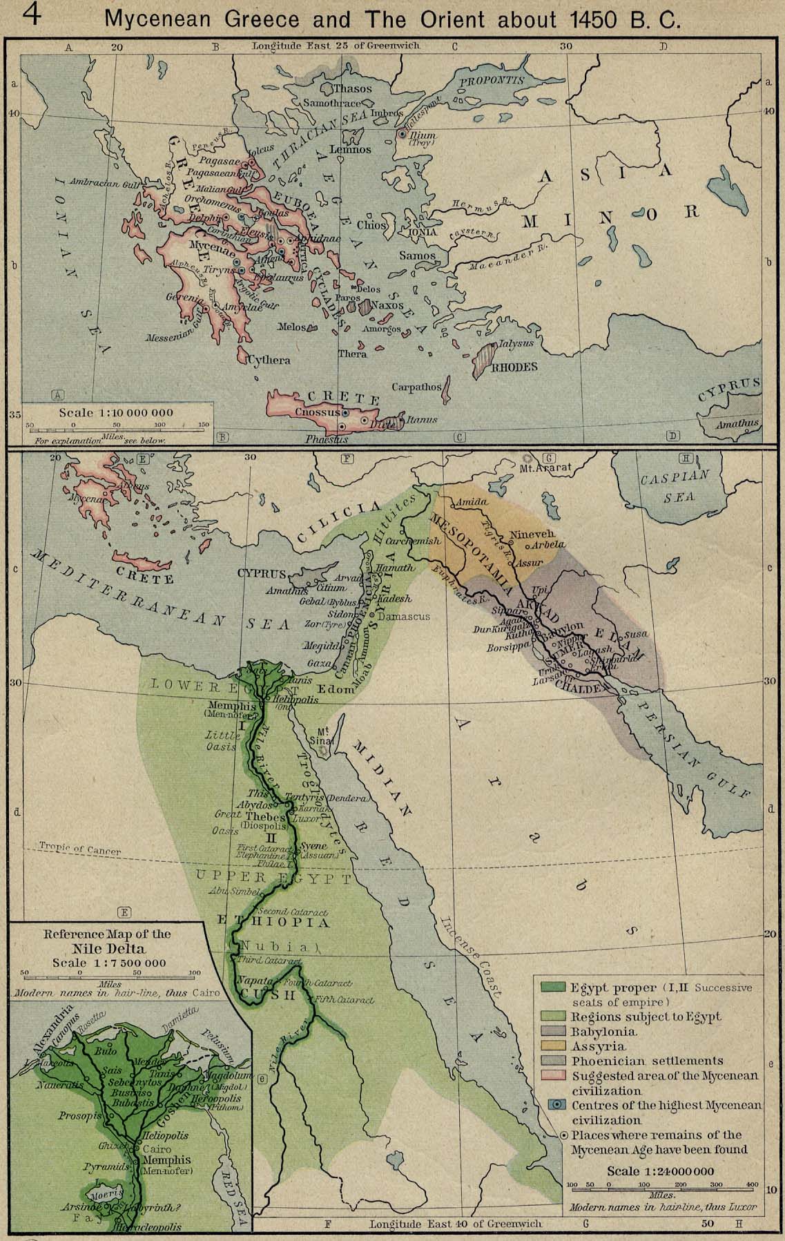
- ^ http://www.lib.utexas.edu/maps/historical/shepherd/mycenean_greece_orient.jpg [bare URL image file]
- ^ "Egyptian History: Dynasties 12 to 17 – The Middle Kingdom and the rule of the Hyksos". Reshafim.org.il. Retrieved 2010-03-16.
- ^ "2 Chronicles 14:2–15; – Passage Lookup — New International Version". BibleGateway.com. Retrieved 2010-03-16.
- ^ "The link between the ancient Yemeni kingdom and the ancient Slovenian State of Carantania uncovered: - from Marib to Carantania - culture - Yemen Times". Archived from the original on 2007-07-30. Retrieved 2007-05-29.
- ^ "Babylon". Enhancedweb.com. Retrieved 2010-03-16.
- ^ "Rome: The Carthaginian Empire in the Third Century BC". Wsu.edu:8080. 1999-06-06. Archived from the original on 2010-05-27. Retrieved 2010-03-16.
- ^ "Archived copy". Archived from the original on 2012-03-24. Retrieved 2007-06-21.
{{cite web}}: CS1 maint: archived copy as title (link) - ^ a b "thearabhistory.com". thearabhistory.com. Archived from the original on 2007-09-28. Retrieved 2010-03-16.
- ^ "Map of Europe, Southwest 500". Euratlas.com. 2007-01-13. Retrieved 2010-03-16.
- ^ "Complete Map of Europe, Year 500". Euratlas.com. 2007-01-13. Retrieved 2010-03-16.
- ^ Peter Benjamin Golden, (2010), Central Asia in World History, p. 49
- ^ "Complete Map of Europe, Year 800". Euratlas.com. 2007-01-13. Retrieved 2010-03-16.
- ^ "Yahoo | Mail, Weather, Search, Politics, News, Finance, Sports & Videos". Archived from the original on 2009-10-27.
- ^ Euratlas. "Map of Southwestern Europe in Year 800". Euratlas.com. Retrieved 2010-03-16.
- ^ Euratlas. "Map of Southwestern Europe in Year 900". Euratlas.com. Retrieved 2010-03-16.
- ^ Euratlas. "Map of Southeastern Europe in Year 900". Euratlas.com. Retrieved 2010-03-16.
- ^ a b Euratlas. "Map of Southwestern Europe in Year 1000". Euratlas.com. Retrieved 2010-03-16.
- ^ Euratlas. "Map of Southeastern Europe in Year 1000". Euratlas.com. Retrieved 2010-03-16.
- ^ "Map of Europe, Southwest 1100". Euratlas.com. 2007-01-13. Retrieved 2010-03-16.
- ^ a b Euratlas. "Map of Southwestern Europe in Year 1200". Euratlas.com. Retrieved 2010-03-16.
- ^ Euratlas. "Map of Southeastern Europe in Year 1200". Euratlas.com. Retrieved 2010-03-16.
- ^ http://www.zum.de/whkmla/histatlas/europe/eu1550.gif [bare URL image file]
- ^ http://www.zum.de/whkmla/histatlas/centrasia/khwarizm1220.gif [bare URL image file]
- ^ a b "WHKMLA : Historical Atlas, Modern Egypt Page". Zum.de. Retrieved 2010-03-16.
- ^ http://www.zum.de/whkmla/histatlas/asia/asia1500large.gif [bare URL image file]
- ^ http://www.zum.de/whkmla/histatlas/centrasia/ilkhanate1300.gif [bare URL image file]
- ^ "Complete Map of Europe, Year 1400". Euratlas.com. 2007-01-13. Retrieved 2010-03-16.
- ^ "Yahoo | Mail, Weather, Search, Politics, News, Finance, Sports & Videos". Archived from the original on 2009-10-27.
- ^ http://www.zum.de/whkmla/histatlas/russia/goldenhorde1480.gif [bare URL image file]
- ^ http://www.zum.de/whkmla/histatlas/africa/afr1830.gif [bare URL image file]
- ^ a b "WHKMLA : Historical Atlas, Sicily Page". Zum.de. Retrieved 2010-03-16.
- ^ http://www.britannica.com/ebi/art-93089?articleTypeId=31 [dead link]
- ^ http://www.zum.de/whkmla/histatlas/russia/goldenhorde1440.gif [bare URL image file]
- ^ "Complete Map of Europe, Year 1500". Euratlas.com. 2007-01-13. Retrieved 2010-03-16.
- ^ Euratlas. "Map of Southeastern Europe in Year 1500". Euratlas.com. Retrieved 2010-03-16.
- ^ "WHKMLA : Historical Atlas, Crimean Tatars Page". Zum.de. 2005-02-22. Retrieved 2010-03-16.
- ^ "WHKMLA : Historical Atlas, Siberia Page". Zum.de. Retrieved 2010-03-16.
- ^ "WHKMLA : Historical Atlas, Kalmykia Page". Zum.de. 2005-02-23. Retrieved 2010-03-16.
- ^ "WHKMLA : Historical Atlas, Kazakhstan Page". Zum.de. Retrieved 2010-03-16.
- ^ a b Euratlas. "Map of Southeastern Europe in Year 1800". Euratlas.com. Retrieved 2010-03-16.
- ^ "Iran (Persia), 1800-1900 A.D. | Timeline of Art History | the Metropolitan Museum of Art". www.metmuseum.org. Archived from the original on September 30, 2007.