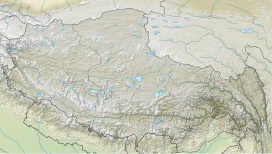
Lajo Dada (also known as Langu Himal) is a mountain peak in Dhaulagiri Zone, Gandaki Province of western-central Nepal.[1]
| Lajo Dada | |
|---|---|
 | |
| Highest point | |
| Elevation | 6,426 m |
| Coordinates | 28°32′45.33″N 85°3′12.18″E / 28.5459250°N 85.0533833°E |
| Geography | |
| Country | Nepal |
| Parent range | Himalayas |
| Climbing | |
| First ascent | October 17, 2017; by three-member Japanese team |
Location edit
It is located at 6,426 m (21,083 ft) above sea level in the west of the Tsum Valley and south of the Tabsar at 6,065 m (19,898 ft).[2] This peak was not accessible to the public until 2014, when it was opened for climbing by the Nepalese government.
Climbing history edit
On October 17, 2017, a three-member Japanese team made the first ascent of Lajo Dada. All three were members of Tomon Alpine Club and graduates of Waseda University — Norifumi Fukuda, Kojuro Hagihara, and Yudai Suzuki.[2][3]
References edit
- ^ "Mount Lajo Dada, Location in Narchyang, Province No. 4, Nepal - Aloeus". www.aloeus.com. Retrieved 2022-09-03.
- ^ a b "AAC Publications - Lajo Dada (a.k.a. Langu Himal), Northern Glacier and West-Northwest Ridge". publications.americanalpineclub.org. American Alpine Club. Retrieved 2022-09-03.
- ^ "Waseda Alpine Club conquers unclimbed 6,426m Himalayan peak". Waseda University. Retrieved 2022-09-03.


