Size of this JPG preview of this PDF file: 675 × 600 pixels. Other resolutions: 270 × 240 pixels | 540 × 480 pixels | 865 × 768 pixels | 1,153 × 1,024 pixels | 2,306 × 2,048 pixels | 5,404 × 4,800 pixels.
Original file (5,404 × 4,800 pixels, file size: 299 KB, MIME type: application/pdf)
| This is a file from the Wikimedia Commons. Information from its description page there is shown below. Commons is a freely licensed media file repository. You can help. |
Summary
| Description |
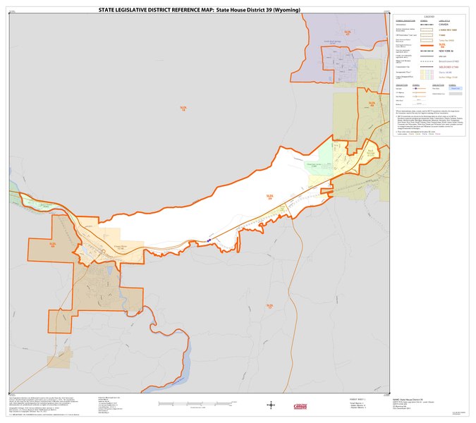
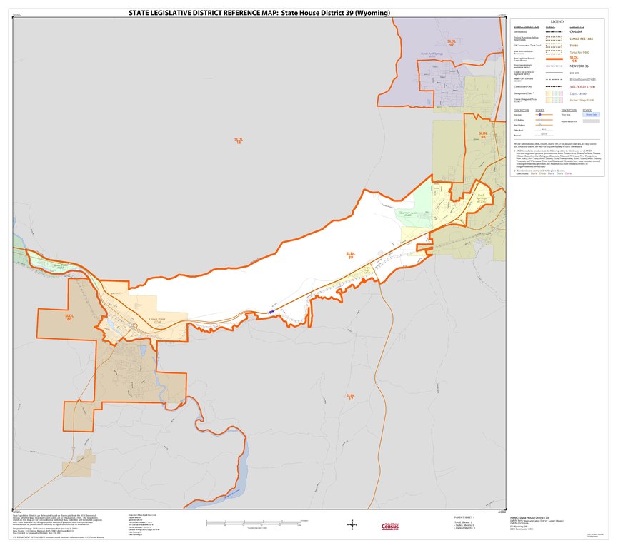
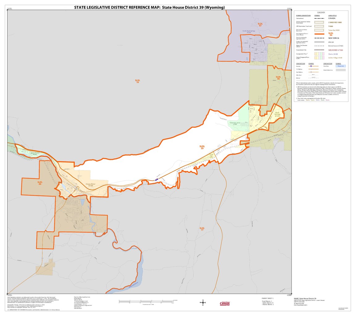
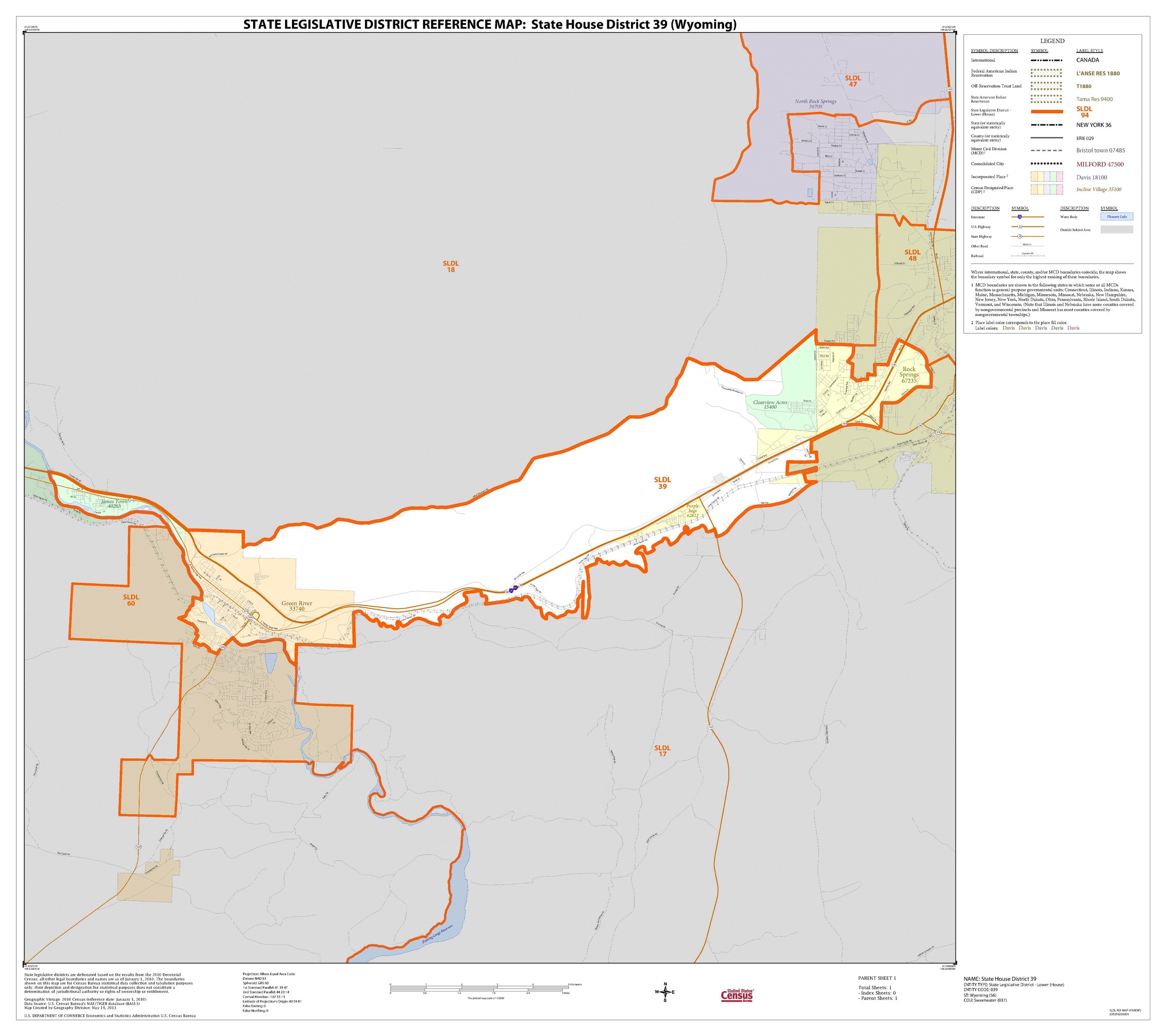
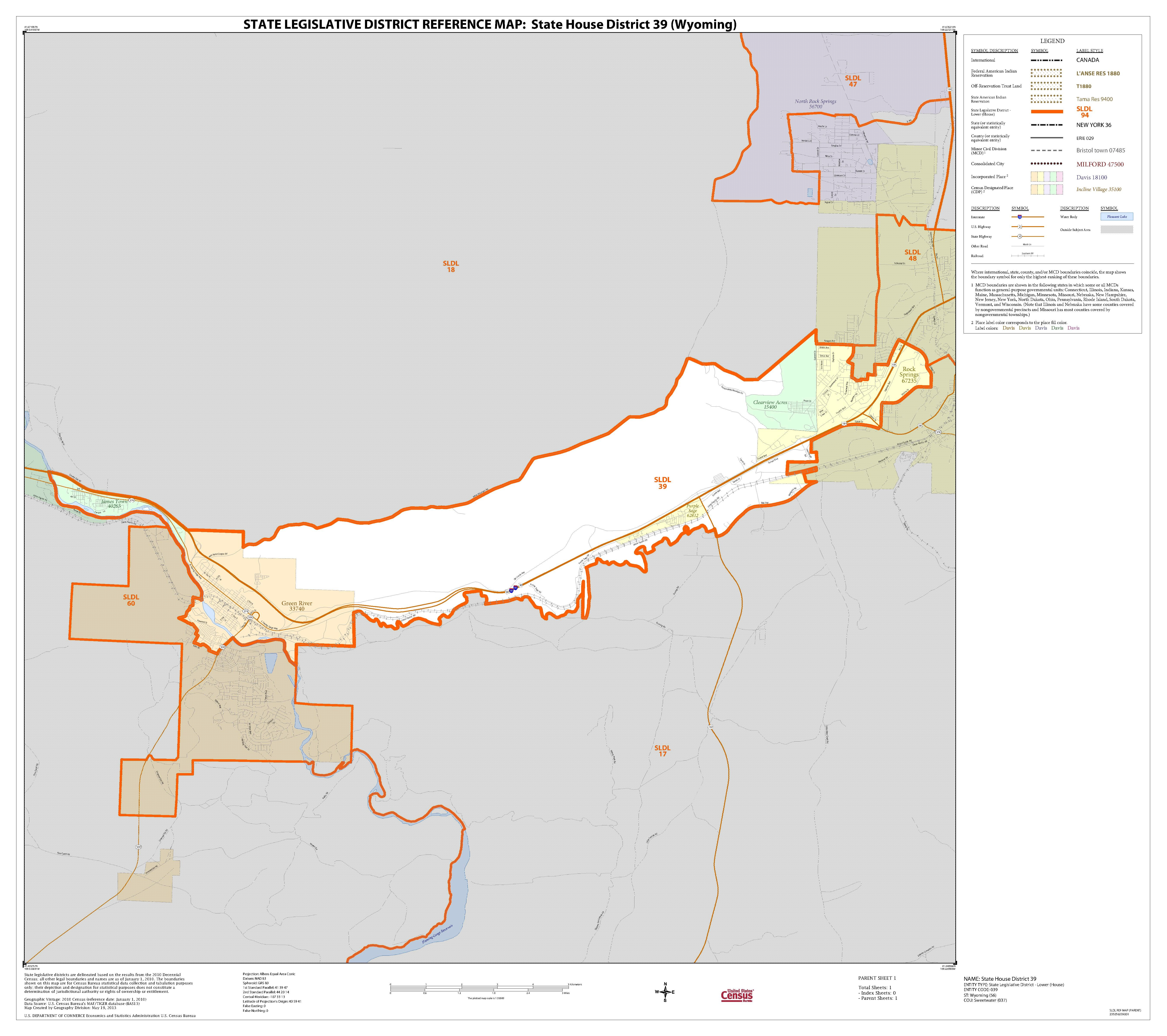
English: U.S. Census Bureau map of Wyoming's 39th House of Representatives district |
| Date | |
| Source | https://www2.census.gov/geo/maps/dc10map/SLD_RefMap/lower/st56_wy/sldl56039/ |
| Author | United States Census Bureau |
Licensing
This image or file is a work of a United States Census Bureau employee, taken or made as part of that person's official duties. As a work of the U.S. federal government, the image is in the public domain.
|
 |
File history
Click on a date/time to view the file as it appeared at that time.
| Date/Time | Thumbnail | Dimensions | User | Comment | |
|---|---|---|---|---|---|
| current | 03:16, 29 July 2021 |  | 5,404 × 4,800 (299 KB) | TEMPO156 | Uploaded a work by {{w|United States Census Bureau}} from https://www2.census.gov/geo/maps/dc10map/SLD_RefMap/lower/st56_wy/sldl56039/ with UploadWizard |
File usage
The following pages on the English Wikipedia use this file (pages on other projects are not listed):