Size of this preview: 750 × 600 pixels. Other resolutions: 300 × 240 pixels | 600 × 480 pixels | 1,000 × 800 pixels.
Original file (1,000 × 800 pixels, file size: 1.36 MB, MIME type: image/png)
| This is a file from the Wikimedia Commons. Information from its description page there is shown below. Commons is a freely licensed media file repository. You can help. |
Summary
| Description |
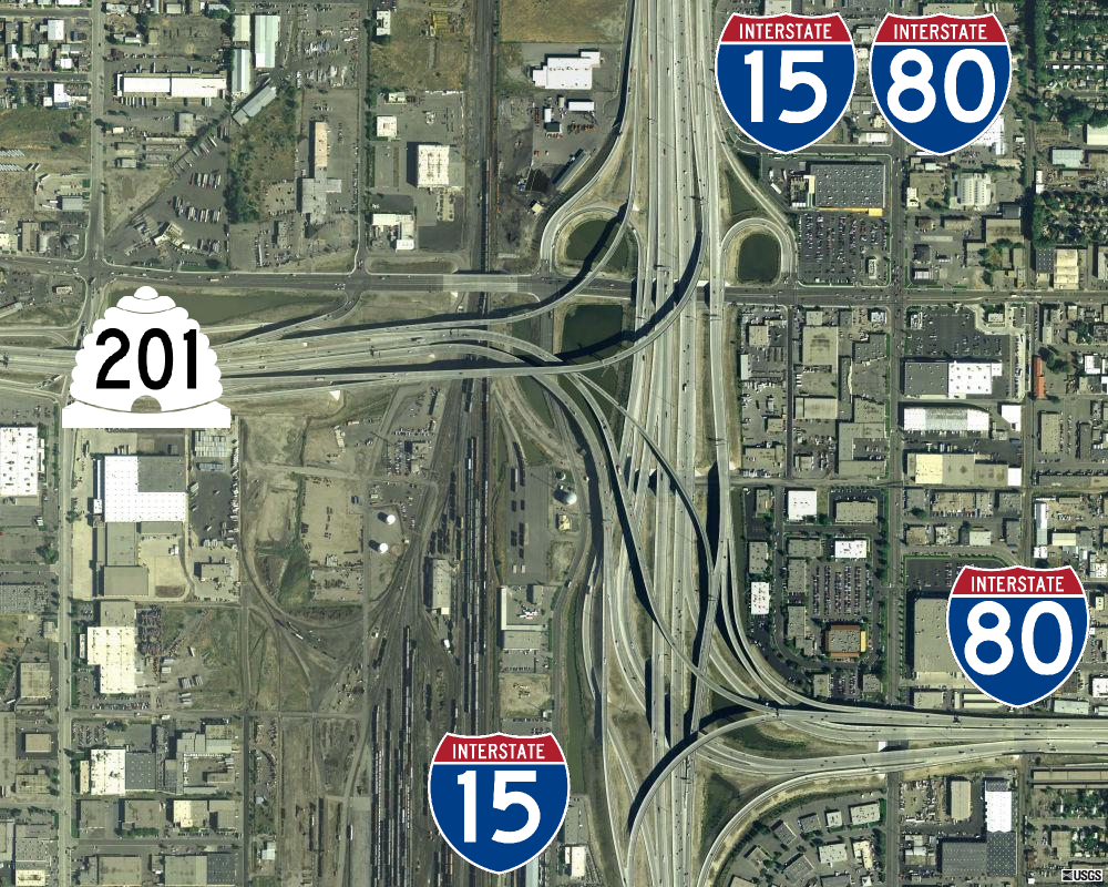
English: Aerial image of the "spaghetti bowl", the junction of SR-201, I-15, and I-80 in South Salt Lake, Utah.
|
||||||||||||
| Date | |||||||||||||
| Source | MSR Maps (September 18, 2003). "2700 S Main St, Salt Lake City, UT 84115 Salt Lake City, Utah, United States" (Map). Cartography by U.S. Geological Survey. | ||||||||||||
| Author |
|
||||||||||||
| Permission (Reusing this file) |
Base Image
ShieldsInterstate shields
Utah state route shield
|
.svg)

.svg)
.svg)
| Camera location | | View this and other nearby images on: OpenStreetMap |
|---|
| Annotations | This image is annotated: View the annotations at Commons |
File history
Click on a date/time to view the file as it appeared at that time.
| Date/Time | Thumbnail | Dimensions | User | Comment | |
|---|---|---|---|---|---|
| current | 01:29, 5 February 2014 | | 1,000 × 800 (1.36 MB) | Admrboltz | pngcrush -reduce -brute (14.90% critical chunk reduction) |
| 23:58, 4 January 2010 |  | 1,000 × 800 (1.6 MB) | CountyLemonade | ||
| 23:48, 7 July 2008 |  | 750 × 601 (920 KB) | CountyLemonade | ||
| 23:32, 7 July 2008 |  | 749 × 582 (914 KB) | CountyLemonade | {{Information |Description={{en|1=An overhead view of the spaghetti bowl, the junction of SR-201/I-15/I-80}} |Source=http://terraserver-usa.com/image.aspx?T=4&S=12&Z=12&X=5 |
File usage
The following pages on the English Wikipedia use this file (pages on other projects are not listed):
Global file usage
The following other wikis use this file:
- Usage on www.wikidata.org