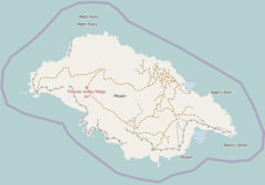
Down Rope is a coastal area on the southeast coast of Pitcairn Island in the south Pacific,[1] to the east of the Aute Valley and north of Break Jim Hip, it lies on the eastern side of an inlet and contains large petroglyphs on the rock face, testament to the Polynesian settlers of centuries ago.[2] It is described as "a steep cliff located on the southern coast south of Ned Young's Ground, and west of St Paul's Point. At its foot, despite its perilous descent, is a popular picnic area and Pitcairn's only beach."[citation needed] The descent from the cliff top is said to be "spine chilling".[3] There is anchorage at Down Rope and ignimbrite is also found in the vicinity.[4][5]
Location of Down Rope on Pitcairn Island
References edit
- ^ Hinz, Earl R.; Howard, Jim (1 May 2006). Landfalls of Paradise: Cruising Guide to the Pacific Islands. University of Hawaii Press. p. 123. ISBN 978-0-8248-3037-3. Retrieved 30 April 2012.
- ^ McKinnon, Rowan (1 August 2009). South Pacific. Lonely Planet. pp. 244–5. ISBN 978-1-74104-786-8. Retrieved 30 April 2012.
- ^ Carlsson, Susanne Chauvel (2000). Pitcairn: island at the edge of time. Central Queensland University Press. p. 83. ISBN 978-1-875998-92-0. Retrieved 30 April 2012.
- ^ Stanley, David (3 December 2004). Moon Handbooks South Pacific. David Stanley. p. 293. ISBN 978-1-56691-411-6. Retrieved 30 April 2012.
- ^ Benton, Tim; Spencer, Tom (1995). The Pitcairn Islands: biogeography, ecology and prehistory : proceedings of an international discussion meeting held at the Linnean Society, 5-6 May 1994. Linnean Society of London, Published for the Linnean Society of London by Academic Press. p. 342. ISBN 978-0-12-089345-4. Retrieved 30 April 2012.
External links edit
25°04′25″S 130°05′40″W / 25.07361°S 130.09444°W
