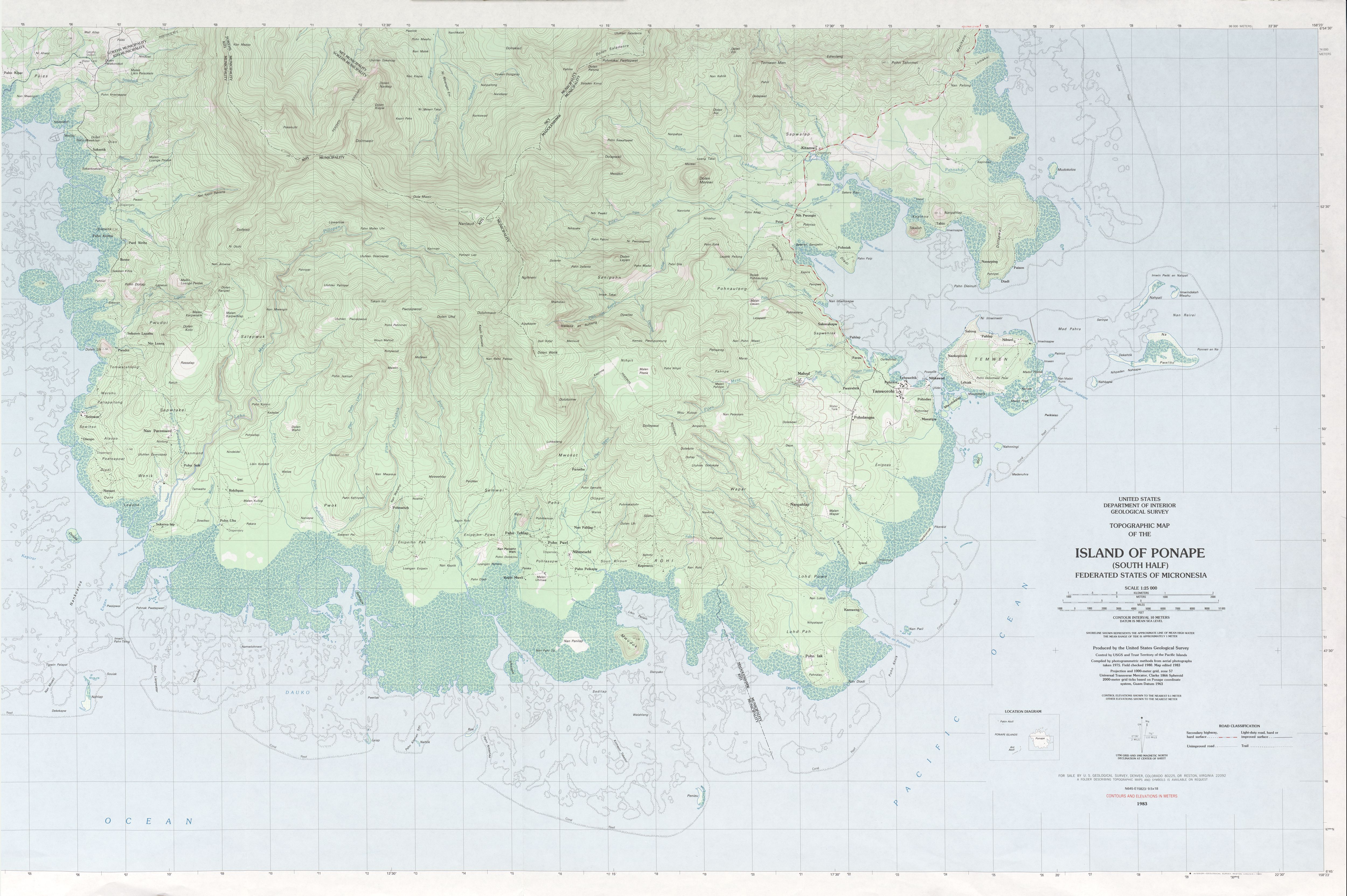
Dolohmwar or Totolom is the third highest point of the Federated States of Micronesia, with an altitude of 760 metres (2,595 ft). Mount Nanlaud 1.9 km to the north-northwest is the highest point at 2,566 feet (782 m).[3] Between the two is Ngihneni,[4] within a meter or two of Nanlaud. All three are clearly depicted on the definitive USGS 1:25,000 scale topographic survey.[2]
| Dolohmwar | |
|---|---|
 Dolohmwar Federated States of Micronesia | |
| Highest point | |
| Elevation | 760 m (2,490 ft)[1] |
| Coordinates | 6°51′25″N 158°13′57″E / 6.85694°N 158.23250°E |
| Geography | |
| Location | Pohnpei, FSM |
| Topo map | [2] |
| Geology | |
| Mountain type | Hill |

Dolohmwar is located on the island and in the state of Pohnpei.
See also edit
References edit
- ^ "Dolohmwar" on Peakery.com Archived March 31, 2012, at the Wayback Machine Retrieved 1 October 2011
- ^ a b "Ponape South". US Geological Survey. 1983. Retrieved 22 Jan 2017.
- ^ "Mount Nanlaud". GeoNames. Retrieved 12 May 2013.
- ^ "Ngihneni--This site provides the coordinates for Nanlaud, not Ngihneni, as per the USGS topo". Retrieved 22 Jan 2017.
External links edit
- (in English) Dolohmwar, Micronesia, GeoNames.org.
This Federated States of Micronesia location article is a stub. You can help Wikipedia by expanding it. |