This article needs additional citations for verification. (September 2022) |
Benson is an unincorporated community in the Canadian province of Saskatchewan. It is located between Estevan and Stoughton on Highway 47. Currently it has a curling rink, community hall and the municipal offices of Rural Municipality of Benson No. 35. The geographical location for Benson is north of the Canada–US border and North Dakota.
Benson | |
|---|---|
 | |
 Location of Benson in Saskatchewan  Benson, Saskatchewan (Canada) | |
| Coordinates: 49°26′48″N 102°59′39″W / 49.446570°N 102.994290°W | |
| Country | Canada |
| Province | Saskatchewan |
| Rural Municipality | Benson |
| Postal code | S0C 0L0 |
| Area code | 306 |
| Highways | Highway 47 |
On July 1, 1935, Benson was hit by a tornado, killing 1, injuring 2, and levelling multiple structures.
Demographics edit
In the 2021 Census of Population conducted by Statistics Canada, Benson had a population of 95 living in 33 of its 42 total private dwellings, a change of -18.1% from its 2016 population of 116. With a land area of 0.45 km2 (0.17 sq mi), it had a population density of 211.1/km2 (546.8/sq mi) in 2021.[1]
Gallery edit
-
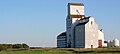 Grain elevator
 -
 The Benson School in 1995 after it closed


References edit
- ^ "Population and dwelling counts: Canada and designated places". Statistics Canada. February 9, 2022. Retrieved August 31, 2022.
External links edit
![]() Media related to Benson, Saskatchewan at Wikimedia Commons
Media related to Benson, Saskatchewan at Wikimedia Commons
This article about a location in the Census Division No. 1 of Saskatchewan is a stub. You can help Wikipedia by expanding it. |