Size of this preview: 800 × 440 pixels. Other resolutions: 320 × 176 pixels | 640 × 352 pixels | 1,024 × 563 pixels | 1,840 × 1,012 pixels.
Original file (1,840 × 1,012 pixels, file size: 956 KB, MIME type: image/png)
| This is a file from the Wikimedia Commons. Information from its description page there is shown below. Commons is a freely licensed media file repository. You can help. |
Summary
| Description |
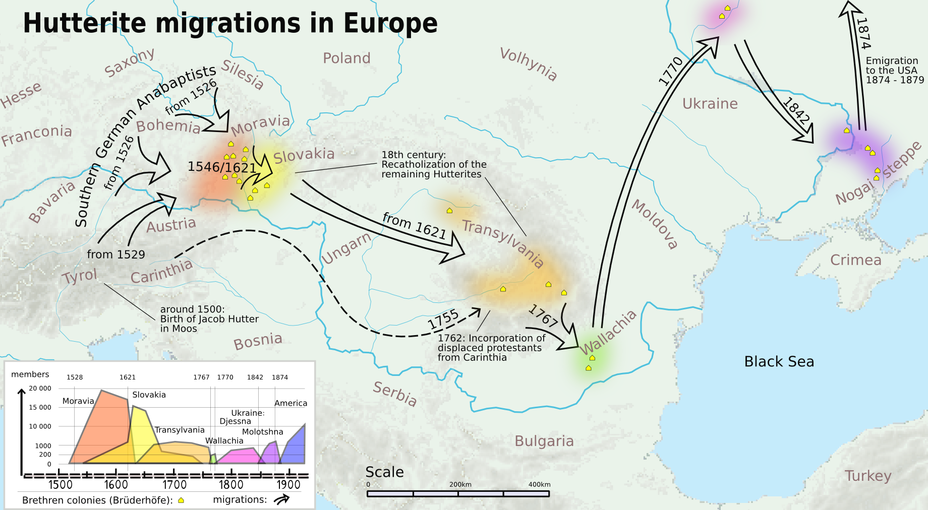
English: The map is based on "Europe_topography_map.png" by user:San Jose and some books about the Hutterite comunities.
Authors: User:Karlis, User:Feetjen and users of the mapping-workshop |
| Date | |
| Source | Own work |
| Author | Karlis |
| Other versions | Migration der Hutterer in Europa.png |
Licensing
I, the copyright holder of this work, hereby publish it under the following licenses:
This file is licensed under the Creative Commons Attribution-Share Alike 3.0 Unported license.
- You are free:
- to share – to copy, distribute and transmit the work
- to remix – to adapt the work
- Under the following conditions:
- attribution – You must give appropriate credit, provide a link to the license, and indicate if changes were made. You may do so in any reasonable manner, but not in any way that suggests the licensor endorses you or your use.
- share alike – If you remix, transform, or build upon the material, you must distribute your contributions under the same or compatible license as the original.

|
Permission is granted to copy, distribute and/or modify this document under the terms of the GNU Free Documentation License, Version 1.2 or any later version published by the Free Software Foundation; with no Invariant Sections, no Front-Cover Texts, and no Back-Cover Texts. A copy of the license is included in the section entitled GNU Free Documentation License. |
You may select the license of your choice.
File history
Click on a date/time to view the file as it appeared at that time.
| Date/Time | Thumbnail | Dimensions | User | Comment | |
|---|---|---|---|---|---|
| current | 14:14, 4 November 2012 | | 1,840 × 1,012 (956 KB) | Nelliette | Reverted to version as of 09:41, 9 October 2011 |
| 17:59, 14 November 2011 |  | 577 × 317 (229 KB) | Karlis | some text changes | |
| 09:41, 9 October 2011 |  | 1,840 × 1,012 (956 KB) | Karlis | {{Information |Description ={{en|1=The map is based on "Europe_topography_map.png" by user:San Jose and some books about the Hutterite comunities. Authors: User:Karlis, User:Feetjen and users of the mapping-workshop}} |Source ={{own}} |Aut |
File usage
The following pages on the English Wikipedia use this file (pages on other projects are not listed):
Global file usage
The following other wikis use this file:
- Usage on de.wikipedia.org
- Usage on es.wikipedia.org
- Usage on fi.wikipedia.org
- Usage on it.wikipedia.org
- Usage on ro.wikipedia.org
- Usage on ru.wikipedia.org
- Usage on sk.wikipedia.org
- Usage on uk.wikipedia.org