Size of this preview: 800 × 533 pixels. Other resolutions: 320 × 213 pixels | 640 × 427 pixels | 1,024 × 683 pixels | 1,280 × 853 pixels | 2,560 × 1,706 pixels | 3,500 × 2,333 pixels.
Original file (3,500 × 2,333 pixels, file size: 2.07 MB, MIME type: image/jpeg)
| This is a file from the Wikimedia Commons. Information from its description page there is shown below. Commons is a freely licensed media file repository. You can help. |
Summary
| Description |
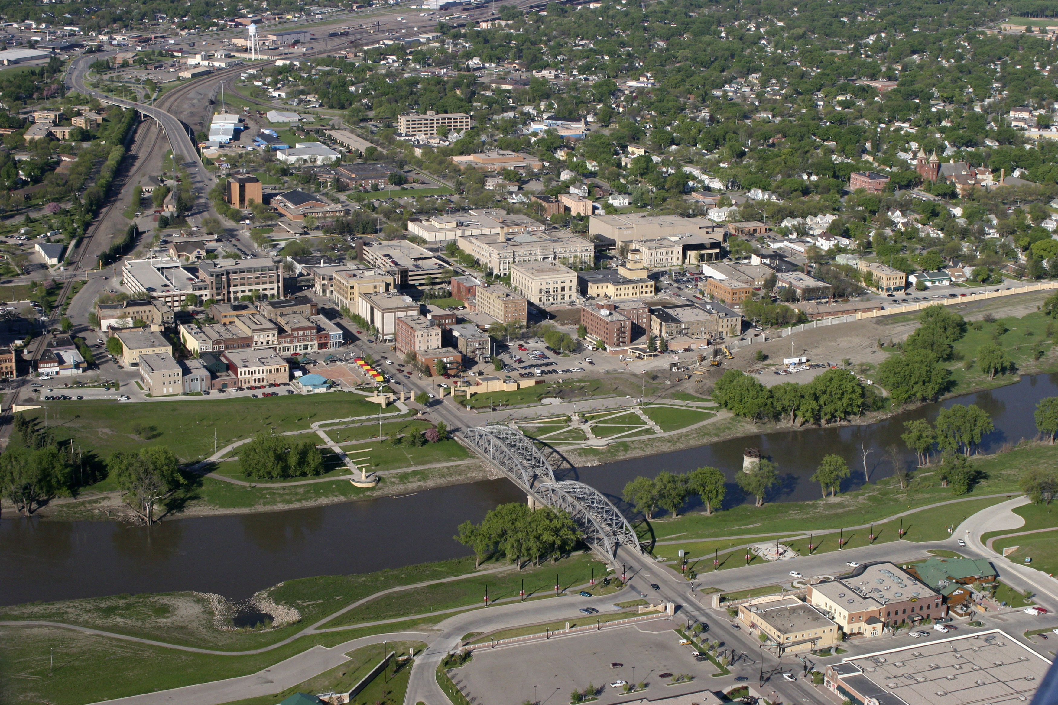
English: Grand Forks, ND, May 17, 2006 -- Aerial view of Grand Forks mitigation project building new levee walls, burns and pumping stations protecting the city from the Red River.
Photo by Brenda Riskey/UND |
| Date | |
| Source |
This image is from the FEMA Photo Library (obsolete as of 2019). An archived copy may be found at the Wayback Machine (note: link may be permanently dead, as not all photos were backed up in this way). If the FEMA link is permanently dead, the photo can be found at NARA Access to Archival Databases (only works if photo was taken between 1989 and October 2004), or at City-data.com. |
| Author | Brenda Riskey |
Licensing
This image is a work of a Federal Emergency Management Agency employee, taken or made as part of that person's official duties. As works of the U.S. federal government, all FEMA images are in the public domain in the United States. Additional media usage information may be found at https://www.fema.gov/photo-video-audio-use-guidelines
|
File history
Click on a date/time to view the file as it appeared at that time.
| Date/Time | Thumbnail | Dimensions | User | Comment | |
|---|---|---|---|---|---|
| current | 10:21, 15 October 2009 | | 3,500 × 2,333 (2.07 MB) | BotMultichillT | == {{int:filedesc}} == {{Information |description={{en|1=Grand Forks, ND, May 17, 2006 -- Aerial view of Grand Forks mitigation project building new levee walls, burns and pumping stations protecting the city from the Red River. Photo by Brenda Riskey/U |
File usage
The following pages on the English Wikipedia use this file (pages on other projects are not listed):
Global file usage
The following other wikis use this file:
- Usage on azb.wikipedia.org
- Usage on bn.wikipedia.org
- Usage on cs.wikipedia.org
- Usage on fi.wikipedia.org
- Usage on fo.wikipedia.org
- Usage on gd.wikipedia.org
- Usage on ja.wikipedia.org
- Usage on lt.wikipedia.org
- Usage on nv.wikipedia.org
- Usage on simple.wikipedia.org
- Usage on sr.wikipedia.org
- Usage on uk.wikipedia.org
- Usage on zh.wikipedia.org