File:British India map of Northeast India and Myanmar, Bengal Assam Meghalaya Arunachal Pradesh Nagaland Manipur Mizoram Tripura regions 1891.jpg
Size of this preview: 381 × 600 pixels. Other resolutions: 152 × 240 pixels | 305 × 480 pixels | 488 × 768 pixels | 650 × 1,024 pixels | 1,884 × 2,966 pixels.
Original file (1,884 × 2,966 pixels, file size: 630 KB, MIME type: image/jpeg)
| This is a file from the Wikimedia Commons. Information from its description page there is shown below. Commons is a freely licensed media file repository. You can help. |
| Description |
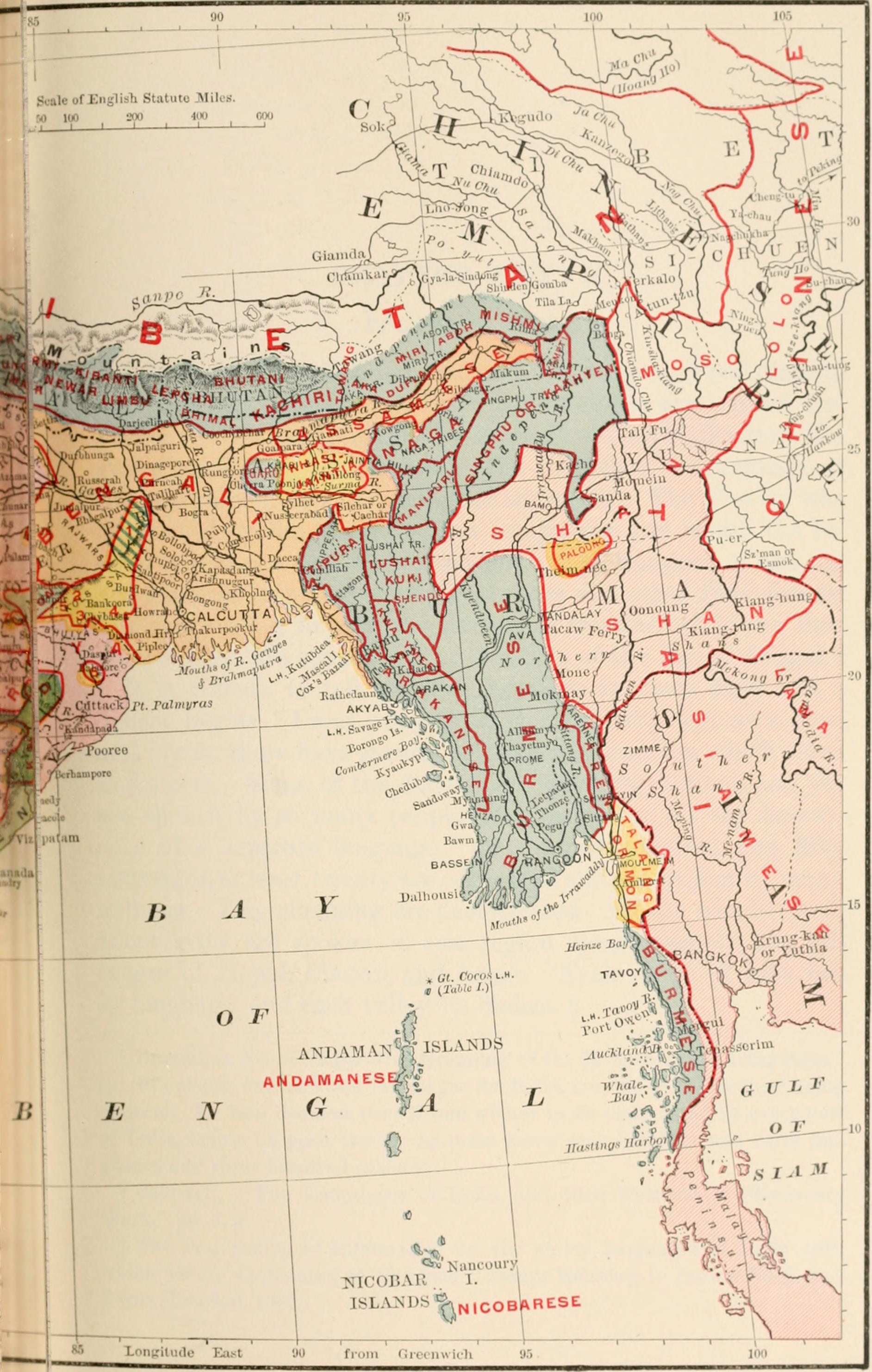
Language map There are about one hundred and fifty languages and dialects spoken by the natives of India. There are seven chief languages. Source: Languages of India Map, Page 343 of "Indika. The country and the people of India and Ceylon" (1891) Author: John Fletcher Hurst (1834-1903) Publisher: Harper, New York |
| Date | |
| Source | Image from page 374 of "Indika. The country and the people of India and Ceylon" (1891) |
| Author | Internet Archive Book Images |
Licensing
This file is licensed under the Creative Commons Attribution-Share Alike 2.0 Generic license.
- You are free:
- to share – to copy, distribute and transmit the work
- to remix – to adapt the work
- Under the following conditions:
- attribution – You must give appropriate credit, provide a link to the license, and indicate if changes were made. You may do so in any reasonable manner, but not in any way that suggests the licensor endorses you or your use.
- share alike – If you remix, transform, or build upon the material, you must distribute your contributions under the same or compatible license as the original.
| This image was originally posted to Flickr by Internet Archive Book Images at https://www.flickr.com/photos/126377022@N07/14583575319. It was reviewed on 2 August 2014 by FlickreviewR and was confirmed to be licensed under the terms of the cc-by-sa-2.0. |
File history
Click on a date/time to view the file as it appeared at that time.
| Date/Time | Thumbnail | Dimensions | User | Comment | |
|---|---|---|---|---|---|
| current | 22:44, 2 August 2014 | | 1,884 × 2,966 (630 KB) | AmyNorth | Transferred from Flickr via Flickr2commons |
File usage
The following pages on the English Wikipedia use this file (pages on other projects are not listed):