Zeeland is a village in the Dutch province of North Brabant. It is located in the former municipality of Landerd, about 5 km northeast of Uden.
Zeeland | |
|---|---|
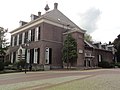
 Former school | |
_vlag.svg) Flag  Coat of arms | |
 Zeeland Location in the province of North Brabant in the Netherlands  Zeeland Zeeland (Netherlands) | |
| Coordinates: 51°41′48″N 5°40′34″E / 51.69667°N 5.67611°E | |
| Country | Netherlands |
| Province | North Brabant |
| Municipality | Maashorst |
| Area | |
| • Total | 3.07 km2 (1.19 sq mi) |
| Elevation | 19 m (62 ft) |
| Population (2021)[1] | |
| • Total | 4,885 |
| • Density | 1,600/km2 (4,100/sq mi) |
| Time zone | UTC+1 (CET) |
| • Summer (DST) | UTC+2 (CEST) |
| Postal code | 5410, 5411[1] |
| Dialing code | 0486 |
| Major roads | A50, N277, N324 |
History edit
The village was first mentioned in 1376 as Zeelant, and refers to Terra Salica, an inheritance system which excluded women.[3] Zeeland developed in the Middle Ages on the edge of the Peel region. The Catholic St Jacobus de Meerdere Church was built between 1871 and 1872 as a replacement for its medieval predecessor.[4]
Zeeland was home to 467 people in 1840.[3] Zeeland was a separate municipality until 1994, when it became part of Landerd.[5] Since 2022 it has been part of the new municipality of Maashorst.[3]
Gallery edit
-
 Zeeland, church
 -
 Zeeland, windmill
 -
 Clergy house
 -
 Farm in Zeeland


References edit
- ^ a b c "Kerncijfers wijken en buurten 2021". Central Bureau of Statistics. Retrieved 17 April 2022.
- ^ "Postcodetool for 5411AA". Actueel Hoogtebestand Nederland (in Dutch). Het Waterschapshuis. Retrieved 17 April 2022.
- ^ a b c "Zeeland (Brabant)". Plaatsengids (in Dutch). Retrieved 17 April 2022.
- ^ Chris Kolman & Ronald Stenvert (1997). Zeeland (in Dutch). Zwolle: Waanders. ISBN 90 400 9945 6. Retrieved 16 April 2022.
- ^ Ad van der Meer and Onno Boonstra, Repertorium van Nederlandse gemeenten, KNAW, 2011.
External links edit
 Media related to Zeeland, North Brabant at Wikimedia Commons
This North Brabant location article is a stub. You can help Wikipedia by expanding it. |