State Trunk Highway 160 (often called Highway 160, STH-160 or WIS 160) is a state highway in the US state of Wisconsin. It runs in east–west in east-central Wisconsin from Angelica to Pulaski.
State Trunk Highway 160 | ||||
|---|---|---|---|---|
| Polish Veterans Memorial Highway | ||||
 WIS 160 highlighted in red | ||||
| Route information | ||||
| Maintained by WisDOT | ||||
| Length | 3.44 mi[1] (5.54 km) | |||
| Major junctions | ||||
| West end | ||||
| East end | ||||
| Location | ||||
| Country | United States | |||
| State | Wisconsin | |||
| Counties | Shawano, Brown | |||
| Highway system | ||||
| ||||

Route description edit
Starting at WIS 29/WIS 55 junction in Angelica, WIS 160 travels eastward. After under 3.5 miles (5.6 km), WIS 160 ends at WIS 32 in Pulaski.
-
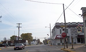 Eastern terminus
 -
 West terminus from WIS 29


History edit
Initially, in 1923, WIS 160 was established to bypass WIS 16 from Mill Center to Angelica through downtown Pulaski.[2][3] In 1930, four years after WIS 16 was renumbered WIS 29,[4][5] both WIS 29 and WIS 160 switched places. However, WIS 160 ended up traveling from WIS 29 in Angelica to WIS 32 in Pulaski.[6][7] In 1996, the route was slightly truncated in favor of the WIS 29 expressway.[8][9]
Major intersections edit
| County | Location | mi | km | Destinations | Notes |
|---|---|---|---|---|---|
| Shawano | Community of Angelica | 0.00 | 0.00 | Roadway continues as WIS 55 | |
| Brown | Pulaski | 3.44 | 5.54 | Roadway continues as southbound WIS 32 | |
| 1.000 mi = 1.609 km; 1.000 km = 0.621 mi | |||||
See also edit
References edit
- ^ Bessert, Chris. "Highways 160–169". Wisconsin Highways. Retrieved March 20, 2007.[self-published source]
- ^ Wisconsin Highway Commission (1923). Official Map of the State Trunk Highway System of Wisconsin (PDF) (Map). Scale not given. Madison: Wisconsin Highway Commission. Retrieved February 21, 2021 – via Wikimedia Commons.
- ^ Wisconsin Highway Commission (1924). Official Highway Map of Wisconsin: 'The Playground of the Middle West' (PDF) (Map). c. 1:950,400. Madison: Wisconsin Highway Commission. OCLC 560719947. Retrieved February 21, 2021 – via Wikimedia Commons.
- ^ Wisconsin Highway Commission (1926). Official Highway Map of Wisconsin (PDF) (Map). 1:950,400. Madison: Wisconsin Highway Commission. OCLC 237003454, 71251169. Retrieved February 21, 2021 – via Wikimedia Commons.
- ^ Wisconsin Highway Commission (1927). Official Highway Map of Wisconsin, 'The Playground of the Middle West' (PDF) (Map). 1:950,400. Madison: Wisconsin Highway Commission. Retrieved February 21, 2021 – via Wikimedia Commons.
- ^ Wisconsin Highway Commission (1930). Official Highway Service Map of Wisconsin (PDF) (Map). 1:506,880. Madison: Wisconsin Highway Commission. Retrieved February 21, 2021 – via Wikimedia Commons.
- ^ Wisconsin Highway Commission (1931). Official Highway Map of Wisconsin (PDF) (Map). 1:887,040. Madison: Wisconsin Highway Commission. Retrieved February 21, 2021 – via Wikimedia Commons.
- ^ Wisconsin Department of Transportation Division of Highways (1995). Wisconsin Highway Map (PDF) (Map) (1995–1996 ed.). 1:823,680. Madison: Wisconsin Department of Transportation. OCLC 300018174. Retrieved February 21, 2021.
- ^ Wisconsin Department of Transportation Division of Highways (1997). Wisconsin Highway Map (PDF) (Map) (1997–1998 ed.). 1:823,680. Madison: Wisconsin Department of Transportation. Retrieved February 21, 2021.
External links edit
 Media related to Wisconsin Highway 160 at Wikimedia Commons