Valy is a municipality and village in Pardubice District in the Pardubice Region of the Czech Republic. It has about 500 inhabitants.
Valy | |
|---|---|
 Lepějovická street | |
 Flag  Coat of arms | |
 Valy Location in the Czech Republic | |
| Coordinates: 50°1′47″N 15°37′0″E / 50.02972°N 15.61667°E | |
| Country | |
| Region | Pardubice |
| District | Pardubice |
| First mentioned | 1398 |
| Area | |
| • Total | 4.29 km2 (1.66 sq mi) |
| Elevation | 217 m (712 ft) |
| Population (2023-01-01)[1] | |
| • Total | 525 |
| • Density | 120/km2 (320/sq mi) |
| Time zone | UTC+1 (CET) |
| • Summer (DST) | UTC+2 (CEST) |
| Postal code | 535 01 |
| Website | www |
Geography edit
Valy is located about 10 kilometres (6 mi) west of Pardubice. It lies in the western tip of the Svitavy Uplands. The highest point is the hill Bílý kopec at 247 metres (810 ft) above sea level. The municipality is situated on the right bank of the Elbe River, which forms the northern municipal border.
The Struha stream flows east of the village and connects with the Elbe. The surroundings of the Struha with the original meandering stream bed is protected as the Meandry Struhy National Monument.[2]
History edit
The first written mention of Valy is from 1398. The history of Valy is connected with the village of Lepějovice, first mentioned in 1167. Lepějovice was abandoned between 1704 and 1848, when both villages were part of the Choltice estate. In addition to Lepějovice, the today's territory of the municipality also includes the former village of Crkaň.[3]
Demographics edit
|
|
| ||||||||||||||||||||||||||||||||||||||||||||||||||||||
| Source: Censuses[4][5] | ||||||||||||||||||||||||||||||||||||||||||||||||||||||||
Transport edit
The I/2 road (the section from Pardubice to Kutná Hora) runs through the municipality.
Two different railway lines passes through the municipality. The Valy u Přelouče stop is located on the Kolín–Česká Třebová line.[6] The Valy u Přelouče zastávka stop is located on the Přelouč–Heřmanův Městec line.[7]
Sights edit
The Church of Saint Michael the Archangel is located in the area on the extinct village of Lepějovice. It is originally a nearly Gothic church from the second half of the 13th century, which was completely rebuilt in the Baroque style in 1819 into its current appearance.[8]
Z pěti kanálů Bridge is a railway bridge from 1845. It is protected as a technical monument.[2]
Gallery edit
-
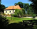
 Municipal office
 -
 Valy u Přelouče train stop
 -
 Church of Saint Michael the Archangel


References edit
- ^ "Population of Municipalities – 1 January 2023". Czech Statistical Office. 2023-05-23.
- ^ a b "Zajímavosti" (in Czech). Obec Valy. Retrieved 2022-07-11.
- ^ "Historie" (in Czech). Obec Valy. Retrieved 2022-07-11.
- ^ "Historický lexikon obcí České republiky 1869–2011 – Okres Pardubice" (in Czech). Czech Statistical Office. 2015-12-21. pp. 15–16.
- ^ "Population Census 2021: Population by sex". Public Database. Czech Statistical Office. 2021-03-27.
- ^ "Detail stanice Valy u Přelouče" (in Czech). České dráhy. Retrieved 2024-02-17.
- ^ "Detail stanice Valy u Přelouče z." (in Czech). České dráhy. Retrieved 2024-02-17.
- ^ "Kostel sv. Archanděla Michaela" (in Czech). National Heritage Institute. Retrieved 2022-07-11.