| This article has not yet been rated on Wikipedia's content assessment scale. |
Location and coordinates edit
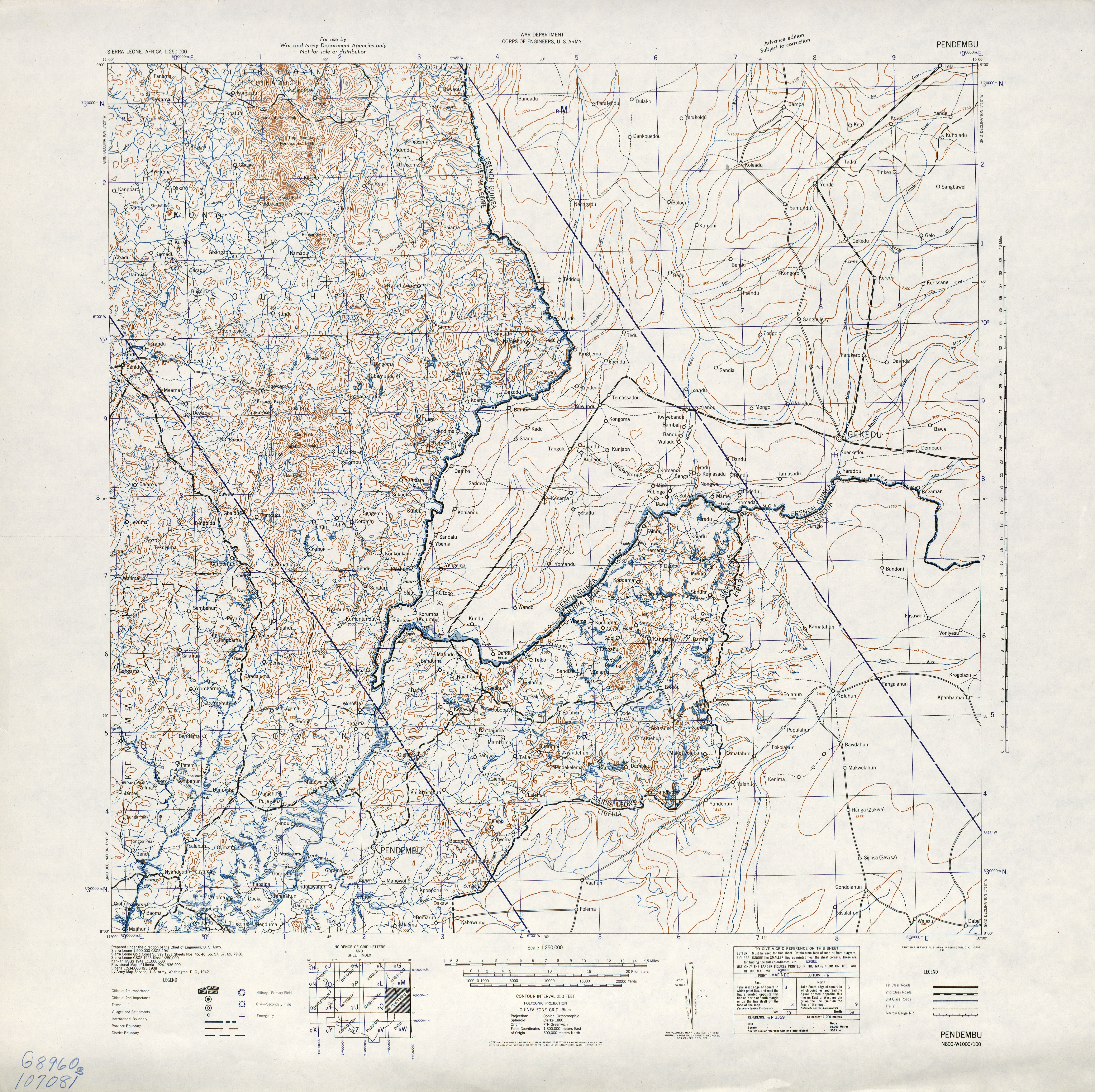
The GNIS lists Yenga at 08°30′N 10°20′W, where there is a fair sized town on the north side of the river. There is nothing much on the south side of the river except at 08°29′57"N 10°19′53"W there are nine buildings and further south at 08°29′50"N 10°19′54"W there is a compound with a few more buildings. The picture shown at Konneh, Mohamed (5 June 2012). "Guinea returns disputed Yenga to Sierra Leone July". West Africa Democracy Radio (WADR)., does not indicate whether it is looking east or west. If we assume that Yenga is on the south side of the river, hence in Sierra Leone, then the picture was taken looking east, and Yenga is the two small built up areas with one house in between. That would make the fair sized town across the river Nongoa, except that the GNIS coordinates place Nongoa much further north at 8°35′N 10°20′W. If Nongoa is further north then what is the substantial town just north of the Moa River at Yenga's coordinates?
The older topographic maps, such as [http://www.lib.utexas.edu/maps/ams/sierra_leone/txu-oclc-6595741-pendembu.jpg Pendenbu U.S. Army Map Service, Series G541, (1942), do not show Yenga, nor do they show the substantial town just north of the Moa River. It shows up clearly on GoogleEarth. --Bejnar (talk) 20:13, 2 August 2012 (UTC)