Southport is a coastal town and suburb in the City of Gold Coast in Queensland, Australia.[3][4] It contains the Gold Coast central business district. In the 2021 census, Southport had a population of 36,786 people.[5]
| Southport Gold Coast, Queensland | |||||||||||||||
|---|---|---|---|---|---|---|---|---|---|---|---|---|---|---|---|
 The Gold Coast Broadwater commercial district c. 2008 | |||||||||||||||
 Southport | |||||||||||||||
 | |||||||||||||||
| Coordinates | 27°58′04″S 153°24′49″E / 27.9678°S 153.4136°E | ||||||||||||||
| Population | 36,786 (SAL 2021)[1] | ||||||||||||||
| Established | 1874[2] | ||||||||||||||
| Postcode(s) | 4215 | ||||||||||||||
| Elevation | 9 m (30 ft) | ||||||||||||||
| Area | 15.6 km2 (6.0 sq mi) | ||||||||||||||
| Time zone | AEST (UTC+10:00) | ||||||||||||||
| Location |
| ||||||||||||||
| LGA(s) | City of Gold Coast | ||||||||||||||
| State electorate(s) | |||||||||||||||
| Federal division(s) | Moncrieff | ||||||||||||||
| |||||||||||||||
Geography edit
Southport is bounded to the south-east by the Nerang River (27°58′32″S 153°25′21″E / 27.9756°S 153.4225°E),[6] where it flows into The Broadwater, the southernmost end of Moreton Bay, which then bounds the suburb to the north-east.[7]
King Reach is a reach (27°59′06″S 153°25′03″E / 27.985°S 153.4175°E) of the Nerang River. It was named in honour of Jeremy King (3 March 1935 – 13 October 2010) for his coaching, involvement and dedication to the sport of rowing within the Southport district. He was involved with rowing for over 50 years. It was gazetted on 28 November 2014.[8]
Ray Newlyn Channel is a channel (27°57′20″S 153°25′04″E / 27.9555°S 153.4177°E) in The Broadwater. It is an east-to-west channel across The Broadwater to Main Beach avoiding two large sandbanks. Raymond Paul (Ray) Newlyn was a Southport resident and a Commander in the Australian Volunteer Coast Guard Association; he died on 18 October 1997, it was gazetted on 11 January 2002.[9][7][10][11]
Musgrave Hill is a neighbourhood (27°57′38″S 153°23′59″E / 27.9605°S 153.3997°E) in western Southport. It was gazetted on 13 November 1982.[12]
History edit
Originally known as Nerang Creek Heads,[13] it was named Southport because it was the southernmost port of the colony of Queensland.[2]
A settlement was first surveyed in 1874 and the name Southport decided the following year.[2] Southport was once the site of timber mills. A port was established to ship logs to Brisbane. Cutting timber opened up the area for settlement. Early rural industries included sugar growing and livestock grazing.
Southport Provisional School opened on 17 February 1880. On 1 July 1882, it became Southport State School.[14]

In 1879, the first Congregational services were held in Southport in the home of J. C. Lather conducted by the Reverend J. Whiting who ministered in the Logan and Albert River districts. Land was purchased in Queen Street and a Congregational church was opened there on 9 October 1880.[15] It was used for monthly Congregational services but was also available for use by other denominations. The first minister, Reverend A.R. Bailey was appointed in 1883. A manse was built in Bauer Street. J.B. Evans was the minister from late 1885, being replaced by J. G. Cribb in 1887. In 1888 a new Congregational Church was erected in White Street costing £530 and based on the designs prepared for the Milton Congregational Church in Brisbane. In 1899, the manse was relocated to behind the White Street church.[16]

In 1883, the first Southport Pier was built to allow steamships to bring cargo and passengers to Southport.[17][18] In the 1880s, Southport became the chosen site for the holiday residence of the Queensland Governor Sir Anthony Musgrave and his wife Lady Musgrave. Known as the Summer Place and still situated on the present day site of The Southport School, the choice of Southport as the preferred holiday destination for one of the most prominent couples in Queensland established the township as Queensland's pre-eminent seaside resort.[19] Following the death of the governor in 1888, the Summer Place continued to be a holiday home for visitors to the area.[20][21]

On Sunday 12 June 1887, Bishop William Webber officially opened St Peter's Anglican Church in Nerang Street on a site bequeathed to the church by Mr Pardoe. The plans for the church were supplied for free by architectal firm Banks and Carandini. However, a shortage of money prevented the design being fully built with many aspects incomplete at the time of the opening.[22] The church was at 87 Nerang Street. Circa 1900, the church was enlarged. In 1959, a new brick church (the current church) was built, with the old church being relocated to Gilston and converted into a house.[23][24]
In 1889, the South Coast railway from Beenleigh to Southport opened. The line was closed in 1964.[25] After the arrival of the rail and prior to the construction of vehicular or pedestrian bridges across the Nerang River, a ferry service run by Johan Meyer ferried passengers to Main Beach, Queensland and a horse and buggy service linked the area to Surfers Paradise.[26]

In April 1900, the Roman Catholic Church purchased a parcel of land for a convent on Marine Parade opposite the pier (27°57′56″S 153°24′54″E / 27.9655°S 153.4151°E).[27][28] The Star of the Sea College opened as day school on 21 January 1901. Operated by the Sisters of Mercy, there were about 60 students enrolled on the opening day.[29] In 1934, the school commenced offering secondary school education.[30] The school closed at the end of 1990 with the girls transferring to Aquinas Catholic College (previously a boys-only school).[14][31] The site was sold with buildings being demolished in 2016.[32] The demolition unearthed a time capsule placed in March 1988 as part of the Australian bicentenary celebrations.[33]
The Southport School opened in 1901.[14] It established its military cadet program in 1906.[34] It was once[when?] the largest boarding school in Queensland.[citation needed]
Guardian Angels' School opened on 1 January 1901.[14][35][36]

By 1901 (Federation), Southport was well established as a tourist seaside spot with numerous accommodation options and a permanent population of 1,230.[37] Tourism continued to expand in the first half of the 20th century with Southport maintaining its role as a seaside resort and a popular destination for day trippers and excursionists travelling from Brisbane.[38]
St Hilda's School opened in 1912.[14]
A concrete jetty was built in 1914 to replace the earlier structure. In 1927, the Pier Theatre which included a cafe and indoor golf course was built on the jetty. A fire destroyed the structure in 1932 but it was rebuilt and open to the public for nearly forty years.[39]
In 1915, 163 allotments of "Pacific Ocean Estate" were advertised to be auctioned on 5 April 1915 (Easter Monday) by Newman and Dawber auctioneers. A map advertising the auction states the Estate was 2 miles from Southport Railway station, and near Southport High School.[40][41]
The construction of the Jubilee Bridge in 1925 between Southport and Main Beach replaced the ferry service and facilitated further growth.[39]

On 25 April 1922 (ANZAC Day), Southport War Memorial located at the foot of Nerang Street was dedicated by the Member of the Queensland Legislative Assembly for Albert, John Appel, in the presence of many Southport people.[42] In 2010, renovation of the parklands required the relocation of the memorial; it was re-dedicated on 11 November 2010.[43]
In 1924, the Southport Surf Life Saving Club was established to protect swimmers at present-day Main Beach.[44]
By the 1950s, Southport was the central entertainment location of the Gold Coast. It was also the administrative centre, with a central business district.[45]
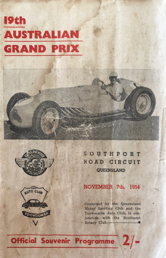
The 1954 Australian Grand Prix was held at the Southport Road Circuit[46] on 7 November,[47] using a circuit made up of public roads.[48] The circuit was 5.7 miles in length, and there were two "no-passing" sections, where the road surface was too narrow for overtaking and too expensive to widen.[47] The Grand Prix was won by Lex Davison in a HWM-Jaguar, ahead of Curly Brydon in an MG TC and Ken Richardson in a Ford V8 Special.[47] Only two more meetings were held at the track – the Queensland Racing Car Championship in October 1955, and a motorcycle meeting in the same year.[47]
Southport State High School opened on 24 January 1955.[36] Prior to its opening, a secondary department had operated at Southport State School.[14]
Circa 1958, All Saints' Anglican Church opened in the Chirn Park neighbourhood. Its closure on 2 November 1997 was approved by Assistant Bishop Williams. The church building was relocated to become the Anglican Church of the Good Shepherd in Mudgeeraba.[49]
Gold Coast Opportunity School opened in 1962. It was replaced by the Southport Special School which opened on 1 January 1970.[36] On 1 January 2003 it was The Kumbari Avenue School.[14] On 19 September 2008 the name reverted to Southport Special School.[50]
Musgrave Hill State School opened on 29 January 1963.[14]
Aquinas Catholic College opened on 25 January 1964.[14]
The Sundale Shopping Centre, which opened on 26 March 1969, was the first of its kind on the Gold Coast costing a record $7.5 million but closed in 1989 after the larger Australia Fair Shopping Centre opened nearby.[51] It was located on 5 hectares (12 acres) of prime real estate facing the Broadwater which was previously the site of the popular Southport Hotel which was originally constructed in 1876.[52] As well as providing panoramic views of the Nerang River from the upper floor, it was home to Queensland's first Big W department store as well as a cinema, restaurants, 45 speciality stores and a 7,000-vehicle car park. It was proposed as a location for the building of the Gold Coast Convention Centre. Such a development would have rejuvenated the old administrative centre of the Gold Coast. However, it lost its bid to Broadbeach, in part because of a lack of tourist accommodation in Southport. The site hosted weekly markets throughout the 1990s for several years after its closure, until its eventual demolition in 2003, at which time a time capsule was buried where the popular mall once stood. The area is now home to the Meriton Brighton on Broadwater development, a mix of high and low-rise buildings together with trendy eateries and some retail outlets. In more recent years another a time capsule was discovered on the Sundale site which was buried when the mall was originally constructed. It was originally meant to be opened in the 2000s and was filled with notes and items which were meant to predict what the 21st century would be like. It is now located in the Gold Coast City Council Local Studies Library.[53]
Keebra Park State High School opened on 30 January 1973.[14][36]
Keebra Park Special School opened on 24 January 1983. It closed on 13 December 1991.
Bellevue Park State School opened on 24 January 1983.[14] It is now within the neighbouring suburb of Ashmore.
Queensland Academy for Health Sciences opened on 1 January 2008.[36]
In 2013, the business area of Southport was declared a priority development area, officially creating the Gold Coast central business district.[54] In 2014, the Gold Coast City Council opened its own Chinatown in the Southport CBD.[55][56]
Demographics edit
In the 2016 census, Southport had a population of 31,908 people, 51.3% female and 48.7% male.[57] The median/average age of the Southport population is 37 years of age, 1 year below the Australian average.[58] 52.6% of people were born in Australia. The most common countries of birth were New Zealand 6.7%, China 4.1%, England 4.0%, South Korea 3.1% and Japan 1.9%. 65.9% of people only spoke English at home. Other languages spoken at home included Mandarin 4.9%, Korean 3.3%, Japanese 2.3%, Cantonese 1.1% and Arabic 0.9%. The most common responses for religion were No Religion 34.5% and Catholic 18.4%.[58] Southport is a populous and ethnically diverse suburb. Its communities of Filipino Australians (624 people; 2.0%), French Australians (277 people; 0.9%); Polish Australians (205 people; 0.6%); Russian Australians (190 people; 0.6%), Croatian Australians (160 people; 0.5%), and Hungarian Australians (152 people; 0.5%) are the largest of any suburb in Queensland.[59]
In the 2021 census, Southport had a population of 36,786 people.[5]
Economy edit
Southport is recognised as the central business district of the City of Gold Coast. It has the city's largest area of office space at 103,818 square metres (1,117,490 sq ft). In the past, Southport was the central entertainment location of the Gold Coast. In current times it is set apart from the normal tourist hub of the Gold Coast. However, it has still experienced tourist-driven development and extraordinary growth. Southport has 18 high-rise towers either completed, under construction or awaiting commencement.
Landmarks and locations edit


The body of water marking the eastern boundary of present-day Southport is known as the Gold Coast Broadwater. The Broadwater houses the Southport Yacht Club and a number of marinas on the southern bank of the Nerang River in an area now known as Main Beach. The area is used for fishing, boating, and watersports. Located opposite Southport on the far side of the Broadwater on The Spit, is the theme park Sea World. The Broadwater is suitable for swimming. The present day southern boundary of Southport is the Nerang River.[citation needed]
On the western side of the Broadwater, is the Southport Broadwater Parklands which opened in 2009[60][61] and has undergone subsequent expansions in 2013 and 2016.[62] Within the Parklands precinct are the Southport Pier, Gold Coast Aquatic Centre and the Southport War Memorial. Overlooking the Parklands is Australia Fair Shopping Centre.[citation needed]
Australia Fair Shopping Centre is an indoor shopping centre spreading over Scarborough Street with frontages on Nerang Street and the Gold Coast Highway. Containing 233 stores and a cinema, it was established in 1983, initially on the site of the former milk factory and entirely on the site of the former Pacific Hotel, which was built in 1878, redesigned in 1927 and demolished in 1988 to make way for the expansion of the shopping complex.[52][63]
The western end of Nerang Street in the vicinity of the intersection of Scarborough Street is also known as the Southport Mall. The re-opening of the mall (the old CBD, located adjacent to the shopping centre) to low-speed through traffic, after eight years of closure to vehicles, took place in 2000.[64]
At the top of the mall, on the south western intersection of Scarborough and Nerang Streets, is the Art Deco styled Hotel Cecil which is considered an 'important anchor' in the streetscape.[65] Opposite the hotel is a G:link station and, a few metres to the north, is the major northern bus interchange for the Gold Coast.[citation needed]
The City of Gold Coast Southport Branch Library is located on the Corner of Garden and Lawson Streets.[66] It was previously located on the top floor of the Australia Fair Shopping Centre. The Southport Branch Library was completed in 2002 and is one of 14 branches of the city's library.[67] Upstairs, in the same building, is the Local Studies Library which includes the city's historical collection of materials including documents, photographs, films, advertising and memorabilia.[68]
Located on Nind Street, the Sata Nita building built in 1936 by Ralf Tennant Johnston, is now home to a funeral business. It was built as a bridal suite ahead of Ralf's marriage to his bride to be, Lila Hughes. Today it known as one of Southport's oldest and quirkiest buildings.[69][70]
In April 2009, the three-tower Southport Central development was opened.[71]
Heritage listings edit
Southport has a number of heritage-listed sites, including:
- Dixon Drive (The Southport School): former Pacific Cable Station buildings [72]
- off Macarthur Parade: Main Beach Pavilion and Southport Surf Lifesaving Club [73][74]
- Marine Parade: Southport Bathing Pavilion [75]
- Marine Parade: Southport Sea Wall [76]
- Marine Parade (Broadwater Parklands): ANZAC Park Memorial Gates [77]
- Marine Parade (Carey Park): Carey Park Fig and Paperbark Trees [78]
- Marine Parade (Southport Broadwater Parklands): Southport War Memorial and Honour Rolls [79]
- Nerang Street: former Southport Town Hall [80][81]
- 210 Queen Street (Owen Park): Southport Drill Hall [82][83]
- 75 Smith Street: Southport State High School Buildings [84][85]
Education edit
Primary only edit

Southport State School is a government primary (Preparatory to Year 6) school for boys and girls at 215 Queen Street (27°58′15″S 153°24′03″E / 27.9707°S 153.4007°E).[86][87] In 2018, the school had an enrolment of 580 students with 47 teachers (42 full-time equivalent) and 22 non-teaching staff (15 full-time equivalent).[88] It includes a special education program.[86][89]
Musgrave Hill State School is a government primary (Early Childhood to Year 6) school for boys and girls at Nakina Street (27°57′33″S 153°23′37″E / 27.9592°S 153.3937°E).[86][90] In 2018, the school had an enrolment of 510 students with 45 teachers (39 full-time equivalent) and 44 non-teaching staff (32 full-time equivalent).[88] It includes a special education program and an early childhood developmental program.[86][91][92]
Guardian Angels' Catholic Primary School is a Catholic primary (Preparatory to Year 6) school for boys and girls at Edmund Rice Drive (27°58′23″S 153°23′03″E / 27.9730°S 153.3841°E).[86][93] In 2018, the school had an enrolment of 789 students with 52 teachers (44 full-time equivalent) and 36 non-teaching staff (26 full-time equivalent).[94]
Primary and secondary edit
Southport Special School is a special primary and secondary (Preparatory to Year 12) school for boys and girls at Cnr Kumbari Avenue & Smith Street (27°57′39″S 153°23′42″E / 27.9607°S 153.3951°E).[86][95] In 2018, the school had an enrolment of 243 students with 67 teachers (61 full-time equivalent) and 83 non-teaching staff (51 full-time equivalent).[88]
The Southport School is an Anglican primary and secondary (Preparatory to Year 12) school for boys at Winchester Street (27°58′58″S 153°24′52″E / 27.9828°S 153.4145°E).[86][96] In 2018, the school had an enrolment of 1,551 students with 132 teachers (126 full-time equivalent) and 103 non-teaching staff (86 full-time equivalent).[88] The school has a well-known clock tower and chapel. It is also one of the few schools in Australia where cadet service is mandatory.[97]
St Hilda's School is an Anglican primary and secondary (Preparatory to Year 12) school for girls at 52 High Street (27°58′12″S 153°24′26″E / 27.9701°S 153.4072°E).[86][98] In 2018, the school had an enrolment of 1,106 students with 103 teachers (99 full-time equivalent) and 86 non-teaching staff (79 full-time equivalent).[88] It is the only all-girls school on the Gold Coast.[citation needed]
Secondary only edit
Southport State High School is a government secondary (7–12) school for boys and girls at 75 Smith Street (27°57′46″S 153°24′09″E / 27.9628°S 153.4024°E).[86][99] In 2018, the school had an enrolment of 1,798 students with 130 teachers (126 full-time equivalent) and 56 non-teaching staff (46 full-time equivalent).[88] It includes a special education program.[86]
Keebra Park State High School is a government secondary (7–12) school for boys and girls at Anne Street (27°59′05″S 153°23′57″E / 27.9847°S 153.3993°E).[86][100] In 2018, the school had an enrolment of 803 students with 78 teachers (75 full-time equivalent) and 39 non-teaching staff (30 full-time equivalent).[88] It includes a special education program and an intensive English language program.[86][101]
Aquinas College is a Catholic secondary (7–12) school for boys and girls at Edmund Rice Drive (27°58′33″S 153°22′57″E / 27.9759°S 153.3826°E).[86][102] In 2018, the school had an enrolment of 1045 students with 92 teachers (88 full-time equivalent) and 45 non-teaching staff (36 full-time equivalent).[103]
Southport Flexible Learning Centre is a Catholic secondary (7–12) school for boys and girls at 2 Nakina Street (27°57′37″S 153°23′37″E / 27.9603°S 153.3936°E).[86][104] In 2018, the school had an enrolment of 59 students with 6 teachers (5 full-time equivalent) and 11 non-teaching staff (6 full-time equivalent).[88]
Queensland Academy for Health Sciences is a government secondary selective-entry (10–12) school for boys and girls at 102 Edmund Rice Drive (27°58′02″S 153°22′58″E / 27.9671°S 153.3829°E).[86][105] In 2018, the school had an enrolment of 331 students with 32 teachers (30 full-time equivalent) and 19 non-teaching staff (15 full-time equivalent).[88]
Precincts edit
Chinatown Gold Coast edit
Chinatown, Gold Coast The $6.8 million Chinatown precinct is being developed in partnership with the community, private sector and government.[106]
Gold Coast Aquatic Centre edit
The Gold Coast Aquatic Centre is located on Marine Parade adjacent to Southport Broadwater. It has a 50-metre Olympic pool with diving towers, 33- and 25-metre pools and a 15-metre indoor teaching pool. These pools are heated. There is a children's aquatic playground which includes a wading pool.[citation needed]
Southport Broadwater Parklands edit
There is a major park located along the shore of the Southport Broadwater. The state government has allocated A$16M with matched funding from Gold Coast City Council (over $32 million in total), to invest into the parklands. The works will include building a pier along the Southport Mall alignment. The park will be known as Broadwater Park.[citation needed]
Health and Knowledge edit
Located on the eastern edge of the suburb is home to the Gold Coast's health and knowledge precinct. Griffith University, Gold Coast Campus is home to over 18,200 students and offers student living accommodation. Griffith University is the city's largest University. Located across the road is the Gold Coast University Hospital (GCUH). GCUH is a large 800 bed teaching hospital that opened in 2013.[citation needed]
Southport General Cemetery edit
The 4.2-hectare Southport General Cemetery was gazetted on 16 July 1880. It is controlled by Gold Coast City Council as trustee. The cemetery is located on Queen Street which was the original route to Southport. This route led to the earliest wharf at Broadwater. Lantern Ghost Tours Gold Coast run historical night tours weekly through the Southport General Cemetery[citation needed]
Community facilities edit
Southport has a number of churches, including:
- St Peter's Anglican Church, 93 Nerang Street[107]
- Guardian Angels' Catholic Church, 99 Scarborough Street[108]
- Southport Uniting Church, 23 Short Street[109]
- Crosslife Baptist Church, 170 Nerang Street[110]
- Southport Church of Christ, 1 Griffith Way[111]
- Christadelphian Ecclesia Southport, 84 Falconer Street[112]
- South Korean Presbyterian Church of Gold Coast, 7 Deakin Avenue[113]
The Southport branch of the Queensland Country Women's Association meets at 20 Young Street.[114]
The Southport Community Centre recently constructed offers a range of activities, services, classes and is located in the Southport CBD precinct.[115]
Despite the name, the Southport Surf Life Saving Club is not in the suburb of Southport but is now within the suburb of Main Beach.[44]
Nature edit
Habitats for native mammals include large trees with or without hollows, fallen logs, leaf litter and understorey vegetation. These provide food, shelter and places for breeding. Southport is a place for picnics, riverside walks and birdwatching in the Broadwater Parklands.[citation needed]
Climate edit
Southport experiences a humid subtropical climate (Köppen climate classification Cfa) with humid, wet summers and mild to warm winters, though at times with cool nights.
| Climate data for Southport | |||||||||||||
|---|---|---|---|---|---|---|---|---|---|---|---|---|---|
| Month | Jan | Feb | Mar | Apr | May | Jun | Jul | Aug | Sep | Oct | Nov | Dec | Year |
| Mean daily maximum °C (°F) | 28.5 (83.3) |
28.3 (82.9) |
27.6 (81.7) |
25.9 (78.6) |
23.3 (73.9) |
21.2 (70.2) |
20.6 (69.1) |
21.4 (70.5) |
23.3 (73.9) |
25.2 (77.4) |
26.7 (80.1) |
28.1 (82.6) |
25.0 (77.0) |
| Mean daily minimum °C (°F) | 20.3 (68.5) |
20.5 (68.9) |
19.2 (66.6) |
16.5 (61.7) |
13.4 (56.1) |
10.6 (51.1) |
9.1 (48.4) |
9.8 (49.6) |
12.1 (53.8) |
15.0 (59.0) |
17.4 (63.3) |
19.2 (66.6) |
15.3 (59.5) |
| Average precipitation mm (inches) | 175.2 (6.90) |
190.3 (7.49) |
198.2 (7.80) |
135.2 (5.32) |
129.7 (5.11) |
94.5 (3.72) |
74.1 (2.92) |
55.4 (2.18) |
57.5 (2.26) |
86.0 (3.39) |
107.5 (4.23) |
133.8 (5.27) |
1,437.4 (56.59) |
| Source: [116] | |||||||||||||
Culture edit
This section needs expansion. You can help by adding to it. (March 2023) |
Sport and recreation edit
A number of sporting teams represent the local area, including the Southport Leagues Club, Southport Gymnastic Club, Southport Tigers, Southport Soccer Club, Southport Surf Life Saving Club and the Southport Sharks.[citation needed]
Transport edit
Southport has numerous main roads that connect Southport with other suburbs. Gold Coast Highway travels the full length along the coast on the Gold Coast connecting Southport with all the coastal suburbs on the city. Smith Street Motorway is a motorway grade extension of smith street connecting the suburb to the Pacific Motorway that connects the city to Brisbane.[citation needed]
Southport is also well serviced by public transport. A light rail system called G:link opened in July 2014 and ran between Broadbeach to Gold Coast University Hospital. In December 2017 G:link was extended to Helensvale. There are seven light rail stations in the suburb, connecting Southport with the major hubs of Surfers Paradise and Broadbeach. There are two major bus stations – Southport and GCUH. The Southport bus station is located in the heart of the suburb on Scarborough Street which provides regular and high frequency services to mainly the northern suburbs. GCUH bus station is situated on the western part of Southport, servicing Gold Coast University Hospital and the northern part of the Griffith University, Gold Coast campus. All services are part of the Translink integrated fare system.[citation needed]
An extension to the light rail system was announced in October 2015. Its intention was to operate from the previous terminus at Gold Coast University Hospital to Helensvale railway station. The extension opened ahead of schedule on 17 December 2017, months before the 2018 Commonwealth Games.[117] Helensvale is the suburb's nearest railway station, located 11 kilometres (6.8 mi) from the Southport CBD. The railway line provides a connection to Brisbane city and Brisbane Airport. The Light Rail extension to Helensvale now operates integrally with the University Hospital to Broadbeach South line, with connections at Helensvale to Brisbane (Roma Street).[citation needed]


Notable residents edit
- David Dodd (born 1985), association footballer who played for Brisbane Roar
- Ben Edmondson (born 1978), cricketer
- Georgia Godwin (born 1997), artistic gymnast[118]
- Grant Hackett (born 1980), swimmer
- Laurence Naismith (1908–1992), English-born actor, died in Southport 1992.
- Mitch Nichols (born 1989), association footballer for Perth Glory in the A-League
- Tommy Oar (born 1991), association footballer playing for FC Utrecht
- James O'Connor (born 1990), rugby union footballer, Wallabies
- Nick Riewoldt (born 1982), Australian rules footballer with St Kilda.
- John Sattler (1942–2023), rugby league player
- Casey Stoner (born 1985), motorcycle racer, 2007 and 2011 MotoGP World Champion, was born in Southport
- Jai Taurima (born 1972), long jump athlete
- Jim Wilson (born 1967), journalist and radio host
See also edit
References edit
- ^ Australian Bureau of Statistics (28 June 2022). "Southport (Qld) (suburb and locality)". Australian Census 2021 QuickStats. Retrieved 28 June 2022.
- ^ a b c Southport History Archived 2 March 2013 at the Wayback Machine. Gold Coast City Council. Retrieved on 17 January 2013.
- ^ "Southport – poulation centre in City of Gold Coast (entry 52113)". Queensland Place Names. Queensland Government. Retrieved 26 June 2023.
- ^ "Southport – suburb in City of Gold Coast (entry 46086)". Queensland Place Names. Queensland Government. Retrieved 18 September 2020.
- ^ a b Australian Bureau of Statistics (28 June 2022). "Southport (SAL)". 2021 Census QuickStats. Retrieved 28 February 2023.
- ^ "Nerang River – watercourse in the City of Gold Coast (entry 24050)". Queensland Place Names. Queensland Government. Retrieved 22 July 2020.
- ^ a b "Queensland Globe". State of Queensland. Retrieved 22 July 2020.
- ^ "King Reach – reach in City of Gold Coast (entry 49456)". Queensland Place Names. Queensland Government. Retrieved 7 July 2020.
- ^ "Ray Newlyn Channel – channel in City of Gold Coast (entry 42895)". Queensland Place Names. Queensland Government. Retrieved 7 July 2020.
- ^ Mole, Les; Newlyn, Ray; Leis, Leon; Australian Volunteer Coast Guard Association (Southport, Qld.); Royal Life Saving Society - Australia. Queensland Branch; TSN 11 Multi Media Productions; Surf Life Saving Association of Australia. Queensland Centre (1988), Marine accidents : how can we help?, TSN 11, archived from the original on 28 May 2022, retrieved 22 July 2020
{{citation}}: CS1 maint: numeric names: authors list (link) - ^ "Death notice for Raymond Paul Newlyn, late of Southport". The Courier-Mail. 20 October 1997.
- ^ "Musgrave Hill – neighbourhood in City of Gold Coast (entry 23651)". Queensland Place Names. Queensland Government. Retrieved 7 July 2020.
- ^ "Nerang Creek Heads". The Queenslander. 16 October 1875. p. 17. Archived from the original on 28 May 2022. Retrieved 17 January 2016 – via National Library of Australia.
- ^ a b c d e f g h i j k Queensland Family History Society (2010), Queensland schools past and present (Version 1.01 ed.), Queensland Family History Society, ISBN 978-1-921171-26-0
- ^ "Beenleigh". The Queenslander. Vol. XVIII, no. 270. Queensland, Australia. 16 October 1880. p. 487. Archived from the original on 28 May 2022. Retrieved 5 October 2020 – via National Library of Australia.
- ^ "Southport Congregational Church". South Coast Bulletin. Vol. 5, no. 259. Queensland, Australia. 1 December 1933. p. 11. Archived from the original on 28 May 2022. Retrieved 27 July 2020 – via National Library of Australia.
- ^ Melissa Townsend (22 January 2009). "Southport jetty to rekindle memories". goldcoast.com.au. News Limited. Archived from the original on 30 December 2012. Retrieved 31 May 2012.
- ^ "Opening of the New Jetty at Southport". The Brisbane Courier. 30 November 1883. p. 5. Archived from the original on 28 May 2022. Retrieved 4 June 2013 – via National Library of Australia.
- ^ "Current News". The Queenslander. 20 October 1888. p. 693. Archived from the original on 28 May 2022. Retrieved 17 January 2016 – via National Library of Australia.
- ^ "Ladies Column". The Telegraph. Brisbane. 4 June 1898. p. 6. Archived from the original on 28 May 2022. Retrieved 17 January 2016 – via National Library of Australia.
- ^ "Brisbane Society". The Queenslander. 8 December 1894. p. 1101. Archived from the original on 28 May 2022. Retrieved 17 January 2016 – via National Library of Australia.
- ^ "Country Mails". The Brisbane Courier. Vol. XLIII, no. 9, 179. Queensland, Australia. 16 June 1887. p. 3. Archived from the original on 9 September 2022. Retrieved 9 September 2022 – via National Library of Australia.
- ^ Blake, Thom. "St Peter's Anglican Church". Queensland religious places database. Archived from the original on 13 March 2022. Retrieved 9 September 2022.
- ^ "St. Peters Church of England, 87 Nerang Street, Southport, Queensland". City of Gold Coast. 1900–1909. Archived from the original on 9 September 2022. Retrieved 9 September 2022.
- ^ Southport Station in the Later Years Milne, Rod Australian Railway History, April 2004 pp 142–148
- ^ "Meyer's Ferry". Gold Coast City Libraries. 6 August 2018. Archived from the original on 21 March 2022. Retrieved 9 September 2022.
- ^ "Southport Notes". The Brisbane Courier. Vol. LVI, no. 13, 180. Queensland, Australia. 10 April 1900. p. 7. Archived from the original on 28 May 2022. Retrieved 23 July 2020 – via National Library of Australia.
- ^ "Southport Heritage Walk" (PDF). Gold Coast City Council. p. 2. Archived (PDF) from the original on 20 December 2016. Retrieved 23 July 2020.
- ^ "Our Neighbors". The Queenslander. Vol. LX, no. 1315. Queensland, Australia. 2 February 1901. p. 242 (Unknown). Archived from the original on 28 May 2022. Retrieved 23 July 2020 – via National Library of Australia.
- ^ "Parish History | SCP". Southport Catholic Parish. Archived from the original on 20 April 2020. Retrieved 22 July 2020.
- ^ "The Third Decade". Aquinas Catholic College. Archived from the original on 10 March 2020. Retrieved 22 July 2020.
- ^ "Historic Star of the Sea demolished". Gold Coast Bulletin. 3 September 2016. Retrieved 22 July 2020.
- ^ "Star of the Sea Southport". Sisters of Mercy - Brisbane congregation. Archived from the original on 22 July 2020. Retrieved 22 July 2020.
- ^ Bou, Jean; Southport School (2007), A century of service : a history of the Southport School Cadet Unit, 1906-2006, Southport School, ISBN 978-0-646-47122-8
- ^ "Guardian Angels' Primary School". Archived from the original on 29 January 2018. Retrieved 29 January 2018.
- ^ a b c d e "Opening and closing dates of Queensland Schools". Queensland Government. Retrieved 18 April 2019.
- ^ "Southport". Queensland Country Life. Qld.: National Library of Australia. 1 December 1909. p. 16. Archived from the original on 28 May 2022. Retrieved 17 January 2016.
- ^ "Southport For The Visitor. Resort". Daily Standard. Brisbane: National Library of Australia. 11 November 1931. p. 8. Archived from the original on 28 May 2022. Retrieved 17 January 2016.
- ^ a b Longhurst, Robert (1995). Gold Coast:Our heritage in focus. South Brisbane, Queensland: State Library of Queensland. pp. 29–30. ISBN 0-7242-6563-5.
- ^ Pacific Ocean Estate 1915, 5 April 1915, hdl:10462/deriv/341185
- ^ "Pacific Ocean Estate, Southport". The Brisbane Courier. No. 17, 840. Queensland, Australia. 20 March 1915. p. 3. Archived from the original on 28 May 2022. Retrieved 26 November 2019 – via National Library of Australia.
- ^ "Southport War Memorial". The Brisbane Courier. 26 April 1922. p. 8. Archived from the original on 28 May 2022. Retrieved 6 April 2014 – via National Library of Australia.
- ^ "Southport War Memorial". Monument Australia. Archived from the original on 7 April 2014. Retrieved 5 April 2014.
- ^ a b "Southport Surf Life Saving Club: Saving lives since 1924". Retrieved 9 September 2022.
- ^ "History". www.goldcoastculturalprecinct.info. Retrieved 16 January 2023.
- ^ wwww.progcovers.com Archived 7 February 2022 at the Wayback Machine Retrieved 7 February 2022
- ^ a b c d Walker, Terry (1995). Fast Tracks - Australia's Motor Racing Circuits: 1904-1995. Wahroonga, NSW: Turton & Armstrong. p. 150. ISBN 0908031556.
- ^ Galpin, Darren. "Southport". GEL Motorsport Information Page. Archived from the original on 9 February 2008. Retrieved 1 April 2016.
- ^ "Closed Churches". Anglican Church of Southern Queensland. Archived from the original on 3 April 2019. Retrieved 24 February 2019.
- ^ "Register of Recent School Openings, Closures and Name Changes". Queensland Government. Archived from the original on 20 July 2020. Retrieved 22 July 2020.
- ^ Potts, Andrew (12 December 2013). "Gold Coast Bulletin". Archived from the original on 11 November 2020. Retrieved 28 January 2017.
- ^ a b "Southport urban heritage character strategy review" (PDF). City of Gold Coast. Gold Coast City Council. Archived (PDF) from the original on 19 September 2016. Retrieved 28 May 2016.
- ^ Toxward, Emily. "Take a journey through the Coast's shopping history". more Gold Coast. Archived from the original on 31 May 2017. Retrieved 28 January 2017.
- ^ "Southport priority development area". Gold Coast City Council. Archived from the original on 20 March 2022. Retrieved 9 September 2022.
- ^ "09 harmony in chinatown". inplace. Archived from the original on 19 June 2021. Retrieved 9 September 2022.
- ^ "Gold Coast Chinatown Masterplan by Business Gold Coast". Issuu. Archived from the original on 22 May 2022. Retrieved 9 September 2022.
- ^ Australian Bureau of Statistics (27 June 2017). "Southport (SSC)". 2016 Census QuickStats. Retrieved 20 October 2018.
- ^ a b Australian Bureau of Statistics (27 June 2017). "Southport (State Suburb)". 2016 Census QuickStats. Retrieved 9 December 2017.
- ^ "2016Census_G_QLD_SSC – Census DataPacks – General Community Profile". Australian Bureau of Statistics – Census 2016. Archived from the original on 29 July 2017. Retrieved 18 July 2017.
- ^ "Southport's new parklands". The Gold Coast Sun. 19 August 2009.
- ^ "Council committee backs Southport parklands master plan". ABC Regional News. 21 March 2007.
- ^ Potts, Andrew. "Parklands on move". The Gold Coast Bulletin.
- ^ Bedward, Michael. "Pacific Hotel in 1988 photographed by Michael Bedward". City of Gold Coast Libraries. Archived from the original on 28 May 2022. Retrieved 28 May 2016.
- ^ Barnard, Nic (18 November 2000). "Shopping malls suffer mauling on Main Street". The Australian.
- ^ "Southport Urban Heritage and Character Strategy Review" (PDF). City of Gold Coast. Allom Lovell Architects and City of Gold Coast. Archived (PDF) from the original on 19 September 2016. Retrieved 6 May 2016.
- ^ "Southport Library". Gold Coast City Council. Archived from the original on 30 January 2018. Retrieved 30 January 2018.
- ^ "Public Libraries Statistical Bulletin 2016-17" (PDF). Public Libraries Connect. State Library of Queensland. November 2017. p. 13. Archived (PDF) from the original on 30 January 2018. Retrieved 30 January 2018.
- ^ "Local studies library". Gold Coast City Council. Archived from the original on 21 April 2017. Retrieved 30 January 2018.
- ^ "Sata Nita – White Lady Funerals – Gold Coast Open House". Archived from the original on 30 May 2019. Retrieved 30 May 2019.
- ^ "Southport Funeral Directors - White Lady Funerals". www.whiteladyfunerals.com.au. Archived from the original on 30 May 2019. Retrieved 30 May 2019.
- ^ "Southport Central's rental rush hour". goldcoast.com.au. News Limited. 4 July 2009. Archived from the original on 9 March 2012. Retrieved 17 January 2013.
- ^ Gold Coast Local Heritage Register - N to Z, pp. 91-92
- ^ "Main Beach Pavilion and Southport Surf Lifesaving Club (entry 601265)". Queensland Heritage Register. Queensland Heritage Council. Retrieved 19 June 2013.
- ^ Gold Coast Local Heritage Register - N to Z, pp. 119-120
- ^ "Southport Bathing Pavilion (entry 601514)". Queensland Heritage Register. Queensland Heritage Council. Retrieved 19 June 2013.
- ^ Gold Coast Local Heritage Register - N to Z, pp. 125-126
- ^ "ANZAC Park Memorial Gates" (PDF). Gold Coast Local Heritage Register. 5 June 2018. Archived (PDF) from the original on 27 August 2020. Retrieved 27 August 2020.
- ^ Gold Coast Local Heritage Register - A to M, pp. 21-22
- ^ "Southport War Memorial and Honour Rolls" (PDF). Gold Coast Local Heritage Register. 5 June 2018. Archived (PDF) from the original on 27 August 2020. Retrieved 27 August 2020.
- ^ "Southport Town Hall (former) (entry 601649)". Queensland Heritage Register. Queensland Heritage Council. Retrieved 19 June 2013.
- ^ Gold Coast Local Heritage Register - N to Z, pp. 127-128
- ^ "Southport Drill Hall (entry 601479)". Queensland Heritage Register. Queensland Heritage Council. Retrieved 19 June 2013.
- ^ Gold Coast Local Heritage Register - N to Z, pp. 123-124
- ^ "650034". Queensland Heritage Register. Queensland Heritage Council. Retrieved 21 February 2018.
- ^ "Southport State High School" (PDF). Gold Coast Local Heritage Register. 5 June 2018. Archived (PDF) from the original on 27 August 2020. Retrieved 27 August 2020.
- ^ a b c d e f g h i j k l m n o "State and non-state school details". Queensland Government. 9 July 2018. Archived from the original on 21 November 2018. Retrieved 21 November 2018.
- ^ "Southport State School". Archived from the original on 13 December 2012. Retrieved 21 November 2018.
- ^ a b c d e f g h i "ACARA School Profile 2018". Australian Curriculum, Assessment and Reporting Authority. Archived from the original on 27 August 2020. Retrieved 28 January 2020.
- ^ "Southport SS - Special Education Program". Archived from the original on 13 December 2012. Retrieved 21 November 2018.
- ^ "Musgrave Hill State School". Archived from the original on 28 November 2012. Retrieved 21 November 2018.
- ^ "Musgrave Hill SS - Special Education Program". Archived from the original on 28 November 2012. Retrieved 21 November 2018.
- ^ "Musgrave Hill SS - Early Childhood Development Program". Archived from the original on 28 November 2012. Retrieved 21 November 2018.
- ^ "Guardian Angels' Catholic Primary School". Archived from the original on 22 September 2016. Retrieved 21 November 2018.
- ^ "ACARA School Profile 2018". Australian Curriculum, Assessment and Reporting Authority. Archived from the original on 27 August 2020. Retrieved 28 January 2020.
- ^ "Southport Special School". Archived from the original on 10 April 2012. Retrieved 21 November 2018.
- ^ "The Southport School". Archived from the original on 2 October 2018. Retrieved 21 November 2018.
- ^ "Curriculum Handbook: Year 8: 2019" (PDF). The Southport School. Archived (PDF) from the original on 9 September 2022. Retrieved 9 September 2022.
- ^ "St Hilda's School". Archived from the original on 13 September 2018. Retrieved 21 November 2018.
- ^ "Southport State High School". Archived from the original on 3 August 2019. Retrieved 21 November 2018.
- ^ "Keebra Park State High School". Archived from the original on 3 August 2019. Retrieved 21 November 2018.
- ^ "Keebra Park Special Education Unit". Archived from the original on 3 August 2019. Retrieved 21 November 2018.
- ^ "Aquinas College". Archived from the original on 27 February 2015. Retrieved 21 November 2018.
- ^ "ACARA School Profile 2018". Australian Curriculum, Assessment and Reporting Authority. Archived from the original on 27 August 2020. Retrieved 28 January 2020.
- ^ "Southport Flexible Learning Centre". Archived from the original on 23 November 2018. Retrieved 21 November 2018.
- ^ "Queensland Academy for Health Sciences". Archived from the original on 14 September 2008. Retrieved 21 November 2018.
- ^ "City of Gold Coast | Centre Improvement Program – Young Street and Davenport Street, Southport". www.goldcoast.qld.gov.au. Archived from the original on 12 February 2018. Retrieved 12 February 2018.
- ^ "St Peter's Anglican Church Southport". Anglican Church Gold Coast. Archived from the original on 9 September 2022. Retrieved 9 September 2022.
- ^ "The Catholic Parish of Southport". Archived from the original on 18 July 2020. Retrieved 9 September 2022.
- ^ "Southport Uniting Church". Southport Uniting Church. Archived from the original on 31 March 2022. Retrieved 9 September 2022.
- ^ "CrossLife - a baptist church - Home". www.crosslife.org.au. Archived from the original on 15 August 2022. Retrieved 9 September 2022.
- ^ "Home". Southport Church of Christ. Archived from the original on 9 September 2022. Retrieved 9 September 2022.
- ^ "Christadelphian Ecclesia Southport - Gold Coast". Facebook. Archived from the original on 9 September 2022. Retrieved 9 September 2022.
- ^ Blake, Thom. "South Korean Presbyterian Church of Gold Coast". www.thomblake.com.au. Archived from the original on 9 September 2022. Retrieved 9 September 2022.
- ^ "Branch Locations". Queensland Country Women's Association. Archived from the original on 26 December 2018. Retrieved 26 December 2018.
- ^ "Southport Community Centre". Gold Coast City Council. Archived from the original on 13 October 2019. Retrieved 13 October 2019.
- ^ "Climate statistics for Southport". Australian Bureau of Meteorology. Archived from the original on 30 June 2009. Retrieved 29 December 2009.
- ^ "Stage two of Gold Coast light rail on track for Commonwealth Games". Queensland Government. 11 October 2015. Archived from the original on 16 October 2015. Retrieved 12 October 2015.
- ^ "Artistic Gymnastics | Athlete Profile: Georgia GODWIN - Gold Coast 2018 Commonwealth Games". results.gc2018.com. Archived from the original on 4 August 2018. Retrieved 15 August 2019.
Sources edit
- "Gold Coast Local Heritage Register - A to M" (PDF). Gold Coast City Council. Archived (PDF) from the original on 26 August 2020. Retrieved 26 August 2020.
- "Gold Coast Local Heritage Register - N to Z" (PDF). Gold Coast City Council. Archived (PDF) from the original on 26 August 2020. Retrieved 26 August 2020.
Further reading edit
- Star of the Sea College (Southport, Qld.) (1990), Star of the Sea Southport : commemorative magazine 1900-1990, Star of the Sea
- Holt, R. W. (1978), A history of the Congregational, Methodist, and Presbyterian Churches in Southport and environs, leading up to the inauguration of the Southport Uniting Parish, Southport Uniting Parish
External links edit
- "Southport". Queensland Places. Centre for the Government of Queensland, University of Queensland.