Second East–West Highway (Malay: Lebuhraya Timur–Barat Kedua), also known as Simpang Pulai–Kuala Berang Highway, Federal Route 185 and Federal Route 36, is a highway in Peninsular Malaysia which connects Simpang Pulai in Perak to Kuala Jeneris in Terengganu.[1] It overlaps with Federal Route 8 Federal Route 8 between Gua Musang and Sungai Relau. It is notorious for its many sharp corners which increase the risk of road accidents.
 | |
|---|---|
| Second East–West Highway (Simpang Pulai–Kuala Berang Highway) | |
.jpg) | |
| Route information | |
| Length | 313.6 km (194.9 mi) |
| Existed | 2001–present |
| History | Completed in 2004 |
| Major junctions | |
| West end | Simpang Pulai, Perak |
Bukit Payung–Telemung Highway | |
| East end | Kuala Jeneris, Terengganu |
| Location | |
| Country | Malaysia |
| Primary destinations | Ipoh Cameron Highlands Kota Bharu Kuala Lipis Gua Musang Kenyir Lake Kuala Terengganu |
| Highway system | |
Route background edit
The Kilometre Zero of the Federal Route 185 is located at Simpang Pulai, Perak, at its junctions with the Federal Route 1, the main trunk road of the central of Peninsular Malaysia and end at Gua Musang town. Meanwhile, section from Chiku to Kuala Telemung regazetted as Federal Route 36 in February 2017.
Federal Route 185 traverses two of Peninsular Malaysia's main mountain ranges, the Titiwangsa Range (Perak–Pahang–Kelantan) and the Pantai Timur Range (Kelantan–Terengganu). Hence, several tourist attractions can be found along the highway include Cameron Highlands, Lojing and the Kenyir Lake.
History edit
The highway used to be known as Perak State Route 181 from Simpang Pulai to Pos Slim before being extended eastwards and recommissioned as a federal highway. The construction of the highway began in 2001 and was completed in 2004. Phase 2 was completed at the end of 2010.
Location of the project edit
The route runs through the states of Perak, Pahang, Kelantan and Terengganu, starting at Simpang Pulai and traversing through the main range at Lojing, then Chiku, before entering Jalan Felda Aring and ending at Kuala Jeneris.
Project scope of work edit
The total distance of the road is 313.66 km (194.90 mi), excluding the 41 km existing road from Gua Musang to Chiku, Kelantan. The road is designed to Malaysian Public Works Department (JKR) geometric standard of R3 with a design speed of 50 km/h.
In terms of riding comfort, this R3 standard falls in between the R5 or R6 standard for expressway (typically with a design speed of 80–110 km/h) and R1 or R2 standard such as the winding hilly road (typically with a design speed of 20–30 km/h).
Typically, the road is a two-lane single carriageway with a lane width of 3.5m and shoulder width of 2.5m. Climbing lanes are also provided at certain sections with steep gradient, to assist slow moving vehicles. The project also involves the construction of viaducts, bridges and culverts.
Those who want to go from Simpang Pulai to Kuala Berang/Kuala Berang to Simpang Pulai must go through part of federal route 8.
Estimated cost edit
The entire project is estimated to cost RM1.6 billion and divided into 10 packages for implementation.
Features edit
![]() FT 185 Lojing Viaduct is the second highest bridge in Malaysia.
FT 185 Lojing Viaduct is the second highest bridge in Malaysia.
At most sections, the Federal Route 185 was built under the JKR R5 road standard, allowing maximum speed limit of up to 90 km/h.
The highway overlaps with T156 Jalan Pengkalan Utama from Kenyir Lake to Kuala Jeneris.
Notable events edit
- 20 December 2010 – Twenty-seven people, mostly Thai tourist were killed when the double-decked coach bus they were travelling in crashed at the Second East–West Highway of the Perak–Pahang border near Cameron Highlands, Pahang.
- In February 2017, Second East–West Highway section from Chiku to Kuala Berang (Jalan Aring 8 & Jalan Aring 5-Kuala Jeneris) regazetted as
 FT 36. Meanwhile, section overlaps with D29 at Gua Musang regazetted as
  FT 185.
List of junctions and towns edit
This article contains a bulleted list or table of intersections which should be presented in a properly formatted junction table. (November 2021) |
This is a list of junctions and towns along the highway.
| Km | Exit | Junctions | To | Remarks | |
|---|---|---|---|---|---|
0 |
Simpang Pulai Simpang Pulai Junctions |
North West South Alor Star Penang Kuala Lumpur |
T-Junctions | ||
Simpang Pulai–Gua Musang Start/End of highway | |||||
| Simpang Pulai Fire Station | |||||
| Sungai Raya bridge | |||||
| Simpang Pulai Quarry | |||||
| Simpang Pulai Quarry | |||||
| Start/End of four-lane carriageway | |||||
15 |
|||||
| Start/End of four-lane carriageway | |||||
| Viaduct | |||||
| Perak Darul Ridzuan Kinta district border | |||||
| Perak–Pahang border | |||||
| Pahang Darul Makmur Cameron Highlands district border | |||||
| Cameron Highlands | |||||
| Cameron Highlands Avant Chocolate |
Avant Chocolate | ||||
| Cameron Highlands Kampung Raja |
|||||
| Cameron Highlands Cameron Highlands (North) Junctions |
South Tourist attractions |
T-Junctions | |||
| Cameron Highlands | |||||
| Pahang Darul Makmur Cameron Highlands district border | |||||
| Pahang–Kelantan border | |||||
| Kelantan Darul Naim Gua Musang district border | |||||
| Pos Sigar | Pos Sigar Orang Asli village | T-junctions | |||
| Sungai Pangoi bridge | |||||
| Pos Brooke | Pos Brooke Orang Asli village | T-junctions | |||
| Sungai Lojing bridge | |||||
| Pos Mering | Pos Mering Orang Asli village Lojing Highlands |
T-junctions | |||
| Lojing Viaduct Sungai Chenderoh bridge |
|||||
| Lojing | Lojing Highlands | T-junctions | |||
| Sungai Berok bridge | |||||
| Kampung Sungkai | |||||
| Ulu Nenggiri Junctions | West Ulu Nenggiri Kampung Pilting |
T-junctions | |||
Simpang Pulai–Gua Musang | |||||
| Gua Musang Gua Musang Town Junctions |
North South |
Junctions | |||
| Overlaps with |
see also | ||||
| Chiku Chiku Junctions |
North |
T-junctions | |||
Gua Musang–Kuala Berang | |||||
| Kampung Kabang | |||||
| Sungai Lebir bridge | |||||
| Kampung Lanchang | |||||
| Kelantan Darul Naim Gua Musang district border | |||||
| Kelantan–Terengganu border | |||||
| Terengganu Darul Iman Hulu Terengganu district border | |||||
| هولو ترڠݢانو Hulu Terengganu | |||||
| Kenyir Lake | |||||
| Sungai Kembur Viaduct | |||||
| TNB Puah Hydroelectric Dam | TNB Puah Hydroelectric Dam | T-junctions | |||
| Sungai Kelempai Viaduct | |||||
| Pasir Pulau Viaduct | |||||
| Sungai Purun Viaduct | |||||
| Sungai Jeneris Viaduct | |||||
| Jalan Pengkalan Utama Junctions | South TNB Pengkalan Gawi Dam Telemung Waterfall |
T-junctions | |||
| Kenyir Lake Kenyir Lake Junctions |
South Kenyir Lake Pengkalan Gawi Kenyir Lake Resort and Spa Kenyir Lake Visitor Centre |
T-junctions | |||
| Kenyir Lake | |||||
| Kampung Basung | |||||
| Pelung Junctions | North Pelung |
T-junctions | |||
| Kampung Pasir Duta | |||||
Gua Musang–Kuala Berang | |||||
| Kuala Jeneris Kuala Jeneris Junctions |
North South |
Junctions | |||
| East Bukit Payung–Telemung Highway Telemong Kuantan Kuala Lumpur |
|||||
Gallery edit
-
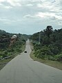
 FT185 near its west end in Simpang Pulai, eastbound
 -
 FT185 snakes up through the Titiwangsa Mountains near the border with Pahang, not far from Cameron Highlands
 -

-
 The highway near Aring, towards the border with Terengganu. Taken prior to widening.
 -
 The Terengganuan section of FT185, near Kenyir Lake
.jpg)
.jpg)

.jpg)
.jpg)
See also edit
References edit
- ^ Statistik Jalan (Edisi 2013). Kuala Lumpur: Malaysian Public Works Department. 2013. pp. 16–64. ISSN 1985-9619.