Rafat (Arabic: رافات) is a Palestinian town located in the Salfit Governorate of the State of Palestine, in the northern West Bank, 38 kilometers southwest of Nablus. According to the Palestinian Central Bureau of Statistics, it had a population of 2,522 in 2017.[2]
Rafat | |
|---|---|
| Arabic transcription(s) | |
| • Arabic | رافات |
| • Latin | Rafat (official) |
 Rafat in the front, az-Zawiya behind | |
 Rafat Location of Rafat within Palestine | |
| Coordinates: 32°04′41″N 35°02′43″E / 32.07806°N 35.04528°E | |
| Palestine grid | 154/164 |
| State | State of Palestine |
| Governorate | Salfit |
| Government | |
| • Type | Village council |
| Elevation | 293 m (961 ft) |
| Population (2017)[2] | |
| • Total | 2,522 |
| Name meaning | Rafat, personal name, meaning "acts of kindness"[3] |
Location edit
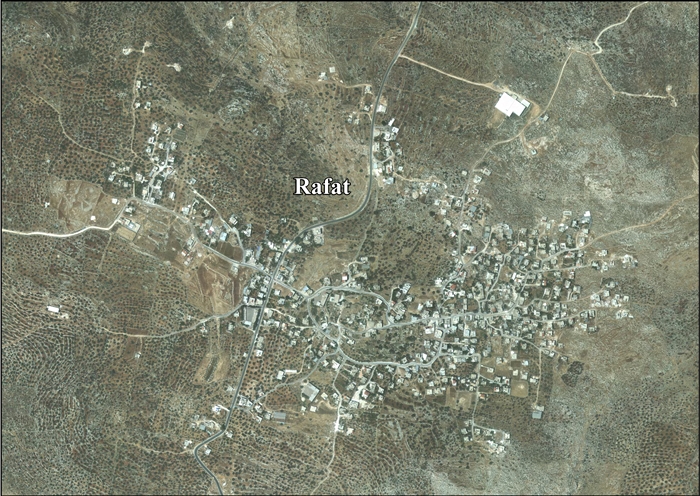
Rafat is located 13 kilometers (8.1 mi) west of Salfit. It is south of az-Zawiya, north east of Deir Ballut, north west of Kafr ad-Dik, and east of Kafr Qasem.[1]
History edit
Sherds from the Iron Age II, Persian, Hellenistic/Roman, Byzantine, Crusader/Ayyubid and Mamluk eras have been found here.[4][5]
Three olive oil installations dating from the Iron Age have been found here, alongside a white mosaic pavement.[4]
Ottoman era edit
In 1517, the village was included in the Ottoman empire with the rest of Palestine, and potsherds from the early Ottoman period have been found here.[4] It appeared in the 1596 tax-records as 'Arafat, located in the Nahiya of Jabal Qubal of the Liwa of Nablus. The population was 6 households, all Muslim. In addition to sporadic income and a fixed tax for residents of the Nablus region, they paid a fixed tax rate of 33.3% on agricultural products like wheat, barley, summer crops, olive trees, goats, and beehives; a total of 3,100 akçe.[6]
In the 18th and 19th centuries, Rafat formed part of the highland region known as Jūrat ‘Amra or Bilād Jammā‘īn. Situated between Dayr Ghassāna in the south and the present Route 5 in the north, and between Majdal Yābā in the west and Jammā‘īn, Mardā and Kifl Ḥāris in the east, this area served, according to historian Roy Marom, "as a buffer zone between the political-economic-social units of the Jerusalem and the Nablus regions. On the political level, it suffered from instability due to the migration of the Bedouin tribes and the constant competition among local clans for the right to collect taxes on behalf of the Ottoman authorities.”[7]
In 1838, it was noted as a Muslim village, in Jurat Merda, south of Nablus.[8] Extensive ruins were also noted here.[9]
In 1870 Guérin found a number of ancient cisterns, and a rectangular birket cut in the rock and measuring 15 paces long by 10 broad. He also speaks of 'several' tombs.[10][11] In 1870/1871 (1288 AH), an Ottoman census listed the village in the nahiya (sub-district) of Jamma'in al-Thani, subordinate to Nablus.[12] In 1882, the PEF's Survey of Western Palestine (SWP) described Rafat as "a semi-ruinous stone village on a ridge, apparently an ancient site, with a very conspicuous Mukam on a piece of rock west of the village, and rock-cut tombs. The water supply is from wells and cisterns."[13] They further noted: "On the north-west of the village is a steep rocky descent, in which are two tombs of the kind called 'rock-sunk', one of which is cut in a square block of rock, the top of which is levelled."[14]
British Mandate era edit
In the 1922 census of Palestine conducted by the British Mandate authorities, Rafat had a population of 92, all Muslim,[15] increasing in the 1931 census to 127, still all Muslim, in a total of 31 houses.[16]
In the 1945 statistics the population of Rafat was 180, all Muslims,[17] while the total land area was 8,125 dunams, according to an official land and population survey.[18] Of this, 1,889 dunams were used for cereals,[19] while 24 dunams were classified as built-up (urban) areas.[20]
-
 Rafat 1943 1:20,000
 -
 Rafat 1945 1:250,000


Jordanian era edit
In the wake of the 1948 Arab–Israeli War, and after the 1949 Armistice Agreements, Rafat came under Jordanian rule.
In 1961, the population was 375.[21]
Post-1967 edit

Since the Six-Day War in 1967, Rafat has been under Israeli occupation.
After the 1995 accords, 7.5% of the village land was classified as Area B, the remaining 92.5% as Area C. According to ARIJ, Israel has confiscated 101 dunams of land from Rafat and land from Zawiya for the Israeli quarry of "Mazor Atiqa". This quarry is now on the Israeli side of the separation wall, and Israel exports 94% of the materials extracted from it to Israel. This in a clear violation of the international law, which does not permit any civil occupation to exploit natural resources in occupied territories for their economic favour.[22]
Notable people edit
References edit
- ^ a b Rafat village profile, ARIJ, p. 4
- ^ a b Preliminary Results of the Population, Housing and Establishments Census, 2017 (PDF). Palestinian Central Bureau of Statistics (PCBS) (Report). State of Palestine. February 2018. pp. 64–82. Retrieved 2023-10-24.
- ^ Palmer, 1881, p. 240
- ^ a b c Finkelstein et al, 1997, pp. 254-255
- ^ Dauphin, 1998, p. 815
- ^ Hütteroth and Abdulfattah, 1977, p. 134
- ^ Marom, Roy (2022-11-01). "Jindās: A History of Lydda's Rural Hinterland in the 15th to the 20th Centuries CE". Lod, Lydda, Diospolis. 1: 17.
- ^ Robinson and Smith, 1841, vol 3, Appendix 2, p. 126
- ^ Robinson and Smith, 1841, vol 3, p. 20
- ^ Guérin, 1875, pp. 129 -130; as given in Conder and Kitchener, 1882, SWP II, p. 367
- ^ Guérin, 1875, p.130: le roc et mesurant 15 pas de long sur 1o de large. Sur les pentes de la colline ont été pratiqués plusieurs tombeaux, dont la forme est celle d'auges ou de fosses creusées perpendiculairement dans le roc, à fleur du sol; elles étaient fermées jadis au moyen soit d'un couvercle en dos d'âne,soit tout simplement de gros blocs monolithes plus ou moins bien équarris, comme on l'observe, par exemple, pour les tombeaux du Kharbet el-Medieh, à l'endroit appelé Kharbet el-Yehoud.
- ^ Grossman, David (2004). Arab Demography and Early Jewish Settlement in Palestine. Jerusalem: Magnes Press. p. 253.
- ^ Conder and Kitchener, 1882, SWP II, p. 286
- ^ Conder and Kitchener, 1882, SWP II, p. 367
- ^ Barron, 1923, Table IX, p. 26
- ^ Mills, 1932, p. 64
- ^ Government of Palestine, Department of Statistics, 1945, p. 19
- ^ Government of Palestine, Department of Statistics. Village Statistics, April, 1945. Quoted in Hadawi, 1970, p. 60
- ^ Government of Palestine, Department of Statistics. Village Statistics, April, 1945. Quoted in Hadawi, 1970, p. 107
- ^ Government of Palestine, Department of Statistics. Village Statistics, April, 1945. Quoted in Hadawi, 1970, p. 157
- ^ Government of Jordan, Department of Statistics, 1964, p. 26
- ^ Rafat village profile, ARIJ, p. 17
Bibliography edit
- Barron, J.B., ed. (1923). Palestine: Report and General Abstracts of the Census of 1922. Government of Palestine.
- Conder, C.R.; Kitchener, H.H. (1882). The Survey of Western Palestine: Memoirs of the Topography, Orography, Hydrography, and Archaeology. Vol. 2. London: Committee of the Palestine Exploration Fund.
- Dauphin, C. (1998). La Palestine byzantine, Peuplement et Populations. BAR International Series 726 (in French). Vol. III : Catalogue. Oxford: Archeopress. ISBN 0-860549-05-4.
- Finkelstein, I.; Lederman, Zvi, eds. (1997). Highlands of many cultures. Vol. 1. Tel Aviv: Institute of Archaeology of Tel Aviv University Publications Section. ISBN 965-440-007-3.
- Government of Jordan, Department of Statistics (1964). First Census of Population and Housing. Volume I: Final Tables; General Characteristics of the Population (PDF).
- Government of Palestine, Department of Statistics (1945). Village Statistics, April, 1945.
- Guérin, V. (1875). Description Géographique Historique et Archéologique de la Palestine (in French). Vol. 2: Samarie, pt. 2. Paris: L'Imprimerie Nationale.
- Hadawi, S. (1970). Village Statistics of 1945: A Classification of Land and Area ownership in Palestine. Palestine Liberation Organization Research Center.
- Hütteroth, Wolf-Dieter; Abdulfattah, Kamal (1977). Historical Geography of Palestine, Transjordan and Southern Syria in the Late 16th Century. Erlanger Geographische Arbeiten, Sonderband 5. Erlangen, Germany: Vorstand der Fränkischen Geographischen Gesellschaft. ISBN 3-920405-41-2.
- Mills, E., ed. (1932). Census of Palestine 1931. Population of Villages, Towns and Administrative Areas. Jerusalem: Government of Palestine.
- Palmer, E.H. (1881). The Survey of Western Palestine: Arabic and English Name Lists Collected During the Survey by Lieutenants Conder and Kitchener, R. E. Transliterated and Explained by E.H. Palmer. Committee of the Palestine Exploration Fund.
- Robinson, E.; Smith, E. (1841). Biblical Researches in Palestine, Mount Sinai and Arabia Petraea: A Journal of Travels in the year 1838. Vol. 3. Boston: Crocker & Brewster.
External links edit
- Welcome To Rafat
- Rafat, Welcome to Palestine
- Survey of Western Palestine, Map 14: IAA, Wikimedia commons
- Rafat village (fact sheet), Applied Research Institute–Jerusalem, ARIJ
- Rafat village profile, ARIJ
- Rafat, aerial photo, ARIJ
- Development Priorities and Needs in Rafat, ARIJ
- Four Demolition Orders in Rafat – Salfit Governorate, POICA