Putāruru is a small town in the South Waikato District[3] and the Waikato region of New Zealand's North Island. It lies on the western side of the Mamaku Ranges and in the upper basin of the Waihou River. It is on the Oraka Stream[4] 65 kilometres south-east of Hamilton. State Highway 1 and the Kinleith Branch railway run through the town.[5]
Putāruru | |
|---|---|
Town | |
 Church at the Timber Museum | |
 | |
| Coordinates: 38°03′00″S 175°46′48″E / 38.050°S 175.780°E | |
| Country | New Zealand |
| Region | Waikato Region |
| District | South Waikato District |
| Ward | Putāruru Ward |
| Electorates | |
| Government | |
| • Territorial Authority | South Waikato District Council |
| • Regional council | Waikato Regional Council |
| Area | |
| • Total | 6.81 km2 (2.63 sq mi) |
| Population (June 2023)[2] | |
| • Total | 4,600 |
| • Density | 680/km2 (1,700/sq mi) |
| Time zone | UTC+12 (NZST) |
| • Summer (DST) | UTC+13 (NZDT) |
| Postcode(s) | 3411 |
Name edit
The town gets its name from a historic event which occurred nearby. Korekore a granddaughter of Raukawa, the founder of the Ngāti Raukawa iwi, was murdered by her husband Parahore. Her servant Ruru witnessed her murder and escaped into the forest where he hid and waited for Parahore and his men to give up their pursuit of him. The place where he exited the forest was named "Te Puta a Ruru" or "the exit of Ruru". This was eventually shorted to Putāruru.[6][7]
History and culture edit
This section needs additional citations for verification. (November 2020) |
Pre-colonial history edit
There were several Māori settlements in the Putāruru district in pre-colonial times. Ngāti Raukawa is the main tribe or iwi in the area and Ngāti Mahana is the hapū (subtribe) within Putāruru. During Te Rauparaha's migration to the Cook Strait area in the 1820s, many Ngāti Raukawa people moved from these settlements to Rangitikei and Manawatu localities, and others followed after the Siege of Ōrākau in 1864. Te Kooti and his followers were pursued through the district early in 1870 by a force under Lt-Col. Thomas McDonnell.
European settlement edit
The Patetere Block, containing the future town site of Putāruru, was acquired from the Māori in the 1860s. In the early 1880s large areas in the Putāruru district came into the possession of the Patetere Land Company, and from 1883 much of this land passed into the hands of the Thames Valley Land Company. Roadmaking commenced in the late 1880s, but the railway, begun by the Thames Valley and Rotorua Railway Co., was the most important factor in the progress of settlement in the area.
The first settler in the district bought his section in 1892.
In the 1880s Putāruru consisted of little more than a hotel and a blacksmith shop.
Exotic afforestation was begun in the district some time after 1910 by a land and timber company with an outlet to the Hamilton-Rotorua railway near Pinedale. Commercial tree planting with Pinus radiata took place between 1924 and 1928 on the Pinedale Block. Milling began in 1940–41 and by 1951 the area had been cut out and replanted. Larger areas further south were planted in 1924 for future milling and to provide the raw material for pulp and paper manufacture. The town of Putāruru was surveyed in 1905 and on 18 December an area of 50,987 acres (206 km2), which had been acquired from the Thames Valley Land Co. by the Crown and included town allotments in Putāruru and Lichfield, was opened by ballot.
The history of the local timber industry is preserved in the New Zealand Timber Museum.
Much of the land in the Putāruru district suffered from a cobalt deficiency, which made farming practically impossible, but since 1935 measures have been taken to restore fertility, and farming has expanded. Putāruru was created a town district in 1926, and on 1 July 1947 it was constituted a borough.

Railways edit
Putāruru railway station was near the junction of Arapuni and Princes Streets,[8] 0.61 km (0.38 mi) north of the junction of the Kinleith Branch with the now mothballed Rotorua Branch.
The Thames Valley and Rotorua Railway line reached Oxford (Tīrau) on 8 March 1886 and Putāruru and Lichfield, 8.22 km (5.11 mi) further south-east, on Monday 21 June 1886.[9] New Zealand Railways Department (NZR) took over the line on 1 April 1886.[10] In August 1886 the station had a 14 ft (4.3 m) by 8 ft (2.4 m) shelter shed, three cottages, a 30 ft (9.1 m) by 40 ft (12 m) goods shed and an incomplete station master's house.[11] Putāruru was still a flag station[12] in 1890, when the daily train took about 3 hours to cover the 88.03 km (54.70 mi) between Putāruru and Frankton (Hamilton).[13]
In March 1887 the contract for the 11.8 km (7.3 mi) Putāruru-Ngātira section of the line to Rotorua was let to Daniel Fallon,[14] work had begun by April 1887[15] and the whole branch opened on 8 December 1894.[16] Putāruru was then served by the Rotorua Express. About that time station was rebuilt and extended to about 64 ft (20 m) long.[11] It had a refreshment room[17][18] and a bookstall[19] and, from 1907, the railway yard had a 50 ft (15 m)[20] turntable[21] and handled much livestock,[22] as well as timber. The refreshment room, run by the hotel until 1919, burnt down in 1925 and was replaced by a room to the south of the main building, which closed in 1968.[11]
In the 1920s a Railway Board investigated the feasibility of a line of about 28 mi 60 ch (46.3 km)[23] to Arapuni and Te Awamutu.[24]
The station closed to passengers on 12 November 1968 and freight on 10 December 2002,[9] though it was served by the Geyserland Express from 1991 to 2001.[25] The station was demolished during March and April 2013.[11] Only a signals equipment shelter[11][26] and a passing loop now remain on the station site.[27]
In the early 1900s the Taupo Totara Timber Company acquired bush blocks north and north-west of Lake Taupō and erected a mill at Kopokorahi, near the present Kinleith (Tokoroa). A bush tramway was constructed linking that mill with the Mokai Mill, 51 miles (82 km) south-east of Putāruru. By 1905 logs were transported to Putāruru via this line, and by 1908 passengers and goods. The dismantling of this line began in 1944 but in 1946 the Ministry of Works purchased it and in 1948 it began rebuilding the 18 miles (29 km) between Putāruru and Kinleith as a New Zealand Government Railways branch line to serve the new Kinleith Mill for pulp and paper production. This was completed on 6 October 1952.
Taumangi railway station edit
Taumangi (or Taumanga) was a flag station[29] 3.7 km (2.3 mi) north of Putāruru and 5.79 km (3.60 mi) south of Tīrau. It was just south of Taumangi Road.[30] In 1923 Taumangi Road was diverted north,[31] when a bridge replaced the former level crossing.[32]
Taumangi opened on the same day as Putāruru, 8 March 1886.[9] By August 1886 there was a 14 ft (4.3 m) by 8 ft (2.4 m) shelter shed and two cottages and by 1896 there was also a platform and cart approach. In 1925 it was noted that inwards traffic was of timber, shingle, gravel, coal, 13 loads of manure, a wagon of lime, hardware and small goods. The public siding closed on 8 September 1941, as it was in a poor condition, but the station remained open for passengers until 22 November 1948, and for parcels, and roadside traffic until 30 July 1951.[33] There is now only a single line through the station site.[34]
Marae edit
The Putāruru area has two marae, affiliated with the hapū of Ngāti Raukawa:
- Mangakāretu Marae and Ngā Hau e Maha meeting house are affiliated with Ngāti Ahuru
- Whakaaratamaiti Marae and Korōria meeting house are affiliated with Ngāti Ahuru and Ngāti Mahana[35][36]
In October 2020, the Government committed $1,259,392 from the Provincial Growth Fund to upgrade Mangakāretu Marae, Whakaaratamaiti Marae and 6 other Ngāti Raukawa marae, creating 18 jobs.[37]
Bent St. Skate Park edit
One of Putaru's most prominent features is it historical skate-bowl park. It was built in the 1980s, as one of the first skate parks in the country, and was recently chosen for a major refurbishment project. This community-led project is set to receive $550,000 from the South Waikato District Council in order to facilitate its upgrade. Intended upgrades include additional skating features, court area, and seating area. [38]
Demographics edit
Putāruru covers 6.81 km2 (2.63 sq mi)[1] and had an estimated population of 4,600 as of June 2023,[2] with a population density of 675 people per km2.
| Year | Pop. | ±% p.a. |
|---|---|---|
| 1996 | 4,047 | — |
| 2001 | 3,783 | −1.34% |
| 2006 | 3,930 | +0.77% |
| 2013 | 3,945 | +0.05% |
| 2018 | 4,314 | +1.80% |
| The population figures before 2006 may be for slightly different boundaries. Source: [39] | ||
Putāraru had a population of 4,314 at the 2018 New Zealand census, an increase of 369 people (9.4%) since the 2013 census, and an increase of 384 people (9.8%) since the 2006 census. There were 1,626 households, comprising 2,088 males and 2,229 females, giving a sex ratio of 0.94 males per female. The median age was 44.0 years (compared with 37.4 years nationally), with 888 people (20.6%) aged under 15 years, 684 (15.9%) aged 15 to 29, 1,740 (40.3%) aged 30 to 64, and 1,005 (23.3%) aged 65 or older.
Ethnicities were 73.8% European/Pākehā, 34.8% Māori, 3.3% Pacific peoples, 4.6% Asian, and 1.4% other ethnicities. People may identify with more than one ethnicity.
The percentage of people born overseas was 13.0, compared with 27.1% nationally.
Although some people chose not to answer the census's question about religious affiliation, 48.5% had no religion, 36.2% were Christian, 3.6% had Māori religious beliefs, 0.7% were Hindu, 0.5% were Muslim, 0.6% were Buddhist and 1.5% had other religions.
Of those at least 15 years old, 297 (8.7%) people had a bachelor's or higher degree, and 1,041 (30.4%) people had no formal qualifications. The median income was $23,600, compared with $31,800 nationally. 309 people (9.0%) earned over $70,000 compared to 17.2% nationally. The employment status of those at least 15 was that 1,371 (40.0%) people were employed full-time, 450 (13.1%) were part-time, and 201 (5.9%) were unemployed.[39]
Rural surrounds edit
Putāruru Rural statistical area, which includes Arapuni, Waotu and Lichfield, covers 555.80 km2 (214.60 sq mi)[1] and had an estimated population of 2,650 as of June 2023,[40] with a population density of 4.8 people per km2.
| Year | Pop. | ±% p.a. |
|---|---|---|
| 2006 | 2,238 | — |
| 2013 | 2,223 | −0.10% |
| 2018 | 2,373 | +1.31% |
| Source: [41] | ||
Putāruru Rural had a population of 2,373 at the 2018 New Zealand census, an increase of 150 people (6.7%) since the 2013 census, and an increase of 135 people (6.0%) since the 2006 census. There were 840 households, comprising 1,173 males and 1,200 females, giving a sex ratio of 0.98 males per female. The median age was 35.7 years (compared with 37.4 years nationally), with 552 people (23.3%) aged under 15 years, 456 (19.2%) aged 15 to 29, 1,092 (46.0%) aged 30 to 64, and 273 (11.5%) aged 65 or older.
Ethnicities were 87.6% European/Pākehā, 18.7% Māori, 2.1% Pacific peoples, 2.7% Asian, and 3.2% other ethnicities. People may identify with more than one ethnicity.
The percentage of people born overseas was 13.5, compared with 27.1% nationally.
Although some people chose not to answer the census's question about religious affiliation, 53.0% had no religion, 35.4% were Christian, 0.6% had Māori religious beliefs, 0.4% were Hindu, 0.3% were Buddhist and 1.3% had other religions.
Of those at least 15 years old, 243 (13.3%) people had a bachelor's or higher degree, and 378 (20.8%) people had no formal qualifications. The median income was $38,300, compared with $31,800 nationally. 312 people (17.1%) earned over $70,000 compared to 17.2% nationally. The employment status of those at least 15 was that 984 (54.0%) people were employed full-time, 333 (18.3%) were part-time, and 45 (2.5%) were unemployed.[41]
Economy edit
Putāruru's economy is based on farming, forestry and timber production.[5]
The nearby Blue Spring is the current source of about 70% of New Zealand's bottled water.[42] Much of the town's water comes from the spring, which is on the Waihou River to the north east.[43]
Education edit
Putāruru Primary School is a state primary school on the main street, established in 1901,[44][45] with a roll of 177.[46]
Putāruru College is a state secondary school at the northern entrance of the town, by the Oraka River,[47] with a roll of 416.[48]
Te Wharekura o Te Kaokaoroa o Pātetere is a Māori medium composite school,[49] with a roll of 313.[50]
St Mary's Catholic School is a state-integrated primary school,[51] with a roll of 158.[52]
All these schools are co-educational. Rolls are as of February 2024.[53]
Notable people edit
- Grant Fox (born 1962), former All Black
- Honey Hireme (born 1981), former New Zealand rugby player
- Glen Mitchell (born 1972), Olympic cyclist[54]
- Lorraine Moller (born 1955), Olympic athlete
- Gareth Morgan (born 1953), economist, philanthropist
- Jennifer Robyn (Jenny) Shattock, former South Waikato mayor[55]
- Wayne Smith (born 1957), former All Black and former All Black coach
References edit
- ^ a b c "ArcGIS Web Application". statsnz.maps.arcgis.com. Retrieved 5 November 2022.
- ^ a b "Subnational population estimates (RC, SA2), by age and sex, at 30 June 1996-2023 (2023 boundaries)". Statistics New Zealand. Retrieved 25 October 2023. (regional councils); "Subnational population estimates (TA, SA2), by age and sex, at 30 June 1996-2023 (2023 boundaries)". Statistics New Zealand. Retrieved 25 October 2023. (territorial authorities); "Subnational population estimates (urban rural), by age and sex, at 30 June 1996-2023 (2023 boundaries)". Statistics New Zealand. Retrieved 25 October 2023. (urban areas)
- ^ "Putaruru – South Waikato District Council". www.southwaikato.govt.nz. Retrieved 15 July 2018.
- ^ "Oraka Stream, Waikato – NZ Topo Map". NZ Topo Map. Retrieved 15 July 2018.
- ^ a b "Putaruru Travel Guide". Jasons Travel Media. Retrieved 30 September 2017.
- ^ "About Putaruru – Pride in Putaruru". www.putaruru.co.nz. Retrieved 5 June 2020.
- ^ Easther, Elisabeth (12 March 2015). "Kia ora: Putaruru". The New Zealand Herald. ISSN 1170-0777. Retrieved 5 June 2020.
- ^ "42 Princes St". Google Maps. Retrieved 24 April 2021.
- ^ a b c Scoble, Juliet (2010). "Names & Opening & Closing Dates of Railway Stations" (PDF). Rail Heritage Trust of New Zealand.
- ^ "Stations" (PDF). NZR Rolling Stock Lists. Retrieved 10 August 2020.
- ^ a b c d e "Archaeological Monitoring of the Putaruru Junction Railway Station" (PDF). dl.heritage.org.nz. July 2015. Retrieved 24 April 2021.
- ^ "WAIKATO TIMES". paperspast.natlib.govt.nz. 17 June 1886. Retrieved 24 April 2021.
- ^ "TE AROHA NEWS". paperspast.natlib.govt.nz. 21 June 1890. Retrieved 23 April 2021.
- ^ "AUCKLAND STAR". paperspast.natlib.govt.nz. 19 March 1887. Retrieved 24 April 2021.
- ^ "WAIKATO TIMES". paperspast.natlib.govt.nz. 30 April 1887. Retrieved 24 April 2021.
- ^ "AUCKLAND-ROTORUA RAILWAY. NEW ZEALAND TIMES". paperspast.natlib.govt.nz. 8 December 1894. Retrieved 24 April 2021.
- ^ "Fire on Railway Station". New Zealand Herald. 25 February 1925. p. 8. Retrieved 14 May 2018.
- ^ "Appendix to the Journals of the House of Representatives — 1926 Session I — D-02 Page XLI Railways Statement by The Minister of Railways, The Right Hon. J. G. Coates". atojs.natlib.govt.nz. Retrieved 14 May 2018.
- ^ "Railway Bookstalls". New Zealand Herald. 19 April 1929. p. 14. Retrieved 14 May 2018.
- ^ "Stations" (PDF). NZR Rolling Stock Lists. Retrieved 10 August 2020.
- ^ "Appendix to the Journals of the House of Representatives — 1934 Session I — D-02 GOVERNMENT RAILWAYS BOARD (REPORT BY THE)". atojs.natlib.govt.nz. Retrieved 14 May 2018.
- ^ "Putaruru Items". Auckland Star. 12 November 1936. p. 3. Retrieved 14 May 2018.
- ^ "A Trip to Lichfield in the Patetere Country. [by Our Special Reporter.]". Waikato Times. 13 April 1886. p. 2. Retrieved 15 May 2018.
- ^ "District News". Waikato Times. 13 November 1919. p. 9. Retrieved 14 May 2018.
- ^ "bettertransport.org.nz • View topic – Inter-regional Rail service distances and times". www.bettertransport.org.nz. Retrieved 22 May 2020.
- ^ "42 Princes St". Google Maps. Retrieved 24 April 2021.
- ^ "Main St". Google Maps. Retrieved 24 April 2021.
- ^ Yonge, John Roger; Company, Quail Map (1993). New Zealand Railway and Tramway Atlas. Quail Map Company. ISBN 9780900609923.
- ^ "TE AROHA NEWS". paperspast.natlib.govt.nz. 21 June 1890. Retrieved 24 April 2021.
- ^ "1:63360 map Sheet: N75 Arapuni". www.mapspast.org.nz. 1947. Retrieved 24 April 2021.
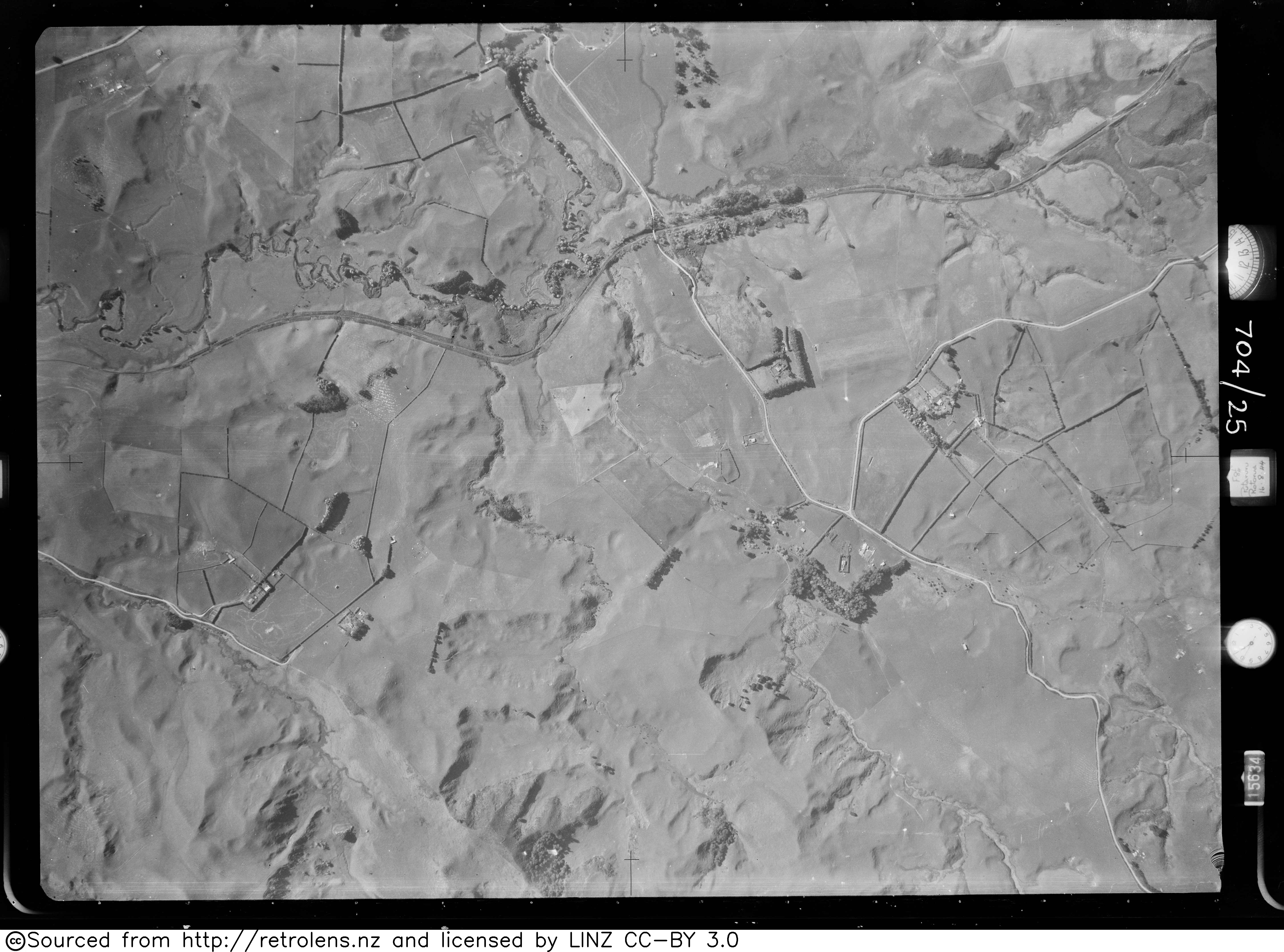
- ^ "Survey Number: SN255 Run Number: 704 Photo Number: 25". Retrolens. 16 August 1944.
- ^ "DISTRICT NEWS. WAIKATO TIMES". paperspast.natlib.govt.nz. 27 January 1923. Retrieved 24 April 2021.
- ^ "Stations" (PDF). NZR Rolling Stock Lists. Retrieved 10 August 2020.
- ^ "Taumangi Rd". Google Maps. Retrieved 24 April 2021.
- ^ "Te Kāhui Māngai directory". tkm.govt.nz. Te Puni Kōkiri.
- ^ "Māori Maps". maorimaps.com. Te Potiki National Trust.
- ^ "Marae Announcements" (Excel). growregions.govt.nz. Provincial Growth Fund. 9 October 2020.
- ^ "South Waikato town's historic skate bowl set for major upgrade". Stuff. 24 May 2021. Retrieved 1 June 2021.
- ^ a b "Statistical area 1 dataset for 2018 Census". Statistics New Zealand. March 2020. Putāruru (186000). 2018 Census place summary: Putāruru
- ^ "Population estimate tables - NZ.Stat". Statistics New Zealand. Retrieved 25 October 2023.
- ^ a b "Statistical area 1 dataset for 2018 Census". Statistics New Zealand. March 2020. Putāruru Rural (185900). 2018 Census place summary: Putāruru Rural
- ^ "Brand Family". Aquasplash. Retrieved 30 September 2017.
- ^ "Te Waihou Walkway". www.southwaikato.govt.nz. Retrieved 15 July 2018.
- ^ "Putaruru Primary School Official School Website". putaruru.school.nz.
- ^ "Putaruru Primary School Ministry of Education School Profile". educationcounts.govt.nz. Ministry of Education.
- ^ "Putaruru Primary School Education Review Office Report". ero.govt.nz. Education Review Office.
- ^ "Putaruru College Ministry of Education School Profile". educationcounts.govt.nz. Ministry of Education.
- ^ "Putaruru College Education Review Office Report". ero.govt.nz. Education Review Office.
- ^ "Te Wharekura o Te Kaokaoroa o Pātetere Ministry of Education School Profile". educationcounts.govt.nz. Ministry of Education.
- ^ "Te Wharekura o Te Kaokaoroa o Pātetere Education Review Office Report". ero.govt.nz. Education Review Office.
- ^ "St Mary's Catholic School Ministry of Education School Profile". educationcounts.govt.nz. Ministry of Education.
- ^ "St Mary's Catholic School Education Review Office Report". ero.govt.nz. Education Review Office.
- ^ "New Zealand Schools Directory". New Zealand Ministry of Education. Retrieved 14 March 2024.
- ^ Evans, Hilary; Gjerde, Arild; Heijmans, Jeroen; Mallon, Bill; et al. "Glen Mitchell". Olympics at Sports-Reference.com. Sports Reference LLC. Archived from the original on 18 April 2020. Retrieved 7 May 2017.
- ^ Martin, Matthew (30 December 2022). "This one's for the South Waikato - former mayor Jenny Shattock makes New Year's Honours list". Stuff. Retrieved 30 December 2022.
External links edit
- 1914 and 2011 photos of railway station
- 1932 photo of brick water tank at the railway station
- New Zealand Timber Museum