Puerto Rico Highway 20 (PR-20) or Expreso Rafael Martínez Nadal is a short tollway located between the municipalities of Guaynabo and San Juan in Puerto Rico.[2] With a length of 9.5 km (5.9 mi), it begins at PR-2 interchange in Pueblo Viejo barrio and ends at PR-1 junction in Río barrio.
Highway 20 | ||||
|---|---|---|---|---|
| Ruta 20 | ||||
| Expreso Rafael Martínez Nadal | ||||
| Route information | ||||
| Maintained by Metropistas | ||||
| Length | 9.5 km[1] (5.9 mi) | |||
| Major junctions | ||||
| South end | ||||
| ||||
| North end | ||||
| Location | ||||
| Country | United States | |||
| Territory | Puerto Rico | |||
| Municipalities | Guaynabo, San Juan | |||
| Highway system | ||||
| ||||

Route description edit
It used to be divided highway with traffic signals, which even turned into a rural road near its south end, but due to the traffic congestion in parallel freeway PR-18, and also in PR-1 and PR-52, it had to be converted and is now 9.5 kilometers long.[3] It has few exits; the first being to PR-169, a road to the rural area of Guaynabo and part of Aguas Buenas; PR-199 which connects it to PR-1 and PR-52; PR-177 which serves Bayamón and Cupey, and PR-17 (Avenida Jesús T. Piñero). It begins in the Muda sector of PR-1 and ends near San Patricio in Caparra, Guaynabo, at PR-2. It is tolled going north from PR-1, but not in the other direction.
-
 PR-20 near its northern terminus in Guaynabo
 -
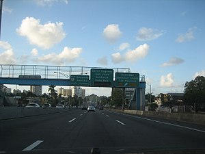
 Traffic on Expreso Rafael Martínez Nadal


Tolls edit
| Location | Toll[4] | Direction | AutoExpreso acceptance |
AutoExpreso replenishment (R) lane |
|---|---|---|---|---|
| Guaynabo | $0.90 | Northbound |
Exit list edit
-
 PR-20 north at its exit to PR-177 west in Frailes, Guaynabo
 -
 PR-20 south at its exit to Avenida Esmeralda in Frailes, Guaynabo
 -
 PR-199 east at PR-20 interchange between downtown Guaynabo and Frailes

.jpg)

| Municipality | Location | km[1] | mi | Exit | Destinations | Notes |
|---|---|---|---|---|---|---|
| Guaynabo | Río | 9.5 | 5.9 | — | Southern terminus of PR-20 | |
| 9.1 | 5.7 | — | ||||
| Camarones | 6.8– 6.7 | 4.2– 4.2 | 6 | PR-Avenida David Urbina – Guaynabo | ||
| Frailes–Guaynabo barrio-pueblo line | 6.4 | 4.0 | Guaynabo Toll Plaza (toll northbound only) | |||
| Guaynabo barrio-pueblo | 5.4– 5.3 | 3.4– 3.3 | 5 | |||
| Frailes | 4.2– 4.1 | 2.6– 2.5 | — | PR-Avenida Esmeralda – Guaynabo | ||
| 3.1 | 1.9 | — | ||||
| San Juan | Monacillo Urbano–Gobernador Piñero line | 2.2 | 1.4 | — | ||
| Gobernador Piñero | 1.6 | 0.99 | — | |||
| Guaynabo | Pueblo Viejo | 0.4 | 0.25 | — | PR-Avenida González Giusti / PR-Avenida San Patricio – Guaynabo | |
| 0.0 | 0.0 | 4 | Northern terminus of PR-20 | |||
| 1.000 mi = 1.609 km; 1.000 km = 0.621 mi | ||||||
See also edit
References edit
- ^ a b Google (28 February 2020). "PR-20" (Map). Google Maps. Google. Retrieved 28 February 2020.
- ^ National Geographic Maps (2011). Puerto Rico (Map). 1:125,000. Adventure Map (Book 3107). Evergreen, Colorado: National Geographic Maps. ISBN 978-1566955188. OCLC 756511572.
- ^ Guía de Carreteras Principales, Expresos y Autopistas. Departamento de Transportación y Obras Publicas de Puerto Rico. Accessed 3 May 2019.
- ^ "Mapas y Tarifas". Metropistas (in Spanish). Archived from the original on 26 February 2024. Retrieved 26 February 2024.
External links edit
 Media related to Puerto Rico Highway 20 at Wikimedia Commons
This Puerto Rican location article is a stub. You can help Wikipedia by expanding it. |
This Puerto Rico road-related article is a stub. You can help Wikipedia by expanding it. |