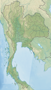
Nam Phong National Park (Thai: อุทยานแห่งชาติน้ำพอง) is a national park in Thailand's Khon Kaen and Chaiyaphum provinces. This mountainous park, in two separate sections, encompasses part of the Ubol Ratana Dam reservoir and also features rock formations and cliff-top viewpoints. The park is named for the Nam Phong River, impounded by the dam.[1][2]
| Nam Phong National Park | |
|---|---|
| อุทยานแห่งชาติน้ำพอง | |
 Hin Chang Si | |
| Location | Thailand |
| Nearest city | Khon Kaen |
| Coordinates | 16°37′20″N 102°35′22″E / 16.62222°N 102.58944°E |
| Area | 197 km2 (76 sq mi) |
| Established | 2000 |
| Visitors | 68,273 (in 2019) |
| Governing body | Department of National Parks, Wildlife and Plant Conservation |
Geography edit
Nam Phong National Park is located about 50 kilometres (30 mi) west of the city of Khon Kaen in the Ubolratana, Ban Fang, Nong Ruea, Mancha Khiri and Khok Pho Chai districts of Khon Kaen Province and the Ban Thaen and Kaeng Khro districts of Chaiyaphum Province.[1] The park's area is 123,125 rai ~ 197 square kilometres (76 sq mi).[3] The park is located in the Phu Phan Kham mountain range in the northern section and the Phu Meng mountain range in the southern section.[1][2] Rivers such as the Nam Phong, Chi and Choen are fed by sources within the park's boundaries.[1]
Attractions edit
Part of the Ubol Ratana Dam reservoir is in the park's northern section and is located by the park headquarters. Hin Chang Si viewpoint, also in the park's northern section, offers views over the reservoir, forested landscapes and east to Khon Kaen. There are also prehistoric rock paintings at this location.[1][2]
There are rock formations at Pha Chan Dai and Kham Phon. There are viewpoints at Pha Sawan and Hin Chang Si. Phu Meng mountain's forests host a wide variety of animal and plant life.[1][2]
The Huai Khe waterfall is in the park's southern section.[2]
Flora and fauna edit
The park's main forest type is deciduous dipterocarp, covering 80% of the park's area. The remainder of the park is mixed deciduous forest and grassland.[2]
Tree species include Shorea obtusa, Shorea siamensis, Dipterocarpus obtusifolius, wild almond, Annamese burada, Hopea ferrea and Cycas.[2]
The park serves as a sanctuary for animals including wild boar, northern red muntjac (Muntiacus muntjak vaginalis), porcupine, pangolin and Siamese hare. Bird life includes white wagtail, grey wagtail, Richard's pipit, sooty-headed bulbul, kingfisher and munia.[2]
See also edit
References edit
- ^ a b c d e f "Nam Phong National Park". Department of National Parks (Thailand). Archived from the original on 9 November 2013. Retrieved 26 June 2014.
- ^ a b c d e f g h Sutthipibul, Vasa; Ampholchantana, Chantanaporn; Dulkull Kapelle, Peeranuch; Charoensiri, Vatid; Lukanawarakul, Ratana, eds. (2006). "Nam Phong National Park". National Parks in Thailand. (free online from the publisher). Department of National Parks (Thailand). pp. 116–117. ISBN 974-286-087-4. Archived from the original (PDF) on 16 June 2014. Retrieved 26 June 2014.
- ^ "ข้อมูลพื้นที่อุทยานแห่งชาติ ที่ประกาศในราชกิจจานุบกษา 133 แห่ง" [National Park Area Information published in the 133 Government Gazettes]. Department of National Parks, Wildlife and Plant Conservation (in Thai). December 2020. Retrieved 1 November 2022, no 100
{{cite web}}: CS1 maint: postscript (link)
External links edit
- Concise Nam Phong National Park information from the Tourism Authority of Thailand
