The Mendeleev Ridge (or Mendeleev Rise, Russian: Хребет Менделеева)[1] is a broad ridge in the Arctic Ocean from the East Siberian Sea area of the Siberian Shelf to the central areas of the ocean. It is attached to the Alpha Ridge of the Amerasian Basin.[2] It is named after Dmitri Mendeleyev.The Ridge was discovered in 1948 by Soviet high latitude expeditions. The name was approved by the Sub-Committee on Geographical Names and Nomenclature of Ocean Bottom Features (SCGN, now SCUFN) in April 1987.[1]

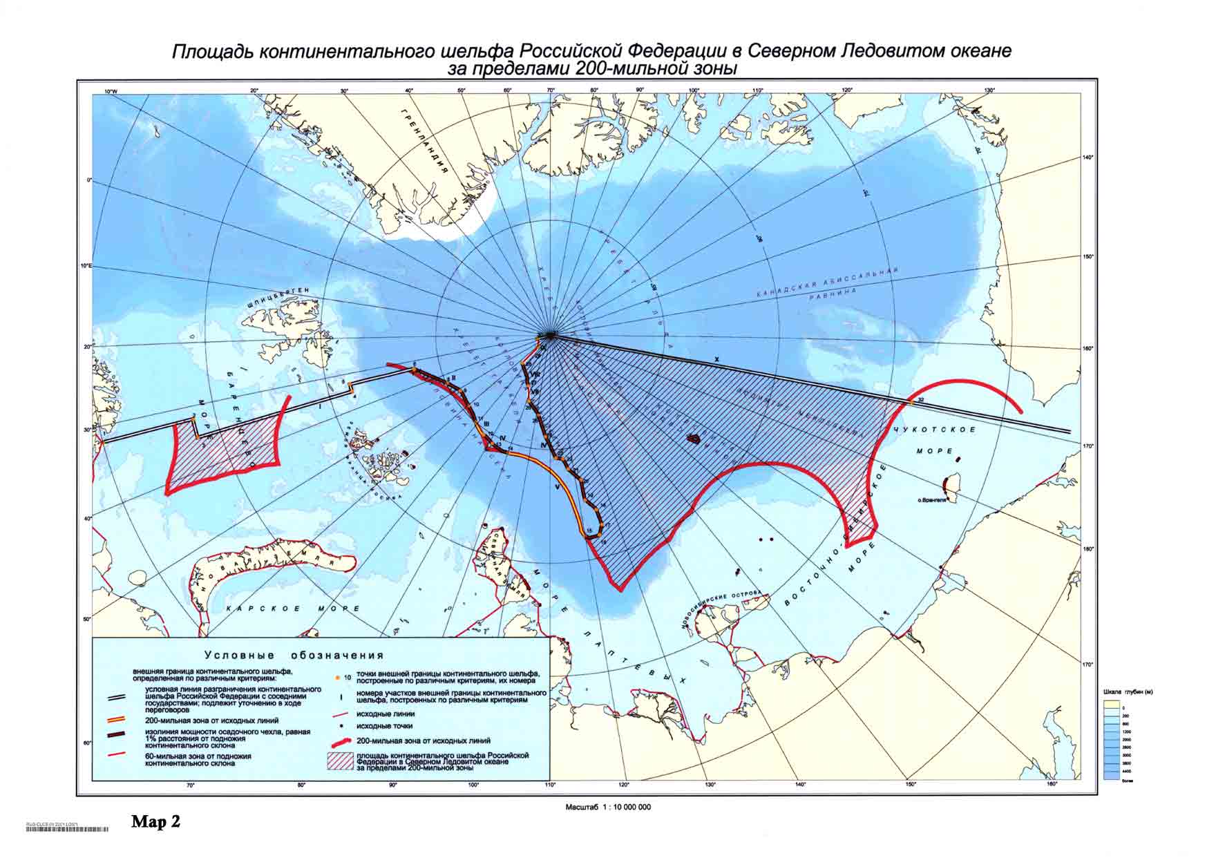
The Mendeleev Ridge is instrumental in the Russian claim to the North pole.[3] The territory claimed by Russia in the submission is a large portion of the Arctic Ocean, including the North Pole.[4] One of the arguments was a statement, that the underwater Lomonosov Ridge and Mendeleev Ridge are extensions of the Eurasian continent. In 2002 the UN Commission neither rejected nor accepted the Russian proposal, recommending additional research.[3]
The origin of the ridge is still contested due to limited data, and it is unclear whether it is an oceanic or continental feature and whether its origin is associated with the Alpha Ridge.[2]
References edit
- ^ a b "IHO-IOC GEBCO Gazetteer" (PDF). International Hydrographic Organization/Intergovernmental Oceanographic Commission. September 2007. Archived from the original (PDF) on 2008-09-11. Retrieved 2008-05-24.
- ^ a b A Geophysical Survey Of The Mendeleev Ridge, Processing Steps And Interpretation
- ^ a b Outer limits of the continental shelf beyond 200 nautical miles from the baselines: Submissions to the Commission: Submission by the Russian Federation CLCS. United Nations
- ^ Area of the continental shelf of the Russian Federation in the Arctic Ocean beyond 200-nautical-mile zone - borders of the 200 mile zone are marked in red, territory claimed by Russia is shaded