Lazarevo (Serbian Cyrillic: Лазарево) is an urban neighborhood in the city of Banjaluka, Bosnia and Herzegovina (Republika Srpska entity). Lazarevo is located in the northern part of the city, and is one of the largest and most organized neighborhoods, made up of two local communities:
- Lazarevo 1
- Lazarevo 2


These names are often disregarded in casual speech and are often replaced by the term "Budžak" (Serbian Cyrillic: Буџак).
History edit
In the first half of the 19th century, then Budžak (now Lazarеvo) was a village near Banja Luka, which was sparsely populated. The inhabitants built houses away from the main road Gradiška, since it was safer to live in during the Ottoman rule. The village expanded during the Austro-Hungarian rule, and it was under Austro-Hungarian rule that a train station was built in Lazarevo, giving it importance in the transport of goods and people. However, this train station has seen a decline in amount of trains and traffic in recent years. A hydroelectric power plant was built in Trappist, which now lays abandoned.[1]
Population edit
Before the Yugoslav civil wars, Lazarevo was divided into four local communities. According to the census in 1991, this town had 15,786 inhabitants. [2]
| Ethnicity | Amount | Percentage of total |
|---|---|---|
| Serbs | 8642 | 54.7% |
| Croats | 2913 | 18.4% |
| Muslims | 1068 | 6.7% |
| Yugoslavs | 2309 | 14.62% |
| Others | 854 | 5.4% |
Religious buildings edit
There are two religious buildings: The monastery of Trappist monks, the only Trappist monastery[3] in Southeastern Europe, which was the largest Trappist abbey in the world at the start of the 20th century with 219 monks, and an Eastern Orthodox church named "Lazarica".
Gallery edit
-
 Post in the populated place Lazarevo
 -
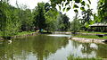 A zoo in Lazarevo
 -
 The Mariastern Trappist monastery
.jpg)


References edit
- ^ "History of Lazarevo". Cyberbulevar.com. 2005-01-18. Retrieved 2013-10-25.
- ^ Census in 1991. Archived 2013-10-05 at the Wayback Machine
- ^ "Mariastern Abbey". Trapisti-banjaluka.org. Retrieved 2013-10-25.
External links edit
44°48′18″N 17°12′25″E / 44.80500°N 17.20694°E
This article about a location in the municipality of Banja Luka, Republika Srpska is a stub. You can help Wikipedia by expanding it. |