The Gibraltar Aerobeacon built in 1841 is one of several lighthouses in Gibraltar, the British Overseas Territory at the southern end of the Iberian Peninsula. It is also known as the Gibraltar Aviation Light and Gibraltar Aero Light. The active beacon is positioned atop the Rock of Gibraltar and is operated by the Government of Gibraltar.
 | |
| Location | Rock of Gibraltar, Gibraltar |
|---|---|
| Coordinates | 36°08′34″N 5°20′34″W / 36.142831°N 5.342797°W |
| Tower | |
| Construction | steel tower |
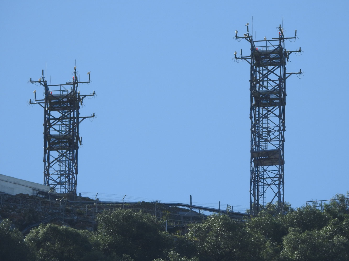
| Shape | square skeletal tower with balcony |
| Markings | grey metallic |
| Operator | Government of Gibraltar |
| Light | |
| Focal height | 405 metres (1,329 ft) |
| Range | red: 30 nautical miles (56 km; 35 mi) |
| Characteristic | Mo.(GB) R., period 10 s |
History edit
While The Lighthouse Directory suggests that the Gibraltar Aerobeacon does not strictly meet its criteria for a lighthouse,[1] the publishers of the directory indicate that the light merits an exception.[2] In Publication 113, it is referred to as the Gibraltar Aviation Light;[3] in The Online List of Lights, it is referred to as the Gibraltar Aero Light.[4] The light by all three names has the same Admiralty number (see infobox).[2][3][4]
The Gibraltar Aerobeacon (pictured in link below) is positioned on top of the Rock of Gibraltar.[2][4] The Rock is approximately 22 miles (35 km) in length. About six furlongs (0.75 miles (1.21 km)) to the south of the north end of the Rock is the signal station at 1,255 feet (383 m). The 1911 Encyclopædia Britannica indicated that, at the station, "the names and messages of passing ships are cabled to all parts of the world."[5] The map of Gibraltar reveals Signal Hill close to the end of the cable car line, at 387 metres (1,270 ft).[6]
The Gibraltar Aerobeacon is a square, skeletal tower which features a large gallery platform on which there is a round radar apparatus.[2] The light characteristic is remarkable for a red light which flashes the Morse Code for Gibraltar.[2][3] It consists of two long flashes and a short flash, after which there is a long flash and three short flashes.[2] The code for Gibraltar is emitted every ten seconds. The range is 30 nautical miles (55 kilometres or 34.5 miles). The active beacon has a focal plane (or focal height) of 405 metres (1329 feet).[2][3]
The site and the light tower are closed to the public. The Gibraltar Aerobeacon is operated by the Government of Gibraltar.[2] The United Kingdom Hydrographic Office Admiralty List of Lights and Fog Signals number is D 2456.[2][3][4] The United States National Geospatial-Intelligence Agency (NGA), formerly the National Imagery and Mapping Agency (NIMA), number is 4256.[2][3][7]
See also edit
References edit
- ^ Rowlett, Russ. "The Lighthouse Directory". University of North Carolina at Chapel Hill. Retrieved 25 July 2012.
- ^ a b c d e f g h i j Rowlett, Russ. "Lighthouses of Gibraltar". The Lighthouse Directory. University of North Carolina at Chapel Hill. Retrieved 25 July 2012.
- ^ a b c d e f "Publication 113 - List of Lights, Radio Aids, and Fog Signals" (PDF). msi.nga.mil. United States National Geospatial-Intelligence Agency. 2011. p. XI-XIV, 70–71. Archived from the original (PDF) on 11 December 2018. Retrieved 25 July 2012.
- ^ a b c d "Gibraltar". trabas.de. The Online List of Lights. Archived from the original on 17 January 2012. Retrieved 25 July 2012.
- ^ Mitchell, Hugh (1911). . In Chisholm, Hugh (ed.). Encyclopædia Britannica. Vol. 11 (11th ed.). Cambridge University Press. p. 938.
- ^ "Gibraltar". upload.wikimedia.org. Wikimedia. Retrieved 25 July 2012.
- ^ "Chapter 4: Nautical Publications". The American Practical Navigator. United States Government (as reprinted on Wikisource). Retrieved 25 July 2012.
External links edit
- Photograph of Gibraltar Aerobeacon by Alexander Trabas The Online List of Lights