.svg)
.svg&action=edit&redlink=1)

Size of this PNG preview of this SVG file: 800 × 582 pixels. Other resolutions: 320 × 233 pixels | 640 × 466 pixels | 1,024 × 745 pixels | 1,280 × 931 pixels | 2,560 × 1,863 pixels | 1,425 × 1,037 pixels.
Original file (SVG file, nominally 1,425 × 1,037 pixels, file size: 1.26 MB)
| This is a file from the Wikimedia Commons. Information from its description page there is shown below. Commons is a freely licensed media file repository. You can help. |
.svg)
| Description |
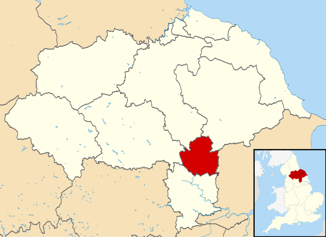
Map of North Yorkshire, UK with York highlighted. Equirectangular map projection on WGS 84 datum, with N/S stretched 170% |
| Date | |
| Source |
|
| Author | Nilfanion, created using Ordnance Survey data |
| Permission (Reusing this file) |
This file is licensed under the Creative Commons Attribution-Share Alike 3.0 Unported license. Attribution: Contains Ordnance Survey data © Crown copyright and database right
|
File history
Click on a date/time to view the file as it appeared at that time.
| Date/Time | Thumbnail | Dimensions | User | Comment | |
|---|---|---|---|---|---|
| current | 09:44, 14 April 2011 | | 1,425 × 1,037 (1.26 MB) | Nilfanion | {{Information |Description=Map of North Yorkshire, UK with York highlighted. Equirectangular map projection on WGS 84 datum, with N/S stretched 170% |Source=Ordnance Survey [https://www.ordnancesurve |
File usage
The following pages on the English Wikipedia use this file (pages on other projects are not listed):
- Bishopthorpe Palace
- City Walls Experience at Micklegate Bar
- DIG: An Archaeological Adventure
- King's Manor
- Lamel Hill
- Richard III Experience at Monk Bar
- St Anthony's Hall
- Terry's
- York Archaeological Trust
- York Cold War Bunker
- User:Dr. Blofeld/April 2011
- User:DragonofBatley/sandbox
- User talk:Traveler100/sandbox/test-settle
- Wikipedia:Graphics Lab/Map workshop/Archive/2016
Global file usage
The following other wikis use this file:
- Usage on azb.wikipedia.org
- Usage on bn.wikipedia.org
- Usage on fr.wikipedia.org
- Usage on io.wikipedia.org
- Usage on is.wikipedia.org
- Usage on ja.wikipedia.org
- Usage on lfn.wikipedia.org
- Usage on pt.wikipedia.org
- Usage on sd.wikipedia.org
- Usage on sv.wikipedia.org
- Usage on tr.wikipedia.org
- Usage on yi.wikipedia.org
.svg)