Size of this preview: 800 × 416 pixels. Other resolutions: 320 × 166 pixels | 640 × 333 pixels | 1,024 × 532 pixels | 1,480 × 769 pixels.
Original file (1,480 × 769 pixels, file size: 314 KB, MIME type: image/jpeg)
| This is a file from the Wikimedia Commons. Information from its description page there is shown below. Commons is a freely licensed media file repository. You can help. |
Summary
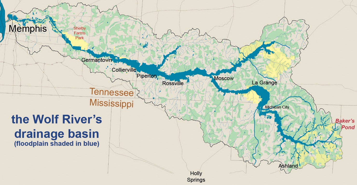
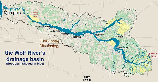
| Description | Map of the Wolf River (Tennessee) drainage basin or watershed. The blue region indicates the river's floodplain, not its normal channel width. |
| Date | |
| Source | Own work |
| Author | Wolf River Conservancy |
| Permission (Reusing this file) |
I, the copyright holder of this work, hereby publish it under the following license: This file is licensed under the Creative Commons Attribution-Share Alike 2.5 Generic license.
|
File history
Click on a date/time to view the file as it appeared at that time.
| Date/Time | Thumbnail | Dimensions | User | Comment | |
|---|---|---|---|---|---|
| current | 03:59, 9 April 2007 | | 1,480 × 769 (314 KB) | Bridgman | {{Information |Description=Map of the Wolf River (Tennessee) drainage basin or watershed. The blue region indicates the river's floodplain, not its normal channel width. |Source=own work |Date=2002 |Author=Wolf River Conservancy |Permission= }} |
File usage
The following pages on the English Wikipedia use this file (pages on other projects are not listed):
Global file usage
The following other wikis use this file:
- Usage on de.wikipedia.org
- Usage on es.wikipedia.org
- Usage on fi.wikipedia.org
- Usage on www.wikidata.org