No higher resolution available.
Westerley_Ware,_by_Kew_Bridge_-_geograph.org.uk_-_1333216.jpg (640 × 480 pixels, file size: 61 KB, MIME type: image/jpeg)
| This is a file from the Wikimedia Commons. Information from its description page there is shown below. Commons is a freely licensed media file repository. You can help. |
Summary
| Description |
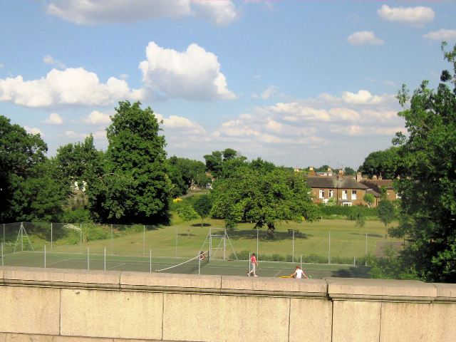
English: Westerley Ware, by Kew Bridge Westerley Ware is a small garden and recreation ground at the foot of Kew Bridge. It has a quiet hedge-bordered memorial garden, a grass area, three hard tennis courts and a childrens playground containing many new items of play equipment. It was originally created as a memorial garden to the fallen in the First World War, the name refers to the practice of netting weirs or "wares" to catch fish. |
| Date | |
| Source | From geograph.org.uk |
| Author | Chris Reynolds |
| Attribution (required by the license) | Chris Reynolds / Westerley Ware, by Kew Bridge / |
| Camera location | | View this and other nearby images on: OpenStreetMap |
|---|
_heading:90.00&language=en)
| Object location | | View this and other nearby images on: OpenStreetMap |
|---|
_heading:90.00&language=en)
Licensing

|
This image was taken from the Geograph project collection. See this photograph's page on the Geograph website for the photographer's contact details. The copyright on this image is owned by Chris Reynolds and is licensed for reuse under the Creative Commons Attribution-ShareAlike 2.0 license.
|
This file is licensed under the Creative Commons Attribution-Share Alike 2.0 Generic license.
Attribution: Chris Reynolds
- You are free:
- to share – to copy, distribute and transmit the work
- to remix – to adapt the work
- Under the following conditions:
- attribution – You must give appropriate credit, provide a link to the license, and indicate if changes were made. You may do so in any reasonable manner, but not in any way that suggests the licensor endorses you or your use.
- share alike – If you remix, transform, or build upon the material, you must distribute your contributions under the same or compatible license as the original.
File history
Click on a date/time to view the file as it appeared at that time.
| Date/Time | Thumbnail | Dimensions | User | Comment | |
|---|---|---|---|---|---|
| current | 02:54, 28 February 2011 | | 640 × 480 (61 KB) | GeographBot | == {{int:filedesc}} == {{Information |description={{en|1=Westerley Ware, by Kew Bridge Westerley Ware is a small garden and recreation ground at the foot of Kew Bridge. It has a quiet hedge-bordered memorial garden, a grass area, three hard tennis courts |
File usage
The following pages on the English Wikipedia use this file (pages on other projects are not listed):
Global file usage
The following other wikis use this file: