Size of this preview: 467 × 600 pixels. Other resolutions: 187 × 240 pixels | 374 × 480 pixels | 598 × 768 pixels | 1,121 × 1,440 pixels.
Original file (1,121 × 1,440 pixels, file size: 309 KB, MIME type: image/jpeg)
| This is a file from the Wikimedia Commons. Information from its description page there is shown below. Commons is a freely licensed media file repository. You can help. |
Summary
| Description |
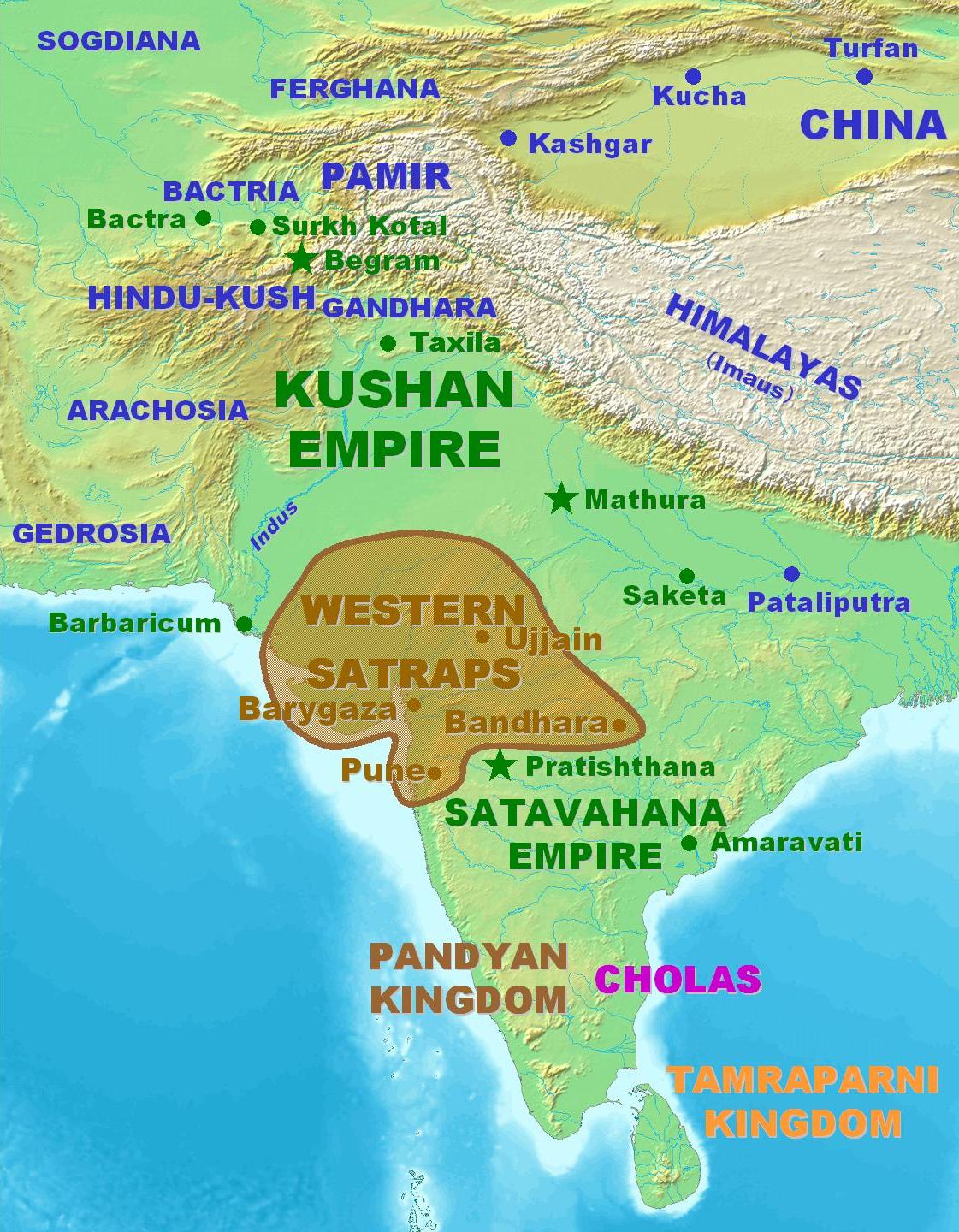
English: Territorial extent of the Western Kshatrapas. |
||
| Source |
|
||
| Author | User PHG at en.wikipedia.org | ||
| Permission (Reusing this file) |
Personal map. Released in the Public Domain. |

Licensing
| This work has been released into the public domain by its author, PHG. This applies worldwide. In some countries this may not be legally possible; if so: |
File history
Click on a date/time to view the file as it appeared at that time.
| Date/Time | Thumbnail | Dimensions | User | Comment | |
|---|---|---|---|---|---|
| current | 11:33, 4 March 2007 | | 1,121 × 1,440 (309 KB) | World Imaging | Better map |
| 19:32, 5 February 2007 |  | 1,122 × 1,440 (313 KB) | World Imaging | Better image. | |
| 20:58, 4 February 2007 |  | 1,127 × 1,440 (316 KB) | World Imaging | Better map. | |
| 15:28, 4 February 2007 |  | 1,124 × 1,440 (315 KB) | World Imaging | Better map. Own work. | |
| 23:25, 13 December 2006 |  | 462 × 504 (37 KB) | Electionworld | {{ew|en|PHG}} Territorial extent of the Western Kshatrapas. Personal map. Released in the Public Domain. {{pd-user|PHG}} |
File usage
The following pages on the English Wikipedia use this file (pages on other projects are not listed):
Global file usage
The following other wikis use this file:
- Usage on azb.wikipedia.org
- Usage on ba.wikipedia.org
- Usage on bn.wikipedia.org
- Usage on cs.wikipedia.org
- Usage on es.wikipedia.org
- Usage on fa.wikipedia.org
- Usage on fa.wikibooks.org
- Usage on fr.wikipedia.org
- Usage on hi.wikipedia.org
- Usage on hu.wikipedia.org
- Usage on hy.wikipedia.org
- Usage on it.wikipedia.org
- Usage on ja.wikipedia.org
- Usage on ka.wikipedia.org
- Usage on lt.wikipedia.org
- Usage on ml.wikipedia.org
- Usage on nl.wikipedia.org
- Usage on ru.wikipedia.org
- Usage on sh.wikipedia.org
- Usage on sq.wikipedia.org
- Usage on ta.wikipedia.org
- Usage on tt.wikipedia.org
- Usage on uk.wikipedia.org
- Usage on vi.wikipedia.org
- Usage on www.wikidata.org
- Usage on zh.wikipedia.org