Size of this preview: 676 × 599 pixels. Other resolutions: 271 × 240 pixels | 542 × 480 pixels | 867 × 768 pixels | 1,155 × 1,024 pixels | 2,311 × 2,048 pixels | 3,273 × 2,901 pixels.
Original file (3,273 × 2,901 pixels, file size: 2.9 MB, MIME type: image/jpeg)
| This is a file from the Wikimedia Commons. Information from its description page there is shown below. Commons is a freely licensed media file repository. You can help. |
Summary
| Camera location | | View this and other nearby images on: OpenStreetMap |
|---|
| Description |
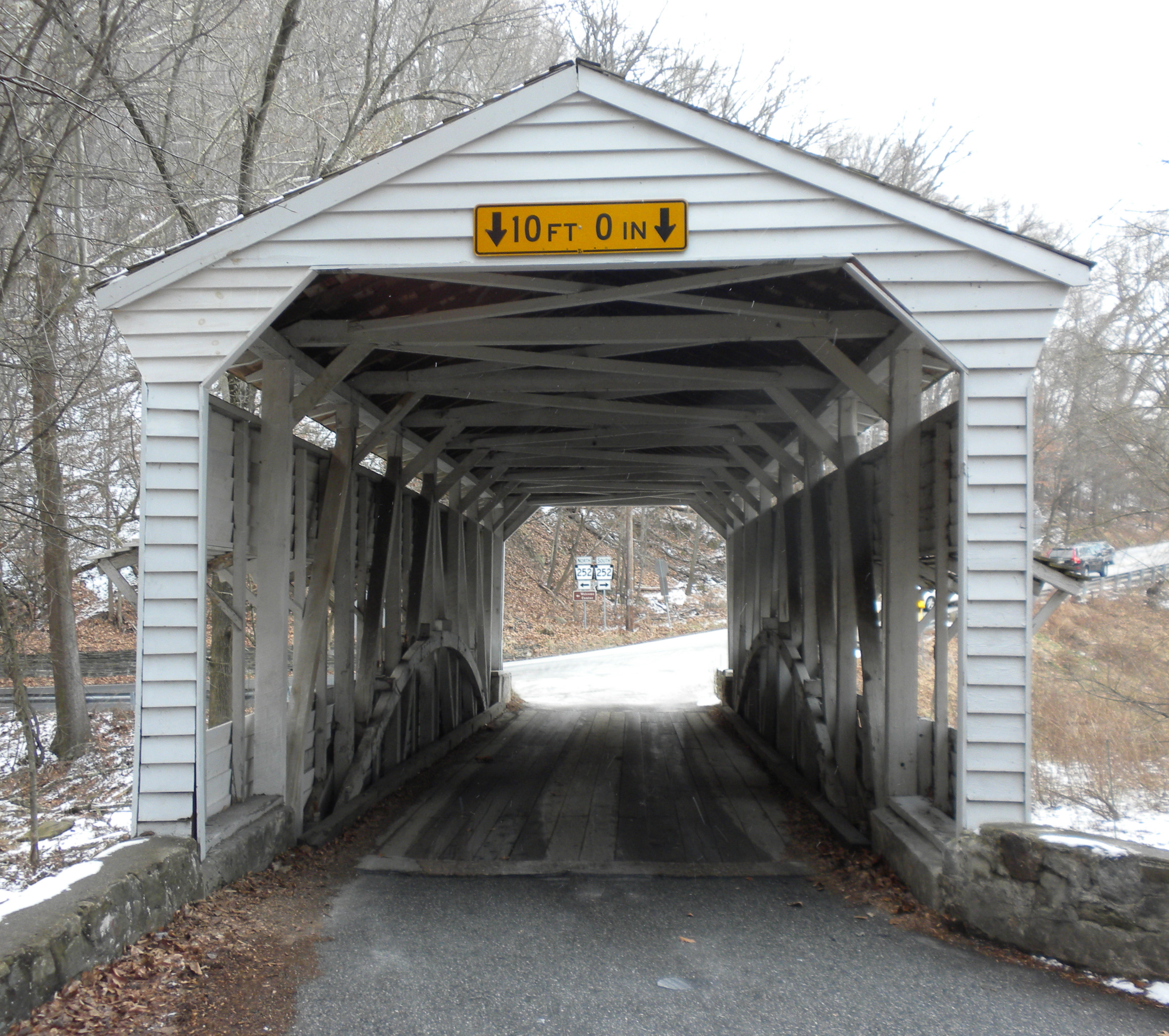
English: Knox Covered Bridge in Valley Forge National Historical Park across Valley Run (creek) near Lord Stirling's Quarters. On (or at the end of) Yellow Springs Road as it joins Valley Creek Road (PA 252). Confusingly, the last bit of Yellow Springs Road, and part of 252 are also known as Baptist Road. Built 1865, with a Burr Truss (see [1]) The bridge is one lane, but is quite actively used. Steel understructure has been added. In Tredyffrin Township, Chester County PA . File:Valley Forge Bridge 2 gives side view. This is a contributing structure in the NRHP listing for the Valley Forge Historic District. See also http://www.tredyffrin.org/pdf/harb/sitesurvey.pdf . I donate this photo to the public domain. |
| Date | |
| Source | Own work |
| Author | Smallbones |
Licensing
| I, the copyright holder of this work, release this work into the public domain. This applies worldwide. In some countries this may not be legally possible; if so: I grant anyone the right to use this work for any purpose, without any conditions, unless such conditions are required by law. |
File history
Click on a date/time to view the file as it appeared at that time.
| Date/Time | Thumbnail | Dimensions | User | Comment | |
|---|---|---|---|---|---|
| current | 23:11, 8 January 2010 | | 3,273 × 2,901 (2.9 MB) | Smallbones | {{Information |Description={{en|1=Covered Bridge in Valley Forge National Historical Park across Valley Run (creek) near Lord Sterling's Headquarters. On (or at the end of) Yellow Springs Road as it joins Valley Creek Road (PA 252). The bridge is one la |
File usage
The following pages on the English Wikipedia use this file (pages on other projects are not listed):