
Size of this PNG preview of this SVG file: 687 × 382 pixels. Other resolutions: 320 × 178 pixels | 640 × 356 pixels | 1,024 × 569 pixels | 1,280 × 712 pixels | 2,560 × 1,423 pixels.
Original file (SVG file, nominally 687 × 382 pixels, file size: 252 KB)
| This is a file from the Wikimedia Commons. Information from its description page there is shown below. Commons is a freely licensed media file repository. You can help. |
| Description |
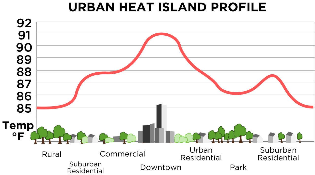
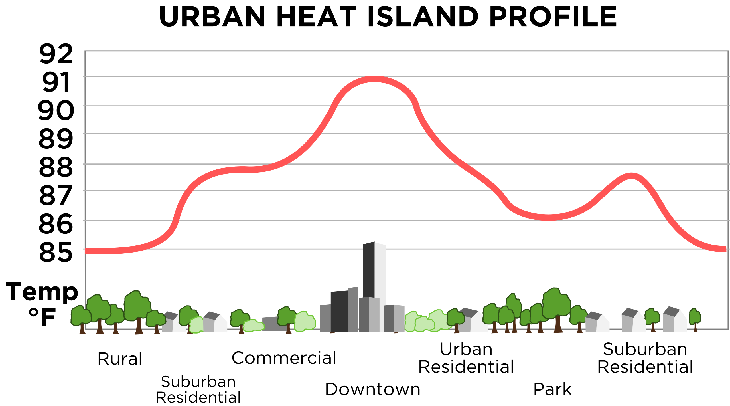
English: Vastly improved version of this, retraced in SVG. Original images source is this image from NOAA. |
|||
| Date | 11/23/08 | |||
| Source | Own work | |||
| Author | TheNewPhobia | |||
| Permission (Reusing this file) |
|
|||
| Other versions | Derivative works of this file: Urban heat island (Celsius).png |
.png)
File history
Click on a date/time to view the file as it appeared at that time.
| Date/Time | Thumbnail | Dimensions | User | Comment | |
|---|---|---|---|---|---|
| current | 16:55, 23 November 2008 | | 687 × 382 (252 KB) | TheNewPhobia | {{Information |Description={{en|1=Vastly improved version of this, retraced in SVG. Original images source is [http://www.crh.noaa.gov/images/lsx/recent_event/urban.gif this image] from NOAA.}} |Source=Own work by |
File usage
The following pages on the English Wikipedia use this file (pages on other projects are not listed):
Global file usage
The following other wikis use this file:
- Usage on fi.wikipedia.org
- Usage on it.wikipedia.org
- Usage on www.wikidata.org
- Usage on zh.wikipedia.org