Size of this preview: 800 × 520 pixels. Other resolutions: 320 × 208 pixels | 640 × 416 pixels | 1,024 × 665 pixels | 1,513 × 983 pixels.
Original file (1,513 × 983 pixels, file size: 60 KB, MIME type: image/png)
| This is a file from the Wikimedia Commons. Information from its description page there is shown below. Commons is a freely licensed media file repository. You can help. |
Summary
| Description |
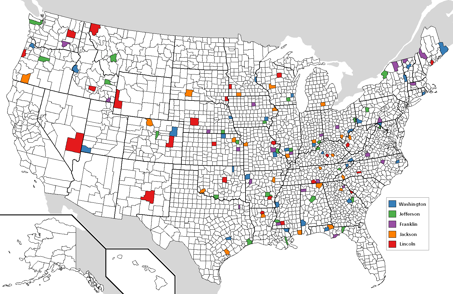
Map of the five most common US counties' names. Note: Those in Louisiana are parishes. Uses color scheme from the free to use color brewer |
| Date | |
| Source | GNU map Image:Map of USA with county outlines (black & white).png |
| Author | self |
.png)
Licensing

|
Permission is granted to copy, distribute and/or modify this document under the terms of the GNU Free Documentation License, Version 1.2 or any later version published by the Free Software Foundation; with no Invariant Sections, no Front-Cover Texts, and no Back-Cover Texts. A copy of the license is included in the section entitled GNU Free Documentation License. |
| This file is licensed under the Creative Commons Attribution-Share Alike 3.0 Unported license. | ||
| ||
| This licensing tag was added to this file as part of the GFDL licensing update. |
File history
Click on a date/time to view the file as it appeared at that time.
| Date/Time | Thumbnail | Dimensions | User | Comment | |
|---|---|---|---|---|---|
| current | 19:52, 16 July 2015 | | 1,513 × 983 (60 KB) | Cmdrjameson | Compressed with pngout. Reduced by 92kB (60% decrease). |
| 02:19, 20 April 2013 |  | 1,513 × 983 (153 KB) | Nyttend | Original version didn't mark Washington County, Indiana | |
| 03:00, 22 May 2007 |  | 1,513 × 983 (107 KB) | Roke~commonswiki | {{Information |Description= Map of the five most common US counties' names {{legend|#377eb8|w:Washington County}} {{legend|#4daf4a|w:Jefferson County}} {{legend|#984ea3|w:Franklin County}} {{legend|#ff7f00|w:Jackson County}} {{legend|#e41a |
File usage
The following pages on the English Wikipedia use this file (pages on other projects are not listed):
Global file usage
The following other wikis use this file:
- Usage on zh.wikipedia.org