
Size of this preview: 800 × 561 pixels. Other resolutions: 320 × 224 pixels | 640 × 448 pixels | 1,024 × 717 pixels | 1,280 × 897 pixels | 1,500 × 1,051 pixels.
Original file (1,500 × 1,051 pixels, file size: 536 KB, MIME type: image/jpeg)
| This is a file from the Wikimedia Commons. Information from its description page there is shown below. Commons is a freely licensed media file repository. You can help. |
| Description |
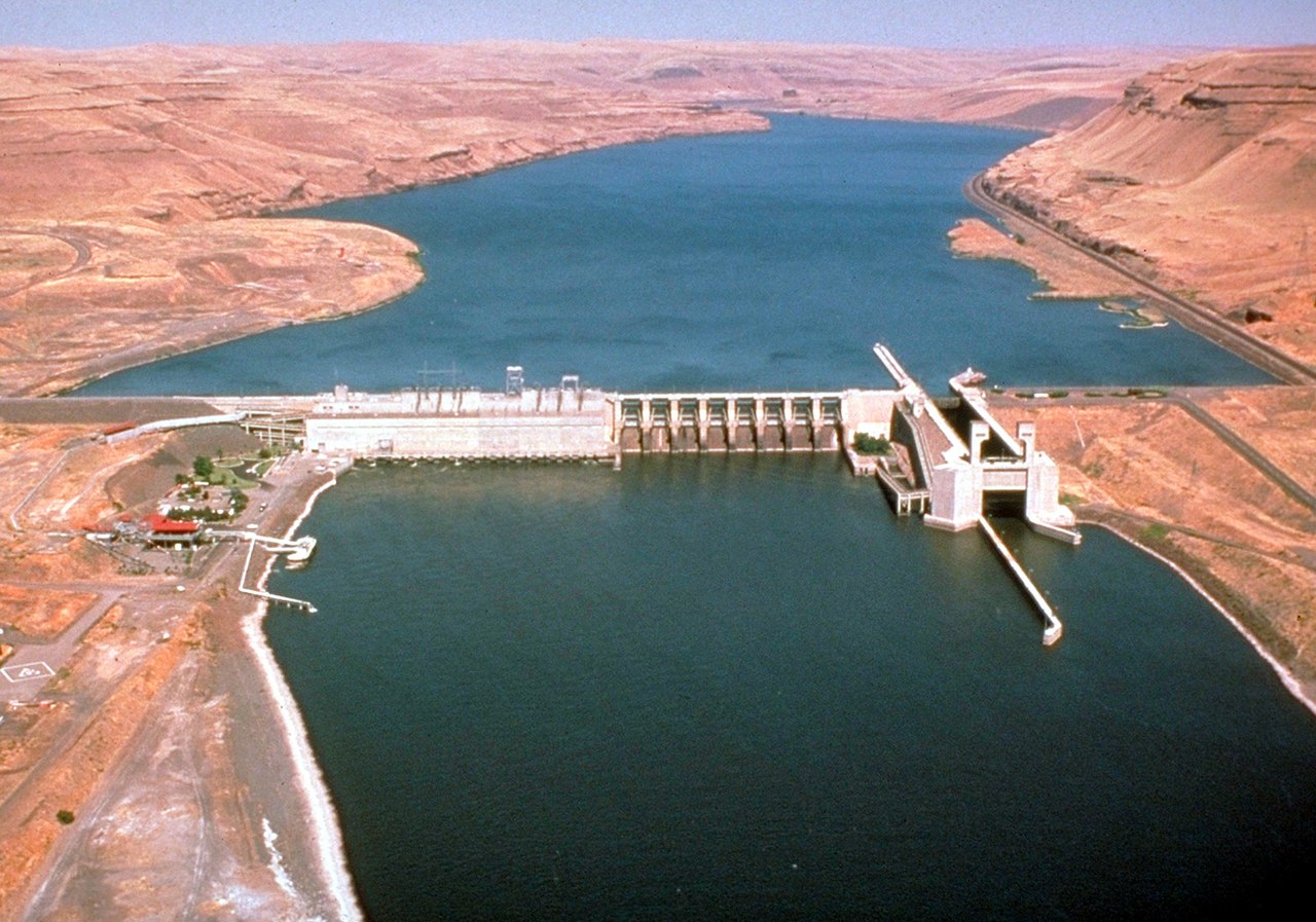
English: Lower Monumental Lock and Dam on the Snake River, Washington, USA. The river is the border between Franklin County to the north (left) and Walla Walla County (right). View is upriver to the northeast. |
|||
| Date | ||||
| Source |
U.S. Army Corps of Engineers Digital Visual Library Image page Image description page Digital Visual Library home page |
|||
| Author | U.S. Army Corps of Engineers, photographer not specified or unknown | |||
| Permission (Reusing this file) |
|
| Camera location | | View this and other nearby images on: OpenStreetMap |
|---|
File history
Click on a date/time to view the file as it appeared at that time.
| Date/Time | Thumbnail | Dimensions | User | Comment | |
|---|---|---|---|---|---|
| current | 21:27, 1 April 2007 | | 1,500 × 1,051 (536 KB) | DanMS | {{Information | Description = {{en|Lower Monumental Lock and Dam on the Snake River, Washington, USA. View is upriver to the northeast.}} | Source = U.S. Army Corps of Engineers Digital Visual Library<br />[http://images.usace.army.mil/images/H |
File usage
The following pages on the English Wikipedia use this file (pages on other projects are not listed):
Global file usage
The following other wikis use this file:
- Usage on ceb.wikipedia.org
- Usage on de.wikipedia.org
- Usage on es.wikipedia.org
- Usage on fr.wikipedia.org
- Usage on no.wikipedia.org
- Usage on pt.wikipedia.org
- Usage on ru.wikipedia.org
- Usage on uk.wikipedia.org
- Usage on www.wikidata.org