No higher resolution available.
Thiepval_Barracks,_Lisburn_-_geograph.org.uk_-_1590410.jpg (640 × 480 pixels, file size: 93 KB, MIME type: image/jpeg)
| This is a file from the Wikimedia Commons. Information from its description page there is shown below. Commons is a freely licensed media file repository. You can help. |
Summary
| Description |
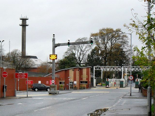
English: Thiepval Barracks, Lisburn. This massive site is the headquarters of the British Army in Northern Ireland - occupying quite a substantial chunk of North Lisburn. It also cuts the Magheralave Road in two. It is home to the 38th (Irish) Brigade and the 19th Light Brigade. Set in an affluent and predominantly Unionist area, the base hasn't managed to escape republican attacks - one soldier was killed in a car bomb in 1996. |
| Date | |
| Source | From geograph.org.uk |
| Author | Dean Molyneaux |
| Attribution (required by the license) | Dean Molyneaux / Thiepval Barracks, Lisburn / |
| Camera location | | View this and other nearby images on: OpenStreetMap |
|---|
_heading:337.00&language=en)
| Object location | | View this and other nearby images on: OpenStreetMap |
|---|
_heading:337.00&language=en)
Licensing

|
This image was taken from the Geograph project collection. See this photograph's page on the Geograph website for the photographer's contact details. The copyright on this image is owned by Dean Molyneaux and is licensed for reuse under the Creative Commons Attribution-ShareAlike 2.0 license.
|
This file is licensed under the Creative Commons Attribution-Share Alike 2.0 Generic license.
Attribution: Dean Molyneaux
- You are free:
- to share – to copy, distribute and transmit the work
- to remix – to adapt the work
- Under the following conditions:
- attribution – You must give appropriate credit, provide a link to the license, and indicate if changes were made. You may do so in any reasonable manner, but not in any way that suggests the licensor endorses you or your use.
- share alike – If you remix, transform, or build upon the material, you must distribute your contributions under the same or compatible license as the original.
File history
Click on a date/time to view the file as it appeared at that time.
| Date/Time | Thumbnail | Dimensions | User | Comment | |
|---|---|---|---|---|---|
| current | 03:38, 2 November 2014 | | 640 × 480 (93 KB) | Bleakcomb | Correct image. Exposure, contrast, colour, sharpen. |
| 04:33, 4 March 2011 |  | 640 × 480 (107 KB) | GeographBot | == {{int:filedesc}} == {{Information |description={{en|1=Thiepval Barracks, Lisburn This massive site is the headquarters of the British Army in Northern Ireland - occupying quite a substantial chunk of North Lisburn. It also cuts the Magheralave Road in |
File usage
The following pages on the English Wikipedia use this file (pages on other projects are not listed):
Global file usage
The following other wikis use this file:
- Usage on ca.wikipedia.org
- Usage on fr.wikipedia.org
- Usage on www.wikidata.org