Size of this preview: 665 × 600 pixels. Other resolutions: 266 × 240 pixels | 532 × 480 pixels | 894 × 806 pixels.
Original file (894 × 806 pixels, file size: 1.18 MB, MIME type: image/jpeg)
File history
Click on a date/time to view the file as it appeared at that time.
| Date/Time | Thumbnail | Dimensions | User | Comment | |
|---|---|---|---|---|---|
| current | 12:40, 1 November 2021 |  | 894 × 806 (1.18 MB) | Claude Zygiel | Lighter |
| 15:44, 2 October 2010 |  | 894 × 806 (680 KB) | Cplakidas | widened to include Magnesia, which was considered part of wider Thessaly | |
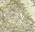
| 08:22, 12 December 2006 |  | 769 × 778 (226 KB) | Roke~commonswiki | Map of Thessaly, cropped from old public domain map of Greece, from the Perry-Castañeda Library Map Collection, Historical Atlas by William R. Shepherd [http://www.lib.utexas.edu/maps/historical/shepherd/greece_ancient_n_ref_1926.jpg north], [http://www. |
File usage
More than 100 pages use this file. The following list shows the first 100 pages that use this file only. A full list is available.
- Acharrae
- Aeginium
- Alope (Thessaly)
- Amphanae
- Amphrysus
- Amyrus
- Ancient Magnesia
- Ancient Thessaly
- Angeia
- Anthela (Thessaly)
- Anticyra (Thessaly)
- Antron
- Aphetae
- Argissa Magoula
- Argos Pelasgikon
- Arne (Thessaly)
- Asterium
- Atrax (Thessaly)
- Azorus
- Boebe (Thessaly)
- Boebeis Lake
- Callithera
- Casthanaea
- Celathara
- Cierium
- Condylon
- Coracae
- Coroneia (Thessaly)
- Ctimene (Thessaly)
- Cuarius
- Cypaera
- Cyphus
- Cyretiae
- Demetrias
- Doliche (Thessaly)
- Echinus (Thessaly)
- Elateia (Thessaly)
- Elone
- Eretria (Thessaly)
- Ericinium
- Eritium
- Euhydrium
- Eurymenae
- Glaphyrae
- Gomphi
- Gonnus
- Gyrton (Thessaly)
- Halos (Thessaly)
- Histiaeotis
- History of Thessaly
- Homolium
- Iresiae
- Ithome (Thessaly)
- Iton (Thessaly)
- Kondaia
- Lapathus (Thessaly)
- Meliboea (Histiaeotis)
- Meliboea (Magnesia)
- Methone (Thessaly)
- Metropolis (Perrhaebia)
- Metropolis (Thessaly)
- Mopsium
- Mount Titanus
- Mylae (Thessaly)
- Myrae
- Nelia
- Oechalia (Thessaly)
- Oechalia (Trachis)
- Oetaea
- Olizon
- Oloosson
- Oxyneia
- Pagasae
- Palaepharsalus
- Pelasgiotis
- Pelinna
- Perrhaebia
- Phacium
- Phaestus (Thessaly)
- Phalanna
- Phalara
- Phaloria
- Pharcadon
- Pheca
- Pherae
- Phthiotic Thebes
- Phylace (Thessaly)
- Phyllus
- Pialia
- Pimpleia
- Pythion
- Rhizus
- Scotussa
- Spalathra
- Thaumaci
- Thessaliotis
- Thessaly
- Theuma (Thessaly)
- Tricca
- Tripolis (Perrhaebia)
View more links to this file.
Global file usage
The following other wikis use this file:
- Usage on an.wikipedia.org
- Usage on bg.wikipedia.org
- Usage on ca.wikipedia.org
- Usage on ceb.wikipedia.org
- Usage on cs.wikipedia.org
- Usage on de.wikipedia.org
- Usage on el.wikipedia.org
- Usage on es.wikipedia.org
- Usage on et.wikipedia.org
- Usage on fa.wikipedia.org
- Usage on fi.wikipedia.org
- Usage on fr.wikipedia.org
- Usage on gl.wikipedia.org
View more global usage of this file.