Original file (1,575 × 1,048 pixels, file size: 891 KB, MIME type: image/jpeg)
| This is a file from the Wikimedia Commons. Information from its description page there is shown below. Commons is a freely licensed media file repository. You can help. |
Summary
| Camera location | | View this and other nearby images on: OpenStreetMap |
|---|
| Description |
English:
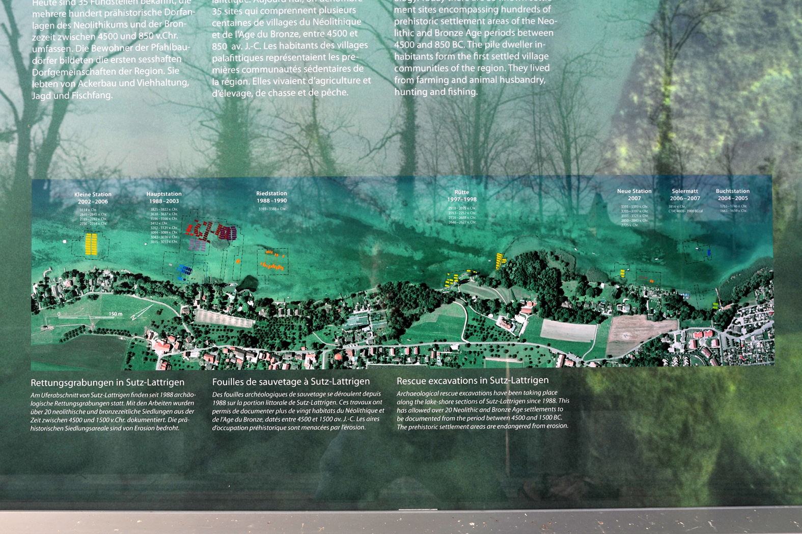
Diving base of the Archaeological service of the canton of Berne at the von Rütte estate in Sutz-Lattrigen; Berne, Switzerland. Right info window; overview of the sites in Sutz-Lattrigen. Deutsch: Tauchbasis des Archäologischen Dienstes des Kantons Bern beim von Rütte Gut in Sutz-Lattrigen; Bern, Schweiz. Rechtes Info-Fenster; Übersicht der Fundorte in Sutz-Lattrigen. |
| Date | |
| Source | Own work |
| Author | Хрюша |
| Other versions |
 |
Licensing
- You are free:
- to share – to copy, distribute and transmit the work
- to remix – to adapt the work
- Under the following conditions:
- attribution – You must give appropriate credit, provide a link to the license, and indicate if changes were made. You may do so in any reasonable manner, but not in any way that suggests the licensor endorses you or your use.
- share alike – If you remix, transform, or build upon the material, you must distribute your contributions under the same or compatible license as the original.
|
According to article 27 of the Copyright Act (en/de/fr/it), works installed at or on publicly accessible places or ground may be pictured, and such pictures may be offered for sale, sold, transmitted, or otherwise published. The image must not be three-dimensional and it must not be possible to use the picture for the same purpose as the original.
The works must be permanently installed, but for the purposes of the law, "permanent" means a fixed installation which may be temporary -- time limited -- but not "accidental", e.g. due to transport of the work. For more information, see COM:CRT/Switzerland#Freedom of panorama.
|


|
This media was created by Chriusha/Хрюша.
|
| Attribution (required by the license) | |
| Additional information: | |
|
The mentioned licence on my media is exclusively valid for the version and resolution up to the shown on Wikimedia Commons. Any other version of the shown media or higher resolution optionally available on another website is not included in this licencing and not allowed for free use. | |
|
The values of focal length and aperture in the metadata need to be read with precaution! |
File history
Click on a date/time to view the file as it appeared at that time.
| Date/Time | Thumbnail | Dimensions | User | Comment | |
|---|---|---|---|---|---|
| current | 13:27, 3 December 2011 | | 1,575 × 1,048 (891 KB) | Chriusha | == {{int:filedesc}} == {{Location|47|6|10.48|N|7|12|43.58|E|type:landmark_region:CH_heading:WNW}} {{Information |Description={{en}}Diving base of the Archaeological service of the canton of Berne at the von Rütte estate in Sutz-Lattrigen; Berne, Switzerl |