Size of this preview: 629 × 600 pixels. Other resolutions: 252 × 240 pixels | 504 × 480 pixels | 900 × 858 pixels.
Original file (900 × 858 pixels, file size: 646 KB, MIME type: image/png)
| This is a file from the Wikimedia Commons. Information from its description page there is shown below. Commons is a freely licensed media file repository. You can help. |
Summary
| Description |
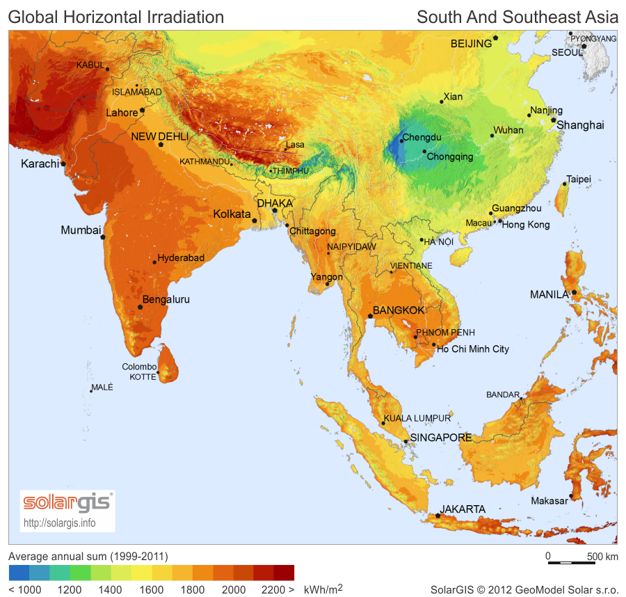
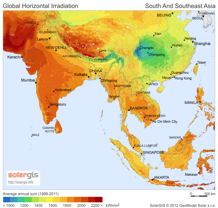
English: Solar Radiation Map: Global Horizontal Irradiation Map of South and Southeast Asia, SolarGIS. |
| Date | |
| Source | Image linked from free download page |
| Author | SolarGIS © 2012 GeoModel Solar |
| Permission (Reusing this file) |
The maps are free for public use, their reproduction and adaptation is authorised provided the following source is acknowledged: SolarGIS © 2014 GeoModel Solar By downloading a free map, you acknowledge that GeoModel Solar retains all rights, titles, and interest in the information provided by the maps, including the copyright, SolarGIS logo and all other intellectual property rights, and that GeoModel Solar has the right to make these maps available under Creative Commons Attribution-ShareAlike 3.0 Unported License. GeoModel Solar makes no representations or warranties about the accuracy, reliability, completeness or suitability for any particular purpose of the free maps. You agree that GeoModel Solar is under no liability for any loss or damage (including consequential damage) that you may suffer from the use of the free maps. |
Licensing
This file is licensed under the Creative Commons Attribution-Share Alike 3.0 Unported license.
Attribution: SolarGIS © 2012 GeoModel Solar
- You are free:
- to share – to copy, distribute and transmit the work
- to remix – to adapt the work
- Under the following conditions:
- attribution – You must give appropriate credit, provide a link to the license, and indicate if changes were made. You may do so in any reasonable manner, but not in any way that suggests the licensor endorses you or your use.
- share alike – If you remix, transform, or build upon the material, you must distribute your contributions under the same or compatible license as the original.
File history
Click on a date/time to view the file as it appeared at that time.
| Date/Time | Thumbnail | Dimensions | User | Comment | |
|---|---|---|---|---|---|
| current | 21:33, 30 April 2017 | | 900 × 858 (646 KB) | Ayane m | 30 KB file size reduction |
| 17:20, 1 September 2014 |  | 900 × 858 (677 KB) | Rfassbind | {{Information |Description={{en|1=Solar Radiation Map: Global Horizontal Irradiation Map of South and Southeast Asia, SolarGIS.}} |Source=[http://solargis.info/doc/_pics/freemaps/1000px/ghi/SolarGIS-Solar-map-South-And-South-East-Asia-en.png Image] lin... |
File usage
The following pages on the English Wikipedia use this file (pages on other projects are not listed):
Global file usage
The following other wikis use this file:
- Usage on ar.wikipedia.org
- Usage on azb.wikipedia.org
- Usage on az.wikipedia.org
- Usage on cs.wikipedia.org
- Usage on es.wikipedia.org
- Usage on eu.wikipedia.org
- Usage on fa.wikipedia.org
- Usage on uk.wikipedia.org
- Usage on uz.wikipedia.org