Size of this preview: 800 × 564 pixels. Other resolutions: 320 × 225 pixels | 640 × 451 pixels | 1,024 × 721 pixels | 1,280 × 902 pixels | 2,000 × 1,409 pixels.
Original file (2,000 × 1,409 pixels, file size: 2.31 MB, MIME type: image/jpeg)
| This is a file from the Wikimedia Commons. Information from its description page there is shown below. Commons is a freely licensed media file repository. You can help. |
Summary
| Description |
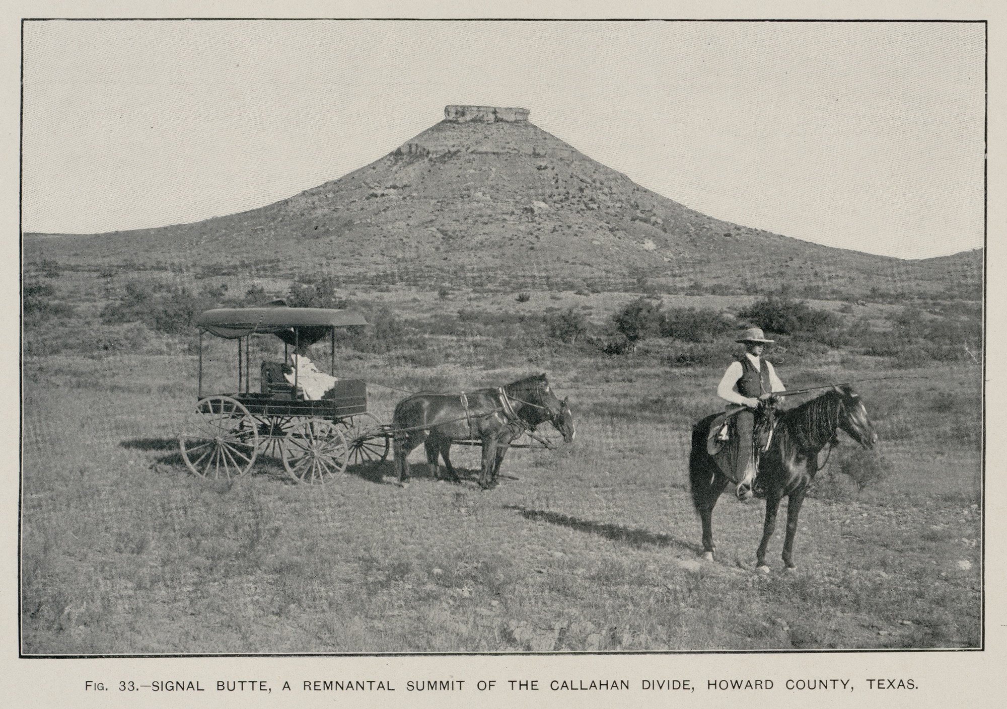
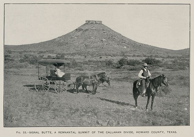
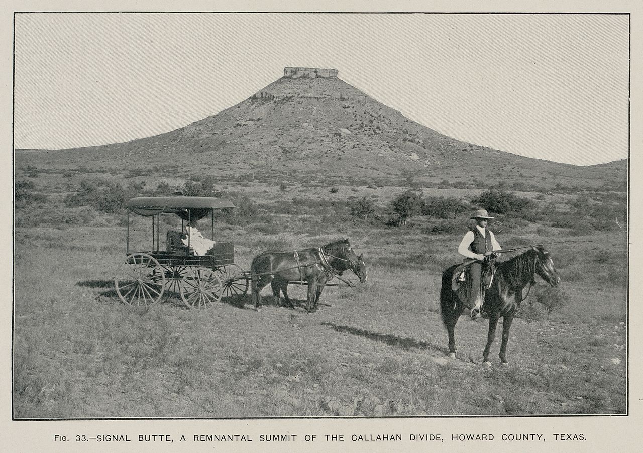
English: Signal Peak near Big Spring, Texas (Texas Geological Survey, 1889) (USGS photo, 1900) |
| Date | |
| Source | Hill, R.T. 1900. Topographic atlas of the United States: Physical geography of the Texas region. United States Department of the Interior, U.S. Geological Survey, Folio 3, 12 pp. |
| Author | Rogers |
Licensing
This image is in the public domain in the United States because it only contains materials that originally came from the United States Geological Survey, an agency of the United States Department of the Interior. For more information, see the official USGS copyright policy.
|
File history
Click on a date/time to view the file as it appeared at that time.
| Date/Time | Thumbnail | Dimensions | User | Comment | |
|---|---|---|---|---|---|
| current | 04:44, 11 June 2009 | | 2,000 × 1,409 (2.31 MB) | Leaflet | {{Information |Description={{en|1=Signal Peak near Big Spring, Texas (Texas Geological Survey, 1889) (USGS photo, 1900)}} |Source=Hill, R.T. 1900. Topographic atlas of the United States: Physical geography of the Texas region. United States Department of |
File usage
The following pages on the English Wikipedia use this file (pages on other projects are not listed):
Global file usage
The following other wikis use this file:
- Usage on ast.wikipedia.org
- Usage on es.wikipedia.org
- Usage on fa.wikipedia.org
- Usage on gl.wikipedia.org
- Usage on ja.wikipedia.org
- Usage on nl.wikipedia.org
- Usage on nn.wikipedia.org
- Usage on ru.wikipedia.org