Original file (956 × 1,316 pixels, file size: 780 KB, MIME type: image/jpeg)
| This is a file from the Wikimedia Commons. Information from its description page there is shown below. Commons is a freely licensed media file repository. You can help. |
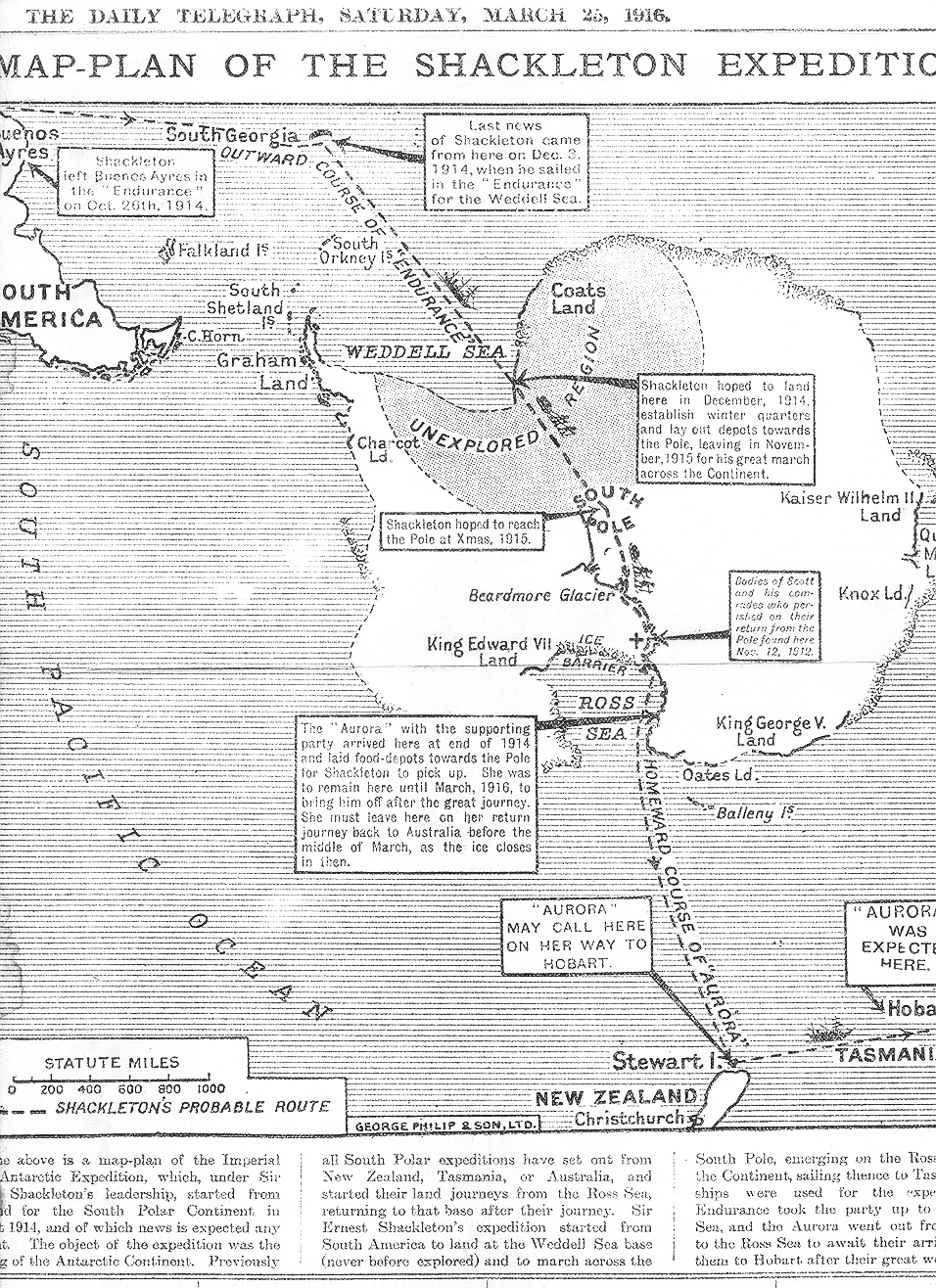
| Description | "The above is a map-plan of the Imperial Trans-Antarctic Expedition, which, under Sir Ernest Shackleton's leadership, started from England for the South Polar Continent in August 1914, and of which news is expected any moment." | ||||
| Date | |||||
| Source | http://www.xefer.com/2005/06/shackleton | ||||
| Author | Daily Telegraph | ||||
| Permission (Reusing this file) |
|
||||
File history
Click on a date/time to view the file as it appeared at that time.
| Date/Time | Thumbnail | Dimensions | User | Comment | |
|---|---|---|---|---|---|
| current | 13:23, 8 April 2018 | | 956 × 1,316 (780 KB) | Hohum | Cleanup |
| 13:55, 30 December 2009 |  | 956 × 1,316 (556 KB) | Zsero | {{Information |Description="The above is a map-plan of the Imperial Trans-Antarctic Expedition, which, under Sir Ernest Shackleton's leadership, started from England for the South Polar Continent in August 1914, and of which news is expected any moment." |
File usage
Global file usage
The following other wikis use this file:
- Usage on be.wikipedia.org
- Usage on da.wikipedia.org
- Usage on nn.wikipedia.org
- Usage on no.wikipedia.org
- Usage on pt.wikipedia.org
- Usage on ru.wikipedia.org
- Usage on uk.wikipedia.org
- Usage on zh.wikipedia.org