
Size of this preview: 800 × 560 pixels. Other resolutions: 320 × 224 pixels | 640 × 448 pixels | 1,024 × 717 pixels | 1,280 × 897 pixels | 2,560 × 1,793 pixels | 3,548 × 2,485 pixels.
Original file (3,548 × 2,485 pixels, file size: 1.52 MB, MIME type: image/png)
| This is a file from the Wikimedia Commons. Information from its description page there is shown below. Commons is a freely licensed media file repository. You can help. |
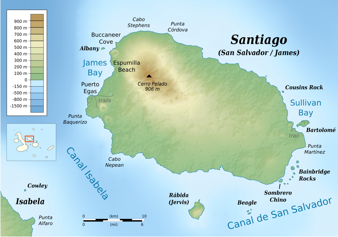
| Description | cylindrical equidistant projection, central meridian -90° 45’, standard parallel 0° | |||||||
| Date | ||||||||
| Source |
own work, using: |
|||||||
| Author | Bamse | |||||||
| Permission (Reusing this file) |
|
|||||||
| Other versions |
|

_topographic_map-de.png)
_topographic_map-es.png)
_topographic_map-en.png)
_topographic_map-en.png&action=edit&redlink=1)
_topographic_map-en.png)
File history
Click on a date/time to view the file as it appeared at that time.
| Date/Time | Thumbnail | Dimensions | User | Comment | |
|---|---|---|---|---|---|
| current | 11:00, 23 May 2016 | | 3,548 × 2,485 (1.52 MB) | Bamse | {{Information |Description ={{en|1=Topographic map of Santiago Island, Galápagos Islands}} cylindrical equidistant projection, central meridian -90° 45’, standard parallel 0° |Sour... |
File usage
The following pages on the English Wikipedia use this file (pages on other projects are not listed):
Global file usage
The following other wikis use this file:
- Usage on ca.wikipedia.org
- Usage on gl.wikipedia.org
- Usage on id.wikipedia.org
- Usage on ja.wikipedia.org
_topographic_map-en.png)