_Highways_map.png)
_Highways_map.png&action=edit&redlink=1)
Size of this preview: 800 × 492 pixels. Other resolutions: 320 × 197 pixels | 640 × 394 pixels | 1,024 × 630 pixels | 1,280 × 787 pixels | 2,091 × 1,286 pixels.
Original file (2,091 × 1,286 pixels, file size: 173 KB, MIME type: image/png)
| This is a file from the Wikimedia Commons. Information from its description page there is shown below. Commons is a freely licensed media file repository. You can help. |
_Highways_map.png)
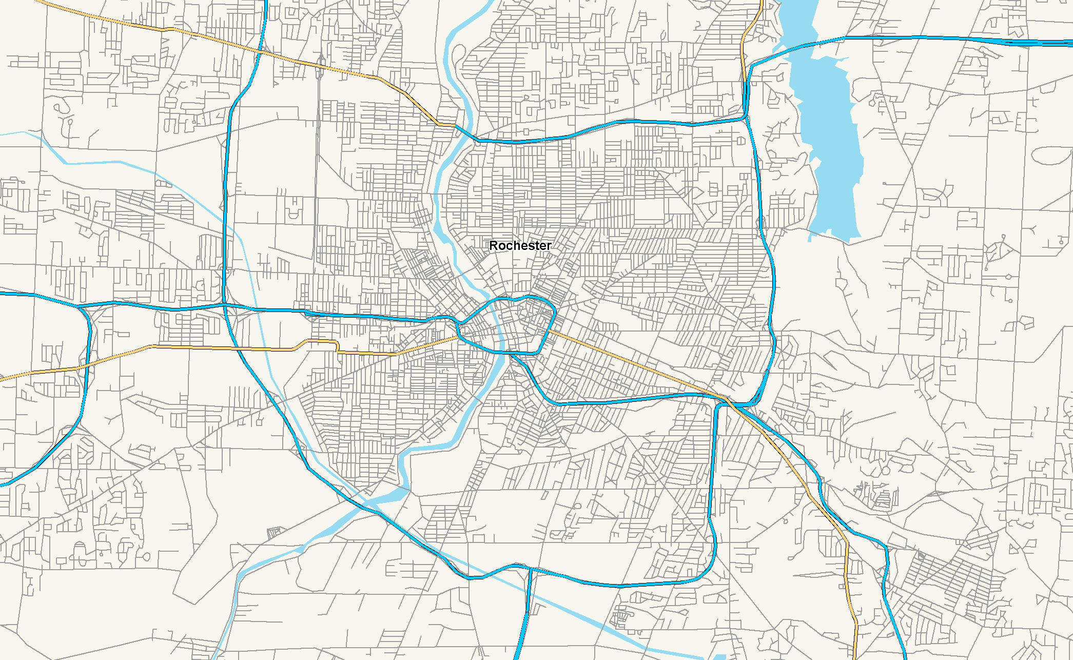
| Description | Close view of the road network of Rochester, NY. Interstates in Blue. |
| Date | |
| Source | Own work |
| Author | Nick Nolte |
| Permission (Reusing this file) |
Public Domain |
I, the copyright holder of this work, hereby publish it under the following license:
| This file is made available under the Creative Commons CC0 1.0 Universal Public Domain Dedication. | |
| The person who associated a work with this deed has dedicated the work to the public domain by waiving all of their rights to the work worldwide under copyright law, including all related and neighboring rights, to the extent allowed by law. You can copy, modify, distribute and perform the work, even for commercial purposes, all without asking permission.
|
File history
Click on a date/time to view the file as it appeared at that time.
| Date/Time | Thumbnail | Dimensions | User | Comment | |
|---|---|---|---|---|---|
| current | 01:46, 30 July 2006 | | 2,091 × 1,286 (173 KB) | Stratosphere | |
| 01:45, 30 July 2006 |  | 2,091 × 1,286 (178 KB) | Stratosphere | ||
| 01:42, 30 July 2006 |  | 2,205 × 1,239 (322 KB) | Stratosphere | ||
| 00:58, 30 July 2006 |  | 2,205 × 1,239 (322 KB) | Stratosphere | {{Information |Description=Close view of the road network of Rochester, NY. Interstates in Blue. |Source=Own Work |Date=July 29, 2006 |Author=Nick Nolte |Permission=Public Domain }} |
File usage
The following pages on the English Wikipedia use this file (pages on other projects are not listed):
_Highways_map.png)